
Where is Bloomington Located? - Bloomington is a city located in the Hennepin County of Minnesota, United States. Bloomington lies between 44.8408 Degrees North latitudes and -93.2983 Degrees West longitudes.
Location Map of Bluffdale, Utah
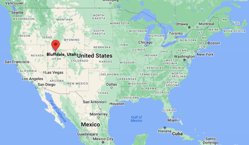
Bloomington Map, Minnesota, USA
Where is Bloomington?: The Google Map showing the location of Bloomington in the U.S. state of Minnesota.
Where is Bloomington Located?
Bloomington is a city located in the Hennepin County of Minnesota, United States. Bloomington lies between 44.8408 Degrees North latitude and -93.2983 Degrees West longitude. According to the 2020 U.S. Census, the population of Bloomington city is 89,987 people and the city has a total area of 38.405 sq mi. The city has numerous parks and recreational facilities.
Most Viewed US Maps
| USA Sttae Map | USA Region Map | USA Road Map |
| USA County Map | Where is USA in World Map? | US ZIP Code Map |
| USA Time Zones Map | US State and Capitals Map | USA Physical Map |
Find 4,400+ U.S. Cities by State - Explore Their Locations and Get Detailed Information
Bloomington, Minnesota Quick Facts
| Fact | Details |
|---|---|
| City | Bloomington |
| County | Hennepin County |
| State | Minnesota |
| State Capital | Saint Paul |
| Country | United States |
| US Region | Midwest |
| Latitude | 44.8408 N |
| Longitude | -93.2983 W |
| Elevation | 830 ft (253 m) |
| Land Area | 35.22 sq mi |
| Water Area | 2.88 sq mi |
| Total Area | 38.405 sq mi |
| Population (Census 2020) | 89,987 |
| Population Density | Approximately 2,555 per sq mi |
| ZIP Codes | 55420, 55425, 55431, 55435, 55437, 55438 |
| Area Code | 952 |
| Time Zone Standard | Central Standard Time (CST, UTC-6) |
| Time Zone Daylight | Central Daylight Time (CDT, UTC-5) |
| Currency | United States Dollar (USD) |
| FIPS Code | 27-06616 |
| Congressional District | Minnesota's 3rd Congressional District |
Nearby Cities and Communities to Bloomington, Minnesota
- Richfield, Minnesota - 4 mi North
- Edina, Minnesota - 6 mi Northwest
- Burnsville, Minnesota - 7 mi South
- Eagan, Minnesota - 7 mi East
- Savage, Minnesota - 9 mi Southwest
- Mendota Heights, Minnesota - 8 mi Northeast
- Minneapolis, Minnesota - 11 mi North
- Saint Paul, Minnesota - 15 mi Northeast
- Shakopee, Minnesota - 15 mi Southwest
- Apple Valley, Minnesota - 10 mi Southeast
Bloomington, Minnesota Climate and Weather Overview
| Month | Avg High (°F) | Avg Low (°F) | Avg Precipitation (in) |
|---|---|---|---|
| January | 24 | 8 | 0.8 |
| April | 58 | 38 | 2.7 |
| July | 84 | 65 | 4.3 |
| October | 58 | 40 | 2.3 |
| Annual | 58 | 39 | 32.0 |
| Climate Attribute | Details |
|---|---|
| Climate Classification | Hot-Summer Humid Continental (Köppen Dfa) |
| Annual Precipitation | Approximately 32.0 inches |
| Annual Sunshine Days | About 198 days |
| Severe Weather Risk | Moderate - Winter snowstorms, thunderstorms and occasional tornadoes |
| Annual Snowfall | Approximately 52 inches |
Driving Distances from Bloomington, Minnesota
| City | State | Distance (mi) | Approx. Drive Time |
|---|---|---|---|
| Richfield | Minnesota | 4 | 8 min |
| Edina | Minnesota | 6 | 12 min |
| Burnsville | Minnesota | 7 | 12 min |
| Eagan | Minnesota | 7 | 12 min |
| Mendota Heights | Minnesota | 8 | 15 min |
| Savage | Minnesota | 9 | 15 min |
| Apple Valley | Minnesota | 10 | 18 min |
| Minneapolis | Minnesota | 11 | 20 min |
| Saint Paul | Minnesota | 15 | 25 min |
| Shakopee | Minnesota | 15 | 25 min |
Transportation and Connectivity in Bloomington, Minnesota
| Transportation | Details |
|---|---|
| Nearest Airport | Minneapolis-Saint Paul International Airport |
| IATA Code | MSP |
| Major Highways | Interstate 35W, Interstate 494, Minnesota State Highway 77, U.S. Highway 169 (nearby) |
| Rail Service | METRO Blue Line light rail and freight rail service |
| Local Transit | Metro Transit buses and METRO Blue Line |
- Interstates 35W and 494 provide excellent road connections to Minneapolis, Saint Paul and surrounding Twin Cities communities.
- Minnesota State Highway 77 offers direct access to downtown Minneapolis and the southern suburbs.
- Minneapolis-Saint Paul International Airport, located partly within Bloomington, is one of the busiest airports in the Upper Midwest with extensive domestic and international service.
- Metro Transit operates local bus routes and the METRO Blue Line, connecting Bloomington with the airport, downtown Minneapolis and the Mall of America.
Key Landmarks and Places to Visit in Bloomington, Minnesota
| Landmark | Type |
|---|---|
| Mall of America | Shopping and Entertainment Center |
| Minnesota Valley National Wildlife Refuge | National Wildlife Refuge |
| Nickelodeon Universe | Indoor Theme Park |
| SEA LIFE Minnesota Aquarium | Aquarium |
| Hyland Lake Park Reserve | Regional Park |
| Normandale Japanese Garden | Botanical Garden |
| Minnesota Children's Museum at Mall of America | Family Attraction |
| Hyland Hills Ski Area | Ski Area |
| Minnesota Valley State Recreation Area | State Recreation Area |
| Bush Lake Beach | Recreation Area |
Colleges and Universities in Bloomington, Minnesota
| Institution | Type | Level | Notable For |
|---|---|---|---|
| Normandale Community College | Public | Community College | Transfer programs and career education |
| Northwestern Health Sciences University | Private | University | Health sciences and chiropractic education |
| University of Minnesota Twin Cities | Public | Research University | Engineering, medicine and scientific research |
| Metropolitan State University | Public | University | Business, public administration and education |
| St. Thomas University | Private | University | Business, engineering and liberal arts |
| Dakota County Technical College | Public | Technical College | Workforce training and technical education |
Waterbodies in Bloomington, Minnesota
Minnesota River, Bush Lake, Hyland Lake, Nine Mile Creek, Penn Lake, Normandale Lake, Anderson Lakes, Long Meadow Lake, Marsh Lake, Black Dog Lake.
Golf Courses in Bloomington, Minnesota
Dwan Golf Club, Hyland Greens Golf Course, Braemar Golf Course, Valleywood Golf Course, Lost Spur Golf and Event Center, Meadows at Mystic Lake, Edinburgh USA Golf Course, The Wilds Golf Club.
Bloomington, Minnesota - Key Historical Facts
- Bloomington was established as a township in 1858 and was named after Bloomington, Illinois.
- The community developed as an agricultural area before experiencing rapid suburban growth after World War II due to its location south of Minneapolis.
- The opening of the Mall of America in 1992 transformed Bloomington into one of the nation's leading shopping and tourism destinations.
- The city is also home to a significant portion of Minneapolis-Saint Paul International Airport, making transportation and travel important contributors to the local economy.
- Bloomington has expanded into a major center for retail, hospitality, healthcare and corporate offices while preserving extensive parkland and natural areas.
- Today, Bloomington is recognized for its world-class attractions, strong economy, excellent parks, quality neighborhoods and central location within the Twin Cities metropolitan area.
References
Minnesota Related Maps and Info
- Where is Andover
- Where is Apple Valley
- Where is Blaine
- Where is Bloomington
- Where is Brooklyn Center
- Where is Brooklyn Park
- Where is Burnsville
- Where is Champlin
- Where is Chanhassen
- Where is Chaska
- Where is Coon Rapids
- Where is Cottage Grove
- Where is Crystal
- Where is Duluth
- Where is Eagan
- Where is Eden Prairie
- Where is Edina
- Where is Elk River
- Where is Faribault
- Where is Farmington
- Where is Fridley
- Where is Golden Valley
- Where is Inver Grove Heights
- Where is Lakeville
- Where is Mankato
- Where is Maple Grove
- Where is Maplewood
- Where is Minnetonka
- Where is Moorhead
- Where is New Brighton
- Where is Oakdale
- Where is Owatonna
- Where is Plymouth
- Where is Prior Lake
- Where is Ramsey
- Where is Richfield
- Where is Rosemount
- Where is Roseville
- Where is Savage
- Where is Shakopee
- Where is Shoreview
- Where is St. Cloud
- Where is St. Louis Park
- Where is St. Paul
- Where is White Bear Lake
- Where is Winona
- Where is Woodbury