
Where is Bozeman Located? - Bozeman is a city located in the Gallatin County of Montana, United States. Bozeman lies between 45.66927 Degrees North latitudes and -111.043 Degrees West longitudes.
Location Map of Brandon, Florida
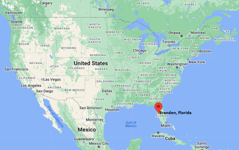
Bozeman Map, Montana, USA
Where is Bozeman?: The Google Map showing the location of Bozeman in the U.S. state of Montana.
Where is Bozeman Located?
Bozeman is a city located in the Gallatin County of Montana, United States. Bozeman lies between 45.66927 Degrees North latitude and -111.043 Degrees West longitude. According to the 2020 U.S. Census, the population of Bozeman city is 53,293 people and the city has a total area of 20.393 sq mi. The city has numerous parks and recreational facilities.
Most Viewed US Maps
| USA Sttae Map | USA Region Map | USA Road Map |
| USA County Map | Where is USA in World Map? | US ZIP Code Map |
| USA Time Zones Map | US State and Capitals Map | USA Physical Map |
Find 4,400+ U.S. Cities by State - Explore Their Locations and Get Detailed Information
Bozeman, Montana Quick Facts
| Fact | Details |
|---|---|
| City | Bozeman |
| County | Gallatin County |
| State | Montana |
| State Capital | Helena |
| Country | United States |
| US Region | West |
| Latitude | 45.66927 N |
| Longitude | -111.043 W |
| Elevation | 4,820 ft (1,469 m) |
| Land Area | 20.68 sq mi |
| Water Area | 0.13 sq mi |
| Total Area | 20.393 sq mi |
| Population (Census 2020) | 53,293 |
| Population Density | Approximately 2,577 per sq mi |
| ZIP Codes | 59715, 59718, 59719, 59771, 59772 |
| Area Code | 406 |
| Time Zone Standard | Mountain Standard Time (MST, UTC-7) |
| Time Zone Daylight | Mountain Daylight Time (MDT, UTC-6) |
| Currency | United States Dollar (USD) |
| FIPS Code | 30-08950 |
| Congressional District | Montana's 1st Congressional District |
Nearby Cities and Towns to Bozeman, Montana
- Belgrade, Montana - 11 mi Northwest
- Four Corners, Montana - 8 mi West
- Manhattan, Montana - 20 mi West
- Livingston, Montana - 26 mi East
- Three Forks, Montana - 32 mi West
- Big Sky, Montana - 45 mi Southwest
- Whitehall, Montana - 57 mi West
- Townsend, Montana - 62 mi North
- Helena, Montana - 96 mi Northwest
- Butte, Montana - 85 mi West
Bozeman, Montana Climate and Weather Overview
| Month | Avg High (°F) | Avg Low (°F) | Avg Precipitation (in) |
|---|---|---|---|
| January | 33 | 14 | 0.8 |
| April | 57 | 31 | 1.6 |
| July | 84 | 48 | 1.1 |
| October | 59 | 31 | 1.0 |
| Annual | 58 | 30 | 18.7 |
| Climate Attribute | Details |
|---|---|
| Climate Classification | Warm-Summer Humid Continental (Köppen Dfb) |
| Annual Precipitation | Approximately 18.7 inches |
| Annual Sunshine Days | About 212 days |
| Severe Weather Risk | Moderate - Winter snowstorms, strong winds and occasional summer thunderstorms |
| Annual Snowfall | Approximately 83 inches |
Driving Distances from Bozeman, Montana
| City | State | Distance (mi) | Approx. Drive Time |
|---|---|---|---|
| Four Corners | Montana | 8 | 12 min |
| Belgrade | Montana | 11 | 15 min |
| Manhattan | Montana | 20 | 25 min |
| Livingston | Montana | 26 | 30 min |
| Three Forks | Montana | 32 | 35 min |
| Big Sky | Montana | 45 | 1 hr |
| Whitehall | Montana | 57 | 1 hr |
| Townsend | Montana | 62 | 1 hr 10 min |
| Butte | Montana | 85 | 1 hr 20 min |
| Helena | Montana | 96 | 1 hr 35 min |
Transportation and Connectivity in Bozeman, Montana
| Transportation | Details |
|---|---|
| Nearest Airport | Bozeman Yellowstone International Airport |
| IATA Code | BZN |
| Major Highways | Interstate 90, U.S. Route 191, Montana Highway 86 |
| Rail Service | Freight rail service available; nearest Amtrak station in Whitefish |
| Local Transit | Streamline Bus public transportation system |
- Interstate 90 provides direct connections to Butte, Billings and other major Montana communities.
- U.S. Route 191 links Bozeman with Big Sky, Yellowstone National Park and central Montana.
- Bozeman Yellowstone International Airport, located in nearby Belgrade, offers year-round flights to major U.S. destinations.
- Streamline Bus provides fare-free public transportation throughout Bozeman, Belgrade, Livingston and surrounding communities.
Key Landmarks and Places to Visit in Bozeman, Montana
| Landmark | Type |
|---|---|
| Museum of the Rockies | Natural History Museum |
| Montana State University | Public University Campus |
| Downtown Bozeman | Historic District |
| Bozeman Hot Springs | Hot Springs Resort |
| Gallatin History Museum | History Museum |
| Peets Hill / Burke Park | Scenic Park |
| American Computer & Robotics Museum | Technology Museum |
| Gallatin Regional Park | Community Park |
| Bridger Bowl Ski Area | Ski Resort |
| Palisade Falls Trail | Hiking Destination |
Colleges and Universities in Bozeman, Montana
| Institution | Type | Level | Notable For |
|---|---|---|---|
| Montana State University | Public | Research University | Engineering, agriculture, architecture and earth sciences |
| Gallatin College MSU | Public | Two-Year College | Career education, trades and workforce training |
| Rocky Mountain College | Private | College | Liberal arts, aviation and business |
| University of Montana | Public | Research University | Law, forestry, health sciences and liberal arts |
| Carroll College | Private | College | Nursing, education and liberal arts |
| Flathead Valley Community College | Public | Community College | Transfer programs and technical education |
Waterbodies in Bozeman, Montana
East Gallatin River, Gallatin River, Hyalite Reservoir, Hyalite Creek, Bozeman Creek, Bridger Creek, Glen Lake, Middle Creek, Sourdough Creek, Madison River.
Golf Courses in Bozeman, Montana
Bridger Creek Golf Course, Riverside Country Club, Black Bull Golf Community, Cottonwood Hills Golf Club, Valley View Golf Club, Spanish Peaks Mountain Club, Big Sky Golf Course, Madison Meadows Golf Course.
Bozeman, Montana - Key Historical Facts
- Bozeman was founded in 1864 by pioneer John Bozeman, who established the Bozeman Trail as a route connecting the Oregon Trail with Montana's gold fields.
- The city became an important supply center for miners, ranchers and settlers moving into the Gallatin Valley during the late nineteenth century.
- Montana State University was established in 1893, helping Bozeman develop into one of the state's leading educational and research centers.
- Agriculture, particularly cattle ranching and grain production, formed the foundation of the local economy before technology and tourism expanded in recent decades.
- Its proximity to Yellowstone National Park, Bridger Bowl and Big Sky Resort has made Bozeman a popular destination for outdoor recreation throughout the year.
- Today, Bozeman is recognized for its thriving technology sector, higher education, vibrant downtown, outdoor lifestyle and access to world-class skiing, hiking and fishing.
References
Other Montana Maps & Info
- Where is Anaconda
- Where is Belgrade
- Where is Big Sky
- Where is Bigfork
- Where is Billings
- Where is Bozeman
- Where is Butte
- Where is Colstrip
- Where is Columbia Falls
- Where is Conrad
- Where is Cut Bank
- Where is Deer Lodge
- Where is Dillon
- Where is East Missoula
- Where is Evergreen
- Where is Four Corners
- Where is Glasgow
- Where is Glendive
- Where is Great Falls
- Where is Hamilton
- Where is Hardin
- Where is Havre
- Where is Helena
- Where is Helena Valley Northeast
- Where is Helena Valley Northwest
- Where is Helena Valley Southeast
- Where is Helena Valley West Central
- Where is Kalispell
- Where is Lakeside
- Where is Laurel
- Where is Lewistown
- Where is Libby
- Where is Livingston
- Where is Lockwood
- Where is Lolo
- Where is Malmstrom AFB
- Where is Manhattan
- Where is Miles City
- Where is Missoula
- Where is Montana City
- Where is North Browning
- Where is Orchard Homes
- Where is Pablo
- Where is Polson
- Where is Red Lodge
- Where is Shelby
- Where is Sidney
- Where is Stevensville
- Where is Whitefish
- Where is Wolf Point