
Where is Four Corners Located? - Four Corners is a city located in the Gallatin County of Montana, United States. Four Corners lies between 41.1399814 Degrees North latitudes and 104.8202462 Degrees West longitudes.
Location Map of Four Corners, Montana
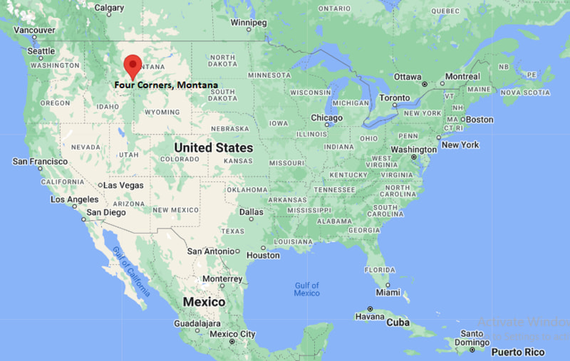
Four Corners Map, Montana, USA
Where is Four Corners?: The Google Map showing the location of Four Corners in the U.S. state of Montana.
Where is Four Corners Located?
Four Corners is a city located in the Gallatin County of Montana, United States. Four Corners lies between 41.1399814 Degrees North latitudes and 104.8202462 Degrees West longitudes. According to 2020 U.S.census, the population of Four Corners city is 5901 people and the city has a total area of 10.68 sq mi. The city has numerous parks and recreational facilities.
Most Viewed US Maps
| USA Sttae Map | USA Region Map | USA Road Map |
| USA County Map | Where is USA in World Map? | US ZIP Code Map |
| USA Time Zones Map | US State and Capitals Map | USA Physical Map |
Find 4,400+ U.S. Cities by State - Explore Their Locations and Get Detailed Information
Four Corners, Montana Quick Facts
| Property | Information |
|---|---|
| City | Four Corners |
| County | Gallatin County |
| State | Montana |
| State Capital | Helena |
| US Region | West |
| Latitude | 45.6695°N |
| Longitude | 111.1824°W |
| Elevation | 4,829 ft (1,472 m) |
| Land Area | 5.33 sq mi |
| Water Area | 0.00 sq mi |
| Total Area | 5.33 sq mi |
| Population (2020 Census) | 5,901 |
| Population Density | 1,107 per sq mi |
| ZIP Codes | 59718, 59771 |
| Area Code | 406 |
| Time Zone Standard | Mountain Standard Time (MST, UTC−7) |
| Time Zone Daylight | Mountain Daylight Time (MDT, UTC−6) |
| Currency | United States Dollar (USD) |
| FIPS Code | 30-28675 |
| Congressional District | Montana's 1st Congressional District |
Nearby Cities to Four Corners, Montana
- Bozeman, Montana - East - 8 mi
- Belgrade, Montana - Northwest - 7 mi
- Manhattan, Montana - West - 12 mi
- Churchill, Montana - Southwest - 9 mi
- Amsterdam, Montana - West - 10 mi
- Gallatin Gateway, Montana - South - 11 mi
- Three Forks, Montana - West - 28 mi
- Livingston, Montana - East - 35 mi
- Big Sky, Montana - South - 45 mi
- Whitehall, Montana - West - 67 mi
Driving Distances from Four Corners, Montana
| City | State | Distance (mi) | Approx. Drive Time |
|---|---|---|---|
| Bozeman | Montana | 8 | 15 minutes |
| Belgrade | Montana | 7 | 12 minutes |
| Manhattan | Montana | 12 | 18 minutes |
| Gallatin Gateway | Montana | 11 | 15 minutes |
| Three Forks | Montana | 28 | 30 minutes |
| Livingston | Montana | 35 | 40 minutes |
| Big Sky | Montana | 45 | 50 minutes |
| Whitehall | Montana | 67 | 1 hour 10 minutes |
| Butte | Montana | 88 | 1 hour 25 minutes |
| Helena | Montana | 97 | 1 hour 35 minutes |
Transportation and Connectivity in Four Corners, Montana
| Mode | Details |
|---|---|
| Airport Name | Bozeman Yellowstone International Airport |
| IATA Code | BZN |
| Port | Not Applicable |
| Major Highways | US Highway 191, Montana Highway 84, Interstate 90 (nearby) |
| Train/Amtrak Service | No passenger rail service; nearest Amtrak station is in Whitefish |
| Local Bus/Transit Service | Streamline Bus serving Four Corners, Bozeman, Belgrade, and Gallatin Valley |
- US Highway 191 connects Four Corners with Bozeman, Gallatin Gateway, Big Sky, and Yellowstone National Park.
- Montana Highway 84 links the community with Four Corners, Norris, and US Highway 287.
- Interstate 90, located a few miles north, provides convenient east-west travel across southern Montana.
What are top Places to Visit in Four Corners, Montana
| Landmark Name | Type |
|---|---|
| Gallatin River | Natural Attraction |
| Bozeman Hot Springs | Hot Springs |
| Gallatin County Regional Park | Regional Park |
| Museum of the Rockies | Museum |
| American Computer & Robotics Museum | Museum |
| Gallatin National Forest | National Forest |
| Big Sky Resort | Ski Resort |
| Montana Grizzly Encounter | Wildlife Sanctuary |
| Downtown Bozeman | Historic District |
| Yellowstone National Park (Northwest Entrance Region) | National Park |
Colleges and Universities in Four Corners, Montana
| Institution Name | Type | Level | Notable For |
|---|---|---|---|
| Montana State University | Public | University | Flagship land-grant research university |
| Gallatin College Montana State University | Public | Community College | Workforce and technical education |
| University of Providence – Bozeman | Private | University | Healthcare and nursing programs |
| Rocky Mountain College | Private | University | Liberal arts education |
| Monforton School District | Public | K–12 District | Local public education |
Waterbodies in Four Corners, Montana
Gallatin River, East Gallatin River, Jefferson River, Madison River, Missouri River Headwaters, Hyalite Reservoir, Bozeman Creek, Middle Creek
Golf Courses in Four Corners, Montana
Riverside Country Club, Cottonwood Hills Golf Club, Bridger Creek Golf Course, Black Bull Golf Club, Valley View Golf Club, Spanish Peaks Mountain Club Golf Course
Four Corners, Montana — Key Historical Facts
- Four Corners developed as a rural crossroads in the Gallatin Valley where important transportation routes linked Bozeman with surrounding agricultural communities.
- The area experienced steady growth during the twentieth century as farming, ranching, and commerce expanded throughout Gallatin County.
- Its location along the route to Yellowstone National Park and Big Sky helped make Four Corners an important gateway for residents and visitors.
- Rapid population growth in the Bozeman metropolitan area transformed Four Corners into one of southwestern Montana's fastest-growing residential communities.
- Today, Four Corners serves as a thriving suburban community offering convenient access to outdoor recreation, higher education, and employment throughout the Gallatin Valley.
References
Other Montana Maps & Info
- Where is Anaconda
- Where is Belgrade
- Where is Big Sky
- Where is Bigfork
- Where is Billings
- Where is Bozeman
- Where is Butte
- Where is Colstrip
- Where is Columbia Falls
- Where is Conrad
- Where is Cut Bank
- Where is Deer Lodge
- Where is Dillon
- Where is East Missoula
- Where is Evergreen
- Where is Four Corners
- Where is Glasgow
- Where is Glendive
- Where is Great Falls
- Where is Hamilton
- Where is Hardin
- Where is Havre
- Where is Helena
- Where is Helena Valley Northeast
- Where is Helena Valley Northwest
- Where is Helena Valley Southeast
- Where is Helena Valley West Central
- Where is Kalispell
- Where is Lakeside
- Where is Laurel
- Where is Lewistown
- Where is Libby
- Where is Livingston
- Where is Lockwood
- Where is Lolo
- Where is Malmstrom AFB
- Where is Manhattan
- Where is Miles City
- Where is Missoula
- Where is Montana City
- Where is North Browning
- Where is Orchard Homes
- Where is Pablo
- Where is Polson
- Where is Red Lodge
- Where is Shelby
- Where is Sidney
- Where is Stevensville
- Where is Whitefish
- Where is Wolf Point