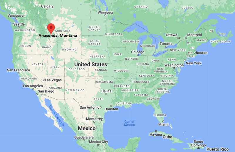
Where is Anaconda Located? - Anaconda is a city located in the Deer Lodge County of Montana, United States. Anaconda lies between 46.12986 Degrees North latitudes and -112.974 Degrees West longitudes.
Location Map of Anaconda, Montana
Anaconda Map, Montana, USA
Where is Anaconda?: The Google Map showing the location of Anaconda in the U.S. state of Montana.
Where is Anaconda Located?
Anaconda is a city located in Deer Lodge County of Montana, United States. Anaconda lies at approximately 46.12986 Degrees North latitude and -112.974 Degrees West longitude. According to the 2020 U.S. Census, the population of Anaconda city is 9,421 people and the city has a total area of 736.68 sq mi. The city has numerous parks and recreational facilities.
Anaconda is connected to Interstate 90 through nearby Warm Springs.
The city serves as the largest community in Deer Lodge County.
Bert Mooney Airport in Butte provides regional commercial air service.
Montana Highway 1, known as the Pintler Scenic Route, passes near the city.
Tourism, outdoor recreation, healthcare and education support the local economy.
Key Landmarks and Places to Visit in Anaconda, Montana
Landmark Name
Type
Anaconda Smoke Stack State Park
Historic Landmark
Old Works Golf Course
Golf Course
Washoe Theater
Historic Theater
Copper Village Museum and Arts Center
Museum
Georgetown Lake
Recreation Area
Lost Creek State Park
State Park
Pintler Veterans Memorial Scenic Highway
Scenic Drive
Community Hospital of Anaconda Grounds
Historic Area
Hickey Park
Community Park
Mount Haggin Wildlife Management Area
Wildlife Area
Colleges and Universities Near Anaconda, Montana
Institution Name
Type
Distance
Notable For
Montana Technological University
Public University
26 mi
Engineering and applied sciences
University of Montana
Public University
95 mi
Research and liberal arts
Helena College
Community College
75 mi
Career and technical education
Carroll College
Private College
76 mi
Liberal arts education
Montana State University
Public University
110 mi
Agriculture and engineering
Waterbodies in and Near Anaconda, Montana
Georgetown Lake, Warm Springs Creek, Lost Creek, Silver Lake, Storm Lake, Flint Creek, Clark Fork River, Twin Lakes, Echo Lake, Willow Creek Reservoir
Golf Courses in and Near Anaconda, Montana
Old Works Golf Course, Fairmont Hot Springs Resort Golf Course, Butte Country Club, Deer Lodge Golf Club, Anaconda Hills Golf Area, Hamilton Golf Club, Missoula Country Club, Ranch Club Golf Course
Anaconda, Montana - Key Historical Facts
Anaconda was founded in 1883 by copper magnate Marcus Daly as a smelting center for the Anaconda Copper Mining Company.
The city became one of the most important copper-processing centers in the United States.
The iconic Anaconda Smelter Stack, completed in 1919, remains one of the tallest masonry structures in the world.
Copper production drove the local economy for nearly a century.
Environmental cleanup and redevelopment efforts transformed former industrial areas into community assets.
Today, Anaconda is known for its mining heritage, outdoor recreation opportunities and historic downtown district.