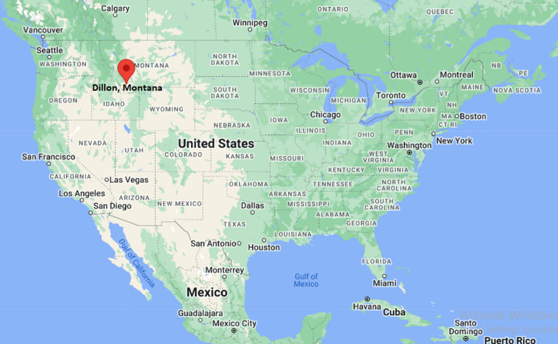
Where is Dillon Located? - Dillon is a city located in the Beaverhead County of Montana, United States. Dillon lies between 41.2185914 Degrees North latitudes and 104.7902455 Degrees West longitudes.
Location Map of Dillon, Montana
Dillon Map, Montana, USA
Where is Dillon?: The Google Map showing the location of Dillon in the U.S. state of Montana.
Where is Dillon Located?
Dillon is a city located in the Beaverhead County of Montana, United States. Dillon lies between 41.2185914 Degrees North latitudes and 104.7902455 Degrees West longitudes. According to 2020 U.S.census, the population of Dillon city is 3880 people and the city has a total area of 1.77 sq mi. The city has numerous parks and recreational facilities.
No passenger rail service; nearest Amtrak station is in Shelby
Local Bus/Transit Service
Regional shuttle and Beaverhead County transportation services
Interstate 15 is the primary north-south highway connecting Dillon with Butte, Helena, Idaho Falls, and Salt Lake City.
Montana Highway 41 links Dillon with Twin Bridges, Whitehall, and southwestern Montana communities.
Montana Highway 278 provides access to Lima, Bannack State Park, and nearby ranching communities.
Dillon Airport supports general aviation, charter flights, and emergency air services for Beaverhead County.
Key Landmarks and Places to Visit in Dillon, Montana
Landmark Name
Type
Beaverhead County Museum
History Museum
University of Montana Western
University Campus
Bannack State Park
State Park
Beaverhead Rock State Park
State Park
Clark's Lookout State Park
State Park
Beaverhead River
Scenic River
Dillon Jaycee Park
Community Park
Lion's Club Park
City Park
Big Hole National Battlefield
Historic Site
Downtown Dillon Historic District
Historic District
Colleges and Universities in Dillon, Montana
Institution Name
Type
Level
Notable For
University of Montana Western
Public
University
Experience One experiential learning program
Montana State University
Public
University
Research, agriculture, engineering, and business
Montana Technological University
Public
University
Engineering, mining, and applied sciences
Carroll College
Private
College
Liberal arts and health sciences
University of Montana
Public
University
Law, forestry, and liberal arts
Waterbodies in Dillon, Montana
Beaverhead River, Clark Canyon Reservoir, Big Hole River, Red Rock River, Grasshopper Creek, Blacktail Deer Creek, Barretts Reservoir, Ruby River
Golf Courses in Dillon, Montana
Beaverhead Golf Course, Fairmont Hot Springs Resort Golf Course, Butte Country Club, Madison Meadows Golf Course, Old Works Golf Course, Anaconda Hills Golf Course
Dillon, Montana - Key Historical Facts
Dillon was founded in 1880 as a railroad and supply center for ranchers, miners, and settlers in southwestern Montana.
The city was named after Sidney Dillon, president of the Union Pacific Railroad, reflecting the railroad's influence on the area's development.
Nearby Bannack, Montana's first territorial capital, contributed significantly to the region's early gold mining economy during the 1860s.
Cattle ranching, agriculture, and transportation became the primary economic drivers as mining activity declined.
The University of Montana Western, established in 1893, has played an important role in education and workforce development across southwestern Montana.
Today, Dillon serves as the commercial, educational, and recreational center of Beaverhead County and is a popular destination for fly fishing, hunting, hiking, and outdoor tourism.