
Where is Bradford Located? - Bradford is a city located in the Orange County of Vermont, United States. Bradford lies between 44.0006 Degrees North latitudes and -72.1406 Degrees West longitudes.
Location Map of Brentwood, Tennessee
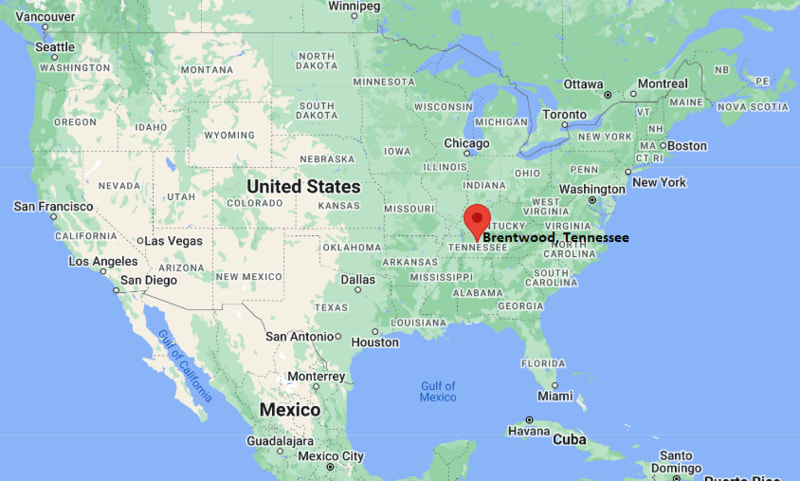
Bradford Map, Vermont, USA
Where is Bradford?: The Google Map showing the location of Bradford in the U.S. state of Vermont.
Where is Bradford Located?
Bradford is a town located in the Orange County of Vermont, United States. Bradford lies between 44.0006 Degrees North latitude and -72.1406 Degrees West longitude. According to the 2020 U.S. Census, the population of Bradford town is 2,700 people and the town has a total area of 0.559 sq mi. The town has numerous parks and recreational facilities.
Most Viewed US Maps
| USA Sttae Map | USA Region Map | USA Road Map |
| USA County Map | Where is USA in World Map? | US ZIP Code Map |
| USA Time Zones Map | US State and Capitals Map | USA Physical Map |
Find 4,400+ U.S. Cities by State - Explore Their Locations and Get Detailed Information
Bradford, Vermont Quick Facts
| Fact | Details |
|---|---|
| Town | Bradford |
| County | Orange County |
| State | Vermont |
| State Capital | Montpelier |
| Country | United States |
| US Region | Northeast |
| Latitude | 44.0006 N |
| Longitude | -72.1406 W |
| Elevation | 440 ft (134 m) |
| Land Area | 39.78 sq mi |
| Water Area | 0.40 sq mi |
| Total Area | 0.559 sq mi |
| Population (Census 2020) | 2,907 |
| Population Density | Approximately 73 per sq mi |
| ZIP Code | 05033 |
| Area Code | 802 |
| Time Zone Standard | Eastern Standard Time (EST, UTC-5) |
| Time Zone Daylight | Eastern Daylight Time (EDT, UTC-4) |
| Currency | United States Dollar (USD) |
| FIPS Code | 50-07375 |
| Congressional District | Vermont At-Large Congressional District |
Nearby Cities and Towns to Bradford, Vermont
- Newbury, Vermont - 6 mi Northeast
- Fairlee, Vermont - 9 mi Northwest
- Corinth, Vermont - 11 mi West
- Orford, New Hampshire - 2 mi East
- Haverhill, New Hampshire - 10 mi Southeast
- Wells River, Vermont - 12 mi North
- Woodsville, New Hampshire - 13 mi Northeast
- Chelsea, Vermont - 18 mi West
- Hanover, New Hampshire - 33 mi South
- Montpelier, Vermont - 42 mi Northwest
Bradford, Vermont Climate and Weather Overview
| Month | Avg High (°F) | Avg Low (°F) | Avg Precipitation (in) |
|---|---|---|---|
| January | 26 | 7 | 2.8 |
| April | 54 | 33 | 3.5 |
| July | 80 | 58 | 4.2 |
| October | 58 | 38 | 3.7 |
| Annual | 54 | 34 | 42.5 |
| Climate Attribute | Details |
|---|---|
| Climate Classification | Warm-Summer Humid Continental (Köppen Dfb) |
| Annual Precipitation | Approximately 42.5 inches |
| Annual Sunshine Days | About 183 days |
| Severe Weather Risk | Moderate - Winter snowstorms, spring flooding and occasional summer thunderstorms |
| Annual Snowfall | Approximately 72 inches |
Driving Distances from Bradford, Vermont
| Town/City | State | Distance (mi) | Approx. Drive Time |
|---|---|---|---|
| Orford | New Hampshire | 2 | 5 min |
| Newbury | Vermont | 6 | 10 min |
| Fairlee | Vermont | 9 | 12 min |
| Haverhill | New Hampshire | 10 | 15 min |
| Corinth | Vermont | 11 | 18 min |
| Wells River | Vermont | 12 | 18 min |
| Woodsville | New Hampshire | 13 | 20 min |
| Chelsea | Vermont | 18 | 25 min |
| Hanover | New Hampshire | 33 | 40 min |
| Montpelier | Vermont | 42 | 55 min |
Transportation and Connectivity in Bradford, Vermont
| Transportation | Details |
|---|---|
| Nearest Airport | Dean Memorial Airport (Claremont, NH) |
| Nearest Major Airport | Lebanon Municipal Airport |
| Major Highways | Interstate 91, U.S. Route 5, Vermont Route 25 |
| Rail Service | Freight rail service available in the region |
| Local Transit | Stagecoach Transportation Services regional bus routes |
- Interstate 91 provides convenient access to White River Junction, Brattleboro and communities throughout Vermont and New Hampshire.
- U.S. Route 5 and Vermont Route 25 connect Bradford with neighboring towns along the Connecticut River Valley.
- Lebanon Municipal Airport, about 30 miles south, supports regional aviation, while larger commercial airports are available in Burlington and Manchester.
- Stagecoach Transportation Services offers regional bus connections for residents traveling throughout east-central Vermont.
Key Landmarks and Places to Visit in Bradford, Vermont
| Landmark | Type |
|---|---|
| Bradford Village Historic District | Historic District |
| Wright's Mountain Trail | Hiking Area |
| Waits River Valley | Scenic Area |
| Bradford Public Library | Public Library |
| Elizabeth's Park | Community Park |
| Lake Morey Resort Area | Recreation Area |
| Haverhill-Bath Covered Bridge | Historic Covered Bridge |
| Thetford Hill State Park (Nearby) | State Recreation Area |
| Connecticut River Access | Outdoor Recreation Site |
| Fairlee Drive-In Theater | Historic Drive-In Theater |
Colleges and Universities in Bradford, Vermont
| Institution | Type | Level | Notable For |
|---|---|---|---|
| Dartmouth College | Private | Research University | Medicine, engineering, business and liberal arts |
| Vermont State University - Randolph Center | Public | University | Technical education, agriculture and applied sciences |
| River Valley Community College | Public | Community College | Healthcare, trades and workforce training |
| Upper Valley Educators Institute | Private | Graduate Education | Teacher education and professional development |
| Colby-Sawyer College | Private | College | Nursing, business and environmental studies |
| Vermont Law and Graduate School | Private | Graduate School | Environmental law and public policy |
Waterbodies in Bradford, Vermont
Connecticut River, Waits River, Halls Lake, Lake Morey, Ticklenaked Pond, Fairlee Lake, Ompompanoosuc River, Wells River, Wright's Brook, South Branch Waits River.
Golf Courses in Bradford, Vermont
Lake Morey Country Club, Bradford Country Club, Montague Golf Club, Hanover Country Club, Eastman Golf Links, Baker Hill Golf Club, Montcalm Golf Club, Newport Golf Club.
Bradford, Vermont - Key Historical Facts
- Bradford was chartered in 1768 and permanently settled after the American Revolution, developing as an agricultural and trading community along the Connecticut River.
- The town became an important transportation center during the nineteenth century with the arrival of the railroad, supporting local farming, timber and commerce.
- Its historic downtown features many well-preserved nineteenth-century buildings that reflect Bradford's commercial growth during the Victorian era.
- The Connecticut River has long played an important role in the town's economy, recreation and connection with neighboring communities in New Hampshire.
- Agriculture, small businesses and tourism continue to support the local economy alongside regional healthcare and education services.
- Today, Bradford is known for its historic village center, scenic Upper Valley location, outdoor recreation and strong sense of community.
References
- Town of Bradford
- U.S. Census Bureau
- Vermont Tourism
- Vermont Agency of Commerce and Community Development
Vermont Maps and Info
- Where is Barre
- Where is Bellows Falls
- Where is Bennington
- Where is Bradford
- Where is Brandon
- Where is Brattleboro
- Where is Bristol
- Where is Burlington
- Where is Castleton
- Where is Chester
- Where is Enosburg Falls
- Where is Essex Junction
- Where is Fair Haven
- Where is Hardwick
- Where is Jericho
- Where is Johnson
- Where is Lyndonville
- Where is Manchester Center
- Where is Middlebury
- Where is Milton
- Where is Montpelier
- Where is Morrisville
- Where is Newport
- Where is North Bennington
- Where is Norwich
- Where is Pittsford
- Where is Poultney
- Where is Quechee
- Where is Randolph
- Where is Richford
- Where is Rutland
- Where is Shelburne
- Where is South Barre
- Where is South Burlington
- Where is St. Albans
- Where is St. Johnsbury
- Where is Swanton
- Where is Vergennes
- Where is Wallingford
- Where is West Brattleboro
- Where is West Rutland
- Where is White River Junction
- Where is Wilder
- Where is Williamstown
- Where is Windsor
- Where is Winooski
- Where is Woodstock