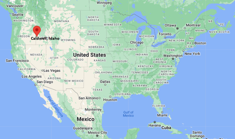
Where is Caldwell Located? - Caldwell is a city located in the Canyon County of Idaho, United States. Caldwell lies between 39.9784 Degrees North latitudes and 86.1180 Degrees West longitudes.
Location Map of Caldwell, Idaho
Caldwell Map, Idaho, USA
Where is Caldwell?: The Google Map showing the location of Caldwell in the U.S. state of Idaho.
Where is Caldwell Located?
Caldwell is a city located in the Canyon County of Idaho, United States. Caldwell lies between 39.9784 Degrees North latitudes and 86.1180 Degrees West longitudes. According to 2020 U.S.census, the population of Caldwell city is 59996 people and the city has a total area of 22.61 sq mi. The city has numerous parks and recreational facilities.
Transportation and Connectivity in Caldwell, Idaho
Transportation
Details
Airport Name
Boise Airport
IATA Code
BOI
Port
Not Applicable
Major Highways
Interstate 84, U.S. Highway 20/26, Idaho State Highway 19
Train/Amtrak Service
No Amtrak service; nearest station at Boise (bus connection)
Local Bus/Transit Service
Valley Regional Transit
Interstate 84 - Primary interstate connecting Caldwell with Boise, Twin Falls and eastern Oregon.
U.S. Highway 20/26 - Major regional highway linking Caldwell with Nampa, Parma and the Treasure Valley.
Idaho State Highway 19 - Connects Caldwell with Middleton and Interstate 84.
Boise Airport - The nearest commercial airport providing domestic flights across the United States.
Valley Regional Transit - Provides regional public transportation within Canyon and Ada counties.
Key Landmarks and Places to Visit in Caldwell, Idaho
Landmark Name
Type
Indian Creek Plaza
Downtown Plaza
College of Idaho Campus
University Campus
Whittenberger Planetarium
Planetarium
Our Memories Indian Creek Museum
History Museum
Lake Lowell
Recreation Area
Deer Flat National Wildlife Refuge
Wildlife Refuge
Canyon County Historical Museum
Museum
Babby Farms
Family Attraction
Fairview Golf Course
Golf Course
West Valley Medical Center Walking Trail
Nature Trail
Colleges and Universities in Caldwell, Idaho
Institution Name
Type
Level
Notable For
The College of Idaho
Private
College
Liberal arts and pre-professional education
College of Western Idaho
Public
Community College
Career and transfer programs
Boise State University
Public
University
Research and graduate education
Northwest Nazarene University
Private
University
Liberal arts and professional programs
Caldwell School District
Public
K-12 District
Public education services
Waterbodies in Caldwell, Idaho
Indian Creek, Lake Lowell, Boise River, Mason Creek, Dixie Drain, Sand Hollow Creek, Snake River, Deer Flat Reservoir
Golf Courses in Caldwell, Idaho
Fairview Golf Course, Purple Sage Golf Course, RedHawk Public Golf Course, TimberStone Golf Course, Falcon Crest Golf Club, Centennial Golf Course, River Birch Golf Course, Ridgecrest Golf Club
Caldwell, Idaho - Key Historical Facts
Caldwell was founded in 1883 as a stop along the Oregon Short Line Railroad and quickly became an agricultural shipping center.
The city was named after Alexander Caldwell, a former United States senator from Kansas.
Irrigation projects in the late nineteenth and early twentieth centuries transformed the surrounding land into productive farmland known for orchards, vineyards, and row crops.
The College of Idaho, established in 1891, has played a major role in the city's educational and cultural development.
Downtown revitalization projects, including Indian Creek Plaza, have strengthened tourism, entertainment, and local business activity.
Today, Caldwell is one of the fastest-growing communities in Idaho's Treasure Valley, recognized for its agriculture, wineries, higher education, and vibrant downtown district.