
Fort Oglethorpe is a city in northwest Georgia and part of the Chattanooga metropolitan area. It is about 10 miles south of downtown Chattanooga, Tennessee, in Catoosa County. The city is known for its Civil War history, Chickamauga and Chattanooga National Military Park, nearby Lookout Mountain, and its location along major routes linking Georgia with Tennessee.
Location Map of Fort Oglethorpe, Catoosa County, Georgia
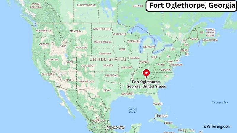
About Map: The map shows the location of Fort Oglethorpe in Catoosa County, in the U.S. state of Georgia.
Fort Oglethorpe Map, Georgia
About Fort Oglethorpe Map: The Google Map highlights the location of Fort Oglethorpe in Catoosa County, Georgia. Use the zoom, satellite, and street-view options to explore the city's neighborhoods, roads, and nearby places.
Where is Fort Oglethorpe Located?
Fort Oglethorpe is a city located in Catoosa County, Georgia, the United States. It lies in northwest Georgia near the Tennessee state line, about 10 miles south of Chattanooga, Tennessee, 15 miles north of Dalton, Georgia, and roughly 120 miles northwest of Atlanta. Fort Oglethorpe is positioned at approximately 34.948° North latitude and 85.257° West longitude. The city covers about 13.3 square miles, or 34.4 square kilometers. The 2020 Census recorded 9,133 residents, while recent estimates place the population at about 9,200. Fort Oglethorpe stands at an elevation of roughly 700 feet above sea level. The community developed around a U.S. Army military post established during the early 20th century and was named for Georgia founder James Oglethorpe. Its location also places it within the historic Chickamauga and Chattanooga campaign area of the Civil War. Chickamauga Battlefield, part of Chickamauga and Chattanooga National Military Park, is one of the city's best-known nearby landmarks. The city also provides access to Lookout Mountain, Cloudland Canyon State Park, and the attractions of Chattanooga. Interstate 75 and U.S. Route 27 provide important transportation links through the region.
Most Viewed US Maps
| USA Sttae Map | USA Region Map | USA Road Map |
| USA County Map | Where is USA in World Map? | US ZIP Code Map |
| USA Time Zones Map | US State and Capitals Map | USA Physical Map |
Find 4,400+ U.S. Cities by State - Explore Their Locations and Get Detailed Information
Fort Oglethorpe City Facts
| City | Fort Oglethorpe |
|---|---|
| State | Georgia |
| County | Catoosa County |
| Country | United States |
| Region | Northwest Georgia, Chattanooga Metropolitan Area |
| Incorporated | 1949 |
| Founded | 1902 |
| Total Area | 13.30 sq mi (34.45 sq km) |
| Land Area | 13.20 sq mi (34.19 sq km) |
| Water Area | 0.10 sq mi (0.26 sq km) |
| Elevation | 700 ft (213 m) |
| Population (2023 estimate) | About 9,200 |
| Population (2020 Census) | 9,133 |
| Population Density | 692.0 people per sq mi |
| Time Zone | Eastern Time (EST/EDT) |
| ZIP Codes | 30742 |
| Area Code | 706, 762 |
| Major Highways | Interstate 75, U.S. Route 27, U.S. Route 41 |
| Public Transit | Chattanooga Area Regional Transportation Authority (CARTA) connections |
| Major Attractions | Chickamauga Battlefield, Chickamauga and Chattanooga National Military Park, Lookout Mountain, Lake Winnepesaukah, Cloudland Canyon State Park |
| Official Website | https://www.fortogov.com/ |
Distance from Fort Oglethorpe, GA to Nearby Cities
- Ringgold, GA – 5 miles (8 km)
- Rossville, GA – 5 miles (8 km)
- Chattanooga, TN – 10 miles (16 km)
- East Ridge, TN – 8 miles (13 km)
- Dalton, GA – 15 miles (24 km)
- LaFayette, GA – 25 miles (40 km)
- Cleveland, TN – 30 miles (48 km)
- Calhoun, GA – 30 miles (48 km)
- Rome, GA – 50 miles (80 km)
- Cartersville, GA – 55 miles (89 km)
- Woodstock, GA – 75 miles (121 km)
- Atlanta, GA – 120 miles (193 km)
- Knoxville, TN – 105 miles (169 km)
- Huntsville, AL – 100 miles (161 km)
- Decatur, AL – 100 miles (161 km)
- Birmingham, AL – 145 miles (233 km)
- Gainesville, GA – 110 miles (177 km)
- Asheville, NC – 160 miles (257 km)
Top Attractions in Fort Oglethorpe
- Chickamauga Battlefield – A major Civil War battlefield and the centerpiece of Chickamauga and Chattanooga National Military Park, with trails, monuments, and historic sites.
- Chickamauga and Chattanooga National Military Park – A large historic park preserving important Civil War sites across northwest Georgia and southeast Tennessee.
- 6th Cavalry Museum – A military history museum at the former Fort Oglethorpe site featuring exhibits about the U.S. Army's cavalry history.
- Lookout Mountain – A prominent mountain landmark near Chattanooga offering scenic overlooks, hiking trails, historic sites, and attractions.
- Lake Winnepesaukah – A longtime regional amusement park in nearby Rossville featuring rides, family attractions, and seasonal activities.
- Cloudland Canyon State Park – A scenic state park on Lookout Mountain with waterfalls, hiking trails, forests, and deep canyon views.
- Rock City Gardens – A popular Lookout Mountain attraction known for rock formations, walking trails, gardens, and panoramic views.
- Ruby Falls – An underground waterfall attraction inside Lookout Mountain near Chattanooga.
- Tennessee Riverwalk – A scenic trail system along the Tennessee River in Chattanooga for walking, cycling, and waterfront recreation.
- Tennessee Aquarium – A major Chattanooga attraction featuring freshwater and saltwater exhibits and aquatic wildlife from around the world.
Airports Near Fort Oglethorpe
- Chattanooga Metropolitan Airport (CHA) – 10 miles
- Barwick-LaFayette Airport (9A0) – 25 miles
- Dalton Municipal Airport (DNN) – 20 miles
- Richard B. Russell Airport (RMG) – 45 miles
- Lovell Field Airport (CHA) – 10 miles
Sources:
Population and area data sourced from the United States Census Bureau (2020 Census). General city information referenced from the official City of Fort Oglethorpe website and local government records.
Most Viewed GA Maps
- Where is Acworth
- Where is Albany
- Where is Alpharetta
- Where is Candler-McAfee
- Where is Canton
- Where is Carrollton
- Where is Cartersville
- Where is Chamblee
- Where is Dalton
- Where is Decatur
- Where is Douglasville
- Where is Duluth
- Where is Dunwoody
- Where is East Point
- Where is Evans
- Where is Gainesville
- Where is Griffin
- Where is Hinesville
- Where is Johns Creek
- Where is Kennesaw
- Where is LaGrange
- Where is Lawrenceville
- Where is Mableton
- Where is Marietta
- Where is Martinez
- Where is McDonough
- Where is Milton
- Where is Newnan
- Where is Peachtree City
- Where is Perry
- Where is Pooler
- Where is Redan
- Where is Rome
- Where is Roswell
- Where is Sandy Springs
- Where is Savannah
- Where is Smyrna
- Where is Snellville
- Where is Statesboro
- Where is Stockbridge
- Where is Sugar Hill
- Where is Suwanee
- Where is Union City
- Where is Valdosta
- Where is Warner Robins
- Where is Woodstock