
Fort Valley is a city in central Georgia and the county seat of Peach County. It is about 30 miles south of Macon and 95 miles south of Atlanta in the heart of the state's peach-growing region. The city is known for its agricultural heritage, Fort Valley State University, historic downtown, and annual events that celebrate its connection to Georgia's peach industry.
Location Map of Fort Valley, Peach County, Georgia
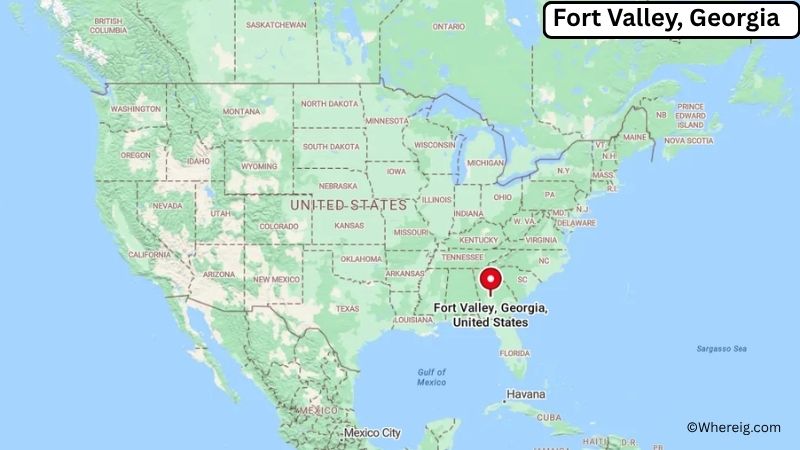
About Map: The map shows the location of Fort Valley in Peach County, in the U.S. state of Georgia.
Fort Valley Map, Georgia
About Fort Valley Map: The Google Map highlights the location of Fort Valley in Peach County, Georgia. Use the zoom, satellite, and street-view options to explore the city's neighborhoods, roads, and nearby places.
Where is Fort Valley Located?
Fort Valley is a city located in Peach County, Georgia, the United States. It lies in central Georgia, about 30 miles southwest of Macon, 25 miles west of Warner Robins, and roughly 95 miles south of Atlanta. Fort Valley is positioned at approximately 32.554° North latitude and 83.888° West longitude. The city covers about 4.32 square miles, or 11.19 square kilometers, of land. The 2020 Census recorded 8,780 residents, while recent estimates place the population at about 8,500. Fort Valley stands at an elevation of roughly 430 feet above sea level. The city was founded in the early 19th century and became an important center for agriculture and transportation. It serves as the county seat of Peach County, a county created in 1924 and named for Georgia's famous peach industry. Fort Valley State University, a historically Black university founded in 1895, is one of the city's major institutions. The area around Fort Valley is known for peach orchards, pecans, and other agricultural products. Historic downtown buildings and nearby agricultural landmarks reflect the community's long connection to farming. U.S. Route 341 and Georgia State Route 49 provide road connections to Macon, Perry, Warner Robins, and other central Georgia communities.
Most Viewed US Maps
| USA Sttae Map | USA Region Map | USA Road Map |
| USA County Map | Where is USA in World Map? | US ZIP Code Map |
| USA Time Zones Map | US State and Capitals Map | USA Physical Map |
Find 4,400+ U.S. Cities by State - Explore Their Locations and Get Detailed Information
Fort Valley City Facts
| City | Fort Valley |
|---|---|
| State | Georgia |
| County | Peach County |
| Country | United States |
| Region | Central Georgia, Peach County |
| Incorporated | 1841 |
| Founded | 1820s |
| Total Area | 4.32 sq mi (11.19 sq km) |
| Land Area | 4.31 sq mi (11.16 sq km) |
| Water Area | 0.01 sq mi (0.03 sq km) |
| Elevation | 430 ft (131 m) |
| Population (2023 estimate) | About 8,500 |
| Population (2020 Census) | 8,780 |
| Population Density | 2,036.0 people per sq mi |
| Time Zone | Eastern Time (EST/EDT) |
| ZIP Codes | 31030 |
| Area Code | 478 |
| Major Highways | U.S. Route 341, Georgia State Route 49, Georgia State Route 96 |
| Public Transit | Macon-Bibb County Transit and regional transportation connections |
| Major Attractions | Fort Valley State University, Massee Lane Gardens, Peach County Courthouse, historic downtown, Georgia National Fairgrounds nearby |
| Official Website | https://www.fortvalleyga.com/ |
Distance from Fort Valley, GA to Nearby Cities
- Perry, GA – 15 miles (24 km)
- Warner Robins, GA – 20 miles (32 km)
- Byron, GA – 15 miles (24 km)
- Roberta, GA – 20 miles (32 km)
- Marshallville, GA – 20 miles (32 km)
- Macon, GA – 30 miles (48 km)
- Montezuma, GA – 25 miles (40 km)
- Reynolds, GA – 30 miles (48 km)
- Gray, GA – 45 miles (72 km)
- Milledgeville, GA – 55 miles (89 km)
- Americus, GA – 55 miles (89 km)
- Columbus, GA – 80 miles (129 km)
- Atlanta, GA – 95 miles (153 km)
- Albany, GA – 90 miles (145 km)
- Valdosta, GA – 125 miles (201 km)
- Savannah, GA – 150 miles (241 km)
- Athens, GA – 125 miles (201 km)
- Augusta, GA – 130 miles (209 km)
Top Attractions in Fort Valley
- Fort Valley State University – A historically Black university founded in 1895 and one of the city's most important educational and cultural institutions.
- Massee Lane Gardens – A botanical garden near Fort Valley known for its extensive camellia collection, landscaped grounds, and seasonal displays.
- Peach County Courthouse – A historic courthouse in downtown Fort Valley serving as an important civic and architectural landmark.
- Historic Downtown Fort Valley – A traditional downtown area with historic commercial buildings, local businesses, restaurants, and community events.
- Peach County Historical Society – A local historical organization preserving artifacts, records, photographs, and stories from the region.
- Georgia National Fairgrounds & Agricenter – A major regional event complex in nearby Perry hosting the Georgia National Fair and agricultural events.
- Lane Southern Orchards – A well-known agricultural attraction near Fort Valley with peach orchards, farm products, and seasonal activities.
- Andersonville National Historic Site – A historic national park southwest of Fort Valley preserving the site of the Civil War-era Andersonville prison and National Prisoner of War Museum.
- Ocmulgee Mounds National Historical Park – A major archaeological and cultural site near Macon preserving ancient earthworks built by Indigenous peoples.
- Robins Air Force Base Museum of Aviation – A large aviation museum near Warner Robins featuring historic aircraft, military exhibits, and Georgia aviation history.
Airports Near Fort Valley
- Middle Georgia Regional Airport (MCN) – 25 miles
- Perry-Houston County Airport (PXE) – 20 miles
- Robins Air Force Base – 20 miles
- Hartsfield-Jackson Atlanta International Airport (ATL) – 100 miles
- Columbus Airport (CSG) – 80 miles
Sources:
Population and area data sourced from the United States Census Bureau (2020 Census). General city information referenced from the official City of Fort Valley website and local government records.
Most Viewed GA Maps
- Where is Acworth
- Where is Albany
- Where is Alpharetta
- Where is Candler-McAfee
- Where is Canton
- Where is Carrollton
- Where is Cartersville
- Where is Chamblee
- Where is Dalton
- Where is Decatur
- Where is Douglasville
- Where is Duluth
- Where is Dunwoody
- Where is East Point
- Where is Evans
- Where is Gainesville
- Where is Griffin
- Where is Hinesville
- Where is Johns Creek
- Where is Kennesaw
- Where is LaGrange
- Where is Lawrenceville
- Where is Mableton
- Where is Marietta
- Where is Martinez
- Where is McDonough
- Where is Milton
- Where is Newnan
- Where is Peachtree City
- Where is Perry
- Where is Pooler
- Where is Redan
- Where is Rome
- Where is Roswell
- Where is Sandy Springs
- Where is Savannah
- Where is Smyrna
- Where is Snellville
- Where is Statesboro
- Where is Stockbridge
- Where is Sugar Hill
- Where is Suwanee
- Where is Union City
- Where is Valdosta
- Where is Warner Robins
- Where is Woodstock