
South Fulton is a large suburban city in the Atlanta metropolitan area of western Fulton County. Located about 15 miles southwest of downtown Atlanta, the city stretches across a broad area near the Chattahoochee River and Douglas County line. South Fulton is known for its parks, historic communities, wooded landscapes, and easy access to Atlanta and Hartsfield-Jackson Atlanta International Airport.
Location Map of South Fulton, Fulton County, Georgia
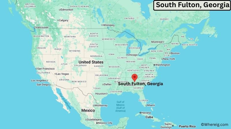
About Map: The map shows the location of South Fulton in Fulton County, in the U.S. state of Georgia.
South Fulton Map, Georgia
About South Fulton Map: The Google Map highlights the location of South Fulton in Fulton County, Georgia. Use the zoom, satellite, and street-view options to explore the city's neighborhoods, roads, and nearby places.
Where is South Fulton Located?
South Fulton is a city located in Fulton County, Georgia, the United States. It occupies the southwestern part of the Atlanta metropolitan area, about 15 miles southwest of downtown Atlanta and roughly 10 miles northwest of Hartsfield-Jackson Atlanta International Airport. East Point is about 8 miles east, while Union City and Fairburn are nearby to the southwest. The city is located at approximately 33.5843° North latitude and 84.5811° West longitude. The 2020 Census recorded 107,436 residents. South Fulton covers about 85 square miles (220 square kilometers), making it one of the largest cities by area in metro Atlanta. The Chattahoochee River forms part of the city's western boundary and provides important natural scenery and wildlife habitat. Cochran Mill Park is a major nearby attraction with trails, waterfalls, streams, and wooded landscapes. South Fulton was incorporated in 2017 after several unincorporated communities in southwestern Fulton County voted to form a new city. A unique feature of South Fulton is its large geographic size and diverse mix of suburban neighborhoods, historic communities, open land, and natural areas.
Most Viewed US Maps
| USA Sttae Map | USA Region Map | USA Road Map |
| USA County Map | Where is USA in World Map? | US ZIP Code Map |
| USA Time Zones Map | US State and Capitals Map | USA Physical Map |
Find 4,400+ U.S. Cities by State - Explore Their Locations and Get Detailed Information
South Fulton City Facts
| Fact | Details |
|---|---|
| City | South Fulton |
| State | Georgia |
| County | Fulton County |
| Country | United States |
| Region | Metro Atlanta, West Central Georgia |
| Incorporated | May 1, 2017 |
| Founded | 2017 |
| Total Area | 85.0 sq mi (220.2 sq km) |
| Land Area | 83.9 sq mi (217.3 sq km) |
| Water Area | 1.1 sq mi (2.9 sq km) |
| Elevation | About 900 ft (274 m) |
| Population (2023 estimate) | About 112,000 |
| Population (2020 Census) | 107,436 |
| Population Density | About 1,280 people per sq mi |
| Time Zone | Eastern Time (EST/EDT) |
| ZIP Codes | 30213, 30291, 30268, 30331, 30349 |
| Area Code | 470, 678, 770, 404 |
| Major Highways | Interstate 85, Interstate 285, Georgia State Route 14, Georgia State Route 92, Georgia State Route 166 |
| Public Transit | MARTA bus and regional transit services |
| Major Attractions | Cochran Mill Park, Chattahoochee River, Cascade Springs Nature Preserve, Wolf Creek Amphitheater |
| Official Website | https://www.cityofsouthfultonga.gov/ |
Distance from South Fulton, GA to Nearby Cities
- Union City, GA – 5 miles (8 km)
- East Point, GA – 8 miles (13 km)
- Fairburn, GA – 8 miles (13 km)
- College Park, GA – 8 miles (13 km)
- Atlanta, GA – 15 miles (24 km)
- Hapeville, GA – 12 miles (19 km)
- Palmetto, GA – 15 miles (24 km)
- Douglasville, GA – 20 miles (32 km)
- Riverdale, GA – 15 miles (24 km)
- Fayetteville, GA – 25 miles (40 km)
- Peachtree City, GA – 20 miles (32 km)
- East Point, GA – 8 miles (13 km)
- Decatur, GA – 25 miles (40 km)
- Marietta, GA – 30 miles (48 km)
- Alpharetta, GA – 35 miles (56 km)
- Roswell, GA – 35 miles (56 km)
- Newnan, GA – 30 miles (48 km)
- Lawrenceville, GA – 45 miles (72 km)
Top Attractions in South Fulton, Georgia
- Cochran Mill Park – A large natural park with hiking trails, streams, waterfalls, wooded areas, historic mill ruins, and scenic landscapes.
- Chattahoochee River – The river forms part of South Fulton's western edge and provides opportunities for fishing, paddling, wildlife observation, and scenic recreation.
- Cascade Springs Nature Preserve – A protected natural area with walking trails, wetlands, springs, historic ruins, and forest habitat.
- Wolf Creek Amphitheater – An outdoor concert and event venue in South Fulton surrounded by wooded landscapes and open-air seating.
- Wolf Creek Golf Club – A nearby golf course known for its wooded fairways, rolling terrain, and views across the South Fulton landscape.
- Campbellton Road Historic District – An area connected to South Fulton's older communities and transportation history.
- Boundary Waters Park – A large recreation area in nearby Douglasville with trails, lakes, fishing, boating, and wooded scenery.
- Sweetwater Creek State Park – A major state park near South Fulton featuring hiking trails, a historic textile mill ruin, a lake, and wooded creek valleys.
- Atlanta BeltLine – A major urban trail and redevelopment project in Atlanta, offering walking, cycling, public art, parks, and access to neighborhoods throughout the city.
Airports Near South Fulton, Georgia
- Hartsfield-Jackson Atlanta International Airport (ATL) – 10 miles
- Fulton County Executive Airport (FTY) – 20 miles
- Peachtree-DeKalb Airport (PDK) – 30 miles
- Atlanta Regional Airport (FFC) – 25 miles
Sources:
Population and area data sourced from the United States Census Bureau (2020 Census). General city information referenced from the official South Fulton city website and local government records.
Most Viewed GA Maps
- Where is Acworth
- Where is Albany
- Where is Alpharetta
- Where is Candler-McAfee
- Where is Canton
- Where is Carrollton
- Where is Cartersville
- Where is Chamblee
- Where is Dalton
- Where is Decatur
- Where is Douglasville
- Where is Duluth
- Where is Dunwoody
- Where is East Point
- Where is Evans
- Where is Gainesville
- Where is Griffin
- Where is Hinesville
- Where is Johns Creek
- Where is Kennesaw
- Where is LaGrange
- Where is Lawrenceville
- Where is Mableton
- Where is Marietta
- Where is Martinez
- Where is McDonough
- Where is Milton
- Where is Newnan
- Where is Peachtree City
- Where is Perry
- Where is Pooler
- Where is Redan
- Where is Rome
- Where is Roswell
- Where is Sandy Springs
- Where is Savannah
- Where is Smyrna
- Where is Snellville
- Where is Statesboro
- Where is Stockbridge
- Where is Sugar Hill
- Where is Suwanee
- Where is Union City
- Where is Valdosta
- Where is Warner Robins
- Where is Woodstock