
Where is Paris Located? - Paris is a city located in the Bear Lake County of Kentucky, United States. Paris lies between 41.6362152 Degrees North latitudes and 70.934205 Degrees West longitudes.
Location Map of Paris, Kentucky
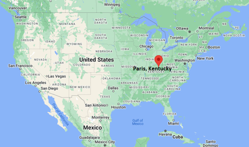
Paris Map, Kentucky, USA
Where is Paris?: The Google Map showing the location of Paris in the U.S. state of Kentucky.
Where is Paris Located?
Paris is a city located in the Bourbon County of Kentucky, United States. Paris lies between 41.6362152 Degrees North latitudes and 70.934205 Degrees West longitudes. According to 2020 U.S.census, the population of Paris city is 10171 people and the city has a total area of 7.91 sq mi. The city has numerous parks and recreational facilities.
Most Viewed US Maps
| USA Sttae Map | USA Region Map | USA Road Map |
| USA County Map | Where is USA in World Map? | US ZIP Code Map |
| USA Time Zones Map | US State and Capitals Map | USA Physical Map |
Find 4,400+ U.S. Cities by State - Explore Their Locations and Get Detailed Information
Paris, Kentucky Quick Facts
| Attribute | Details |
|---|---|
| City | Paris |
| County | Bourbon County |
| State | Kentucky |
| State Capital | Frankfort |
| US Region | Southern United States (East South Central) |
| Latitude | 38.2098° N |
| Longitude | 84.2524° W |
| Elevation | 843 ft (257 m) |
| Land Area | 6.15 sq mi |
| Water Area | 0.02 sq mi |
| Total Area | 6.17 sq mi |
| Population (2020 Census) | 10,171 |
| Population Density | Approximately 1,654 people per sq mi |
| ZIP Codes | 40361, 40362 |
| Area Code | 859 |
| Time Zone Standard | Eastern Standard Time (EST, UTC−5) |
| Time Zone Daylight | Eastern Daylight Time (EDT, UTC−4) |
| Currency | United States Dollar (USD) |
| FIPS Code | 21-58908 |
| Congressional District | Kentucky's 6th Congressional District |
Transportation and Connectivity in Paris, Kentucky
| Category | Details |
|---|---|
| Airport Name | Blue Grass Airport (nearest commercial airport) |
| IATA Code | LEX |
| Port | No commercial port |
| Major Highways | U.S. Route 27, U.S. Route 68, Kentucky Route 627, Kentucky Route 460 |
| Train/Amtrak Service | No passenger rail service; nearest Amtrak station in Cincinnati, Ohio |
| Local Bus/Transit Service | Bourbon Area transportation services and regional transit options |
- U.S. Route 27 – Major north–south highway connecting Paris with Cynthiana, Nicholasville, and central Kentucky.
- U.S. Route 68 – Scenic east–west route linking Paris with Lexington, Maysville, and the Bluegrass Region.
- Kentucky Route 627 – Connects the city with Winchester and nearby Bourbon County communities.
- Kentucky Route 460 – Provides regional access to Mount Sterling and surrounding rural areas.
Top Places to Visit in Paris, Kentucky
| Landmark Name | Type |
|---|---|
| Hopewell Museum | Museum |
| Duncan Tavern Historic Center | Historic Site |
| Claiborne Farm | Horse Farm |
| Old Friends Thoroughbred Retirement Farm | Horse Farm |
| Paris-Bourbon County Farmers Market | Market |
| Nannine Clay Wallis Arboretum | Arboretum |
| Bourbon County Courthouse | Historic Landmark |
| Garrett Morgan Memorial Park | Community Park |
| Historic Downtown Paris | Historic District |
| Cane Ridge Meeting House | Historic Site |
Driving Distances from Paris, Kentucky to Nearby Cities
| City | State | Distance (mi) | Approx. Drive Time |
|---|---|---|---|
| Lexington | Kentucky | 18 | 30 minutes |
| Cynthiana | Kentucky | 18 | 25 minutes |
| Georgetown | Kentucky | 25 | 35 minutes |
| Winchester | Kentucky | 21 | 30 minutes |
| Mount Sterling | Kentucky | 27 | 35 minutes |
| Richmond | Kentucky | 40 | 50 minutes |
| Frankfort | Kentucky | 41 | 50 minutes |
| Maysville | Kentucky | 51 | 1 hour |
| Louisville | Kentucky | 93 | 1 hour 40 minutes |
| Cincinnati | Ohio | 76 | 1 hour 30 minutes |
Colleges and Universities in Paris, Kentucky
| Institution Name | Type | Level | Notable For |
|---|---|---|---|
| Kentucky Community & Technical College System – Paris Learning Center | Public | Community College | Workforce and adult education |
| University of Kentucky | Public | University | Flagship research university |
| Bluegrass Community and Technical College | Public | Community College | Transfer and career education |
| Georgetown College | Private | University | Liberal arts education |
| Bourbon County Schools | Public | K–12 District | Primary and secondary education |
Waterbodies in Paris, Kentucky
Stoner Creek, Hinkston Creek, South Elkhorn Creek, North Fork Licking River, Kentucky River, Townsend Lake, Lake Carnico, Elkhorn Creek, Cane Run, Cooper Run
Stadiums in Paris
Bourbon County High School Stadium, Garrett Morgan Memorial Park Athletic Fields, Claiborne Farm Polo Grounds, Houston Oaks Golf Course, Paris Country Club Golf Course, University of Kentucky Kroger Field, Whitaker Bank Ballpark
Paris, Kentucky — Key Historical Facts
- Paris was founded in 1789 and named in honor of the French capital to recognize France's support during the American Revolutionary War.
- The city became the county seat of Bourbon County and developed into an important center for agriculture, commerce, and Thoroughbred horse breeding.
- Paris is located in the heart of Kentucky's Bluegrass Region, an area internationally recognized for producing champion racehorses.
- Historic landmarks such as Duncan Tavern and the Bourbon County Courthouse reflect the city's rich architectural and cultural heritage.
- Today, Paris is known for its horse farms, historic downtown, scenic countryside, and strong ties to Kentucky's equine industry.
References
- City of Paris
- Bourbon County Government
- U.S. Census Bureau
- University of Kentucky
- Visit Bourbon County
Kentucky Related Maps and Info
- Where is Alexandria
- Where is Ashland
- Where is Bardstown
- Where is Berea
- Where is Bowling Green
- Where is Burlington
- Where is Campbellsville
- Where is Covington
- Where is Danville
- Where is Elizabethtown
- Where is Elsmere
- Where is Erlanger
- Where is Florence
- Where is Fort Campbell North
- Where is Fort Thomas
- Where is Francisville
- Where is Frankfort
- Where is Franklin
- Where is Georgetown
- Where is Glasgow
- Where is Harrodsburg
- Where is Hopkinsville
- Where is Independence
- Where is Jeffersontown
- Where is La Grange
- Where is Lawrenceburg
- Where is Lyndon
- Where is Madisonville
- Where is Mayfield
- Where is Middletown
- Where is Mount Washington
- Where is Murray
- Where is Newport
- Where is Nicholasville
- Where is Oakbrook
- Where is Owensboro
- Where is Paducah
- Where is Paris
- Where is Radcliff
- Where is Shelbyville
- Where is Shepherdsville
- Where is Shively
- Where is Somerset
- Where is St. Matthews
- Where is Versailles
- Where is Winchester