
Perry is a city in Florida's Big Bend region and the county seat of Taylor County. It is about 50 miles southeast of Tallahassee and 35 miles north of the Gulf Coast. Surrounded by pine forests and coastal plain landscapes, Perry is known for its timber industry, nearby Gulf recreation, and access to the natural areas of the Big Bend region.
Location Map of Perry, Taylor County, Florida
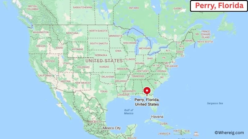
About Map: The map shows the location of Perry in Taylor County, in the U.S. state of Florida.
Perry Map, Florida
About Perry Map: The Google Map highlights the location of Perry in Taylor County, Florida. Use the zoom, satellite, and street-view options to explore the city's neighborhoods, roads, and nearby places.
Where is Perry Located?
Perry is a city located in Taylor County, Florida, the United States. It lies in Florida's Big Bend region, about 50 miles southeast of Tallahassee and roughly 35 miles north of the Gulf of Mexico. Madison is around 45 miles northeast, while Steinhatchee is about 25 miles south. Perry is positioned near 30.117° North latitude and 83.582° West longitude. The 2020 Census recorded 6,794 residents. The city covers about 9.65 square miles, or 25.00 square kilometers. Perry serves as the county seat of Taylor County and has long been connected to forestry, timber processing, agriculture, and small-scale manufacturing. The surrounding landscape is dominated by pine forests, wetlands, and the flat coastal plain of northern Florida. The Gulf Coast is nearby, with Steinhatchee and Keaton Beach providing access to fishing, boating, scalloping, and other outdoor activities. Perry was incorporated in 1885 and was named for Edward A. Perry, a Florida governor and Confederate general. A unique fact about the city is its strong identity as a center of Florida's forest products industry. Perry also provides access to the Big Bend Wildlife Management Area and other protected natural lands. US-19 and US-27 pass through or near the city, connecting Perry with Tallahassee, coastal communities, and other parts of north Florida.
Most Viewed US Maps
| USA Sttae Map | USA Region Map | USA Road Map |
| USA County Map | Where is USA in World Map? | US ZIP Code Map |
| USA Time Zones Map | US State and Capitals Map | USA Physical Map |
Find 4,400+ U.S. Cities by State - Explore Their Locations and Get Detailed Information
Perry City Facts
| City | Perry |
| State | Florida |
| County | Taylor County |
| Country | United States |
| Region | Florida Big Bend and North Florida |
| Incorporated | 1885 |
| Founded | 1850s |
| Total Area | 9.65 sq mi (25.00 sq km) |
| Land Area | 9.55 sq mi (24.73 sq km) |
| Water Area | 0.10 sq mi (0.26 sq km) |
| Elevation | 59 ft (18 m) |
| Population (2023 estimate) | About 6,700 |
| Population (2020 Census) | 6,794 |
| Population Density | 711 people per sq mi |
| Time Zone | Eastern Time (EST/EDT) |
| ZIP Codes | 32347 |
| Area Code | 850 |
| Major Highways | US-19, US-27, US-98, and FL-30 |
| Public Transit | Big Bend Transit |
| Major Attractions | Taylor County Historical Society Museum, Forest Capital Museum State Park, Keaton Beach, and Steinhatchee River |
| Official Website | https://www.cityofperry.net/ |
Distance from Perry, FL to Nearby Cities
- Shady Grove, FL – 20 miles (32 km)
- Steinhatchee, FL – 25 miles (40 km)
- Keaton Beach, FL – 25 miles (40 km)
- Madison, FL – 45 miles (72 km)
- Live Oak, FL – 55 miles (89 km)
- Tallahassee, FL – 50 miles (80 km)
- Monticello, FL – 65 miles (105 km)
- Quitman, GA – 70 miles (113 km)
- Valdosta, GA – 75 miles (121 km)
- Lake City, FL – 75 miles (121 km)
- Thomasville, GA – 80 miles (129 km)
- Gainesville, FL – 95 miles (153 km)
- Ocala, FL – 130 miles (209 km)
- Jacksonville, FL – 145 miles (233 km)
- Panama City, FL – 150 miles (241 km)
- Gainesville, FL – 95 miles (153 km)
- Orlando, FL – 220 miles (354 km)
- Tampa, FL – 220 miles (354 km)
Top Attractions in Perry
- Forest Capital Museum State Park – A state park in Perry highlighting Florida's forestry history with historic buildings, exhibits, and outdoor areas.
- Taylor County Historical Society Museum – A local museum preserving artifacts, photographs, and stories from Perry and Taylor County.
- Steinhatchee River – A nearby river known for fishing, kayaking, boating, wildlife viewing, and access to Florida's Gulf Coast.
- Keaton Beach – A nearby Gulf Coast community popular for fishing, boating, scalloping, and views across the Gulf of Mexico.
- Big Bend Wildlife Management Area – A large natural area offering opportunities for hunting, wildlife viewing, hiking, and exploring North Florida's forests and wetlands.
- Taylor County Sports Complex – A local recreation facility supporting sports, community activities, and outdoor events.
- St. Marks National Wildlife Refuge – A major regional wildlife refuge south of Tallahassee with coastal marshes, wetlands, bird habitat, trails, and historic sites.
- Edward Ball Wakulla Springs State Park – A nearby state park famous for its large freshwater spring, wildlife, glass-bottom boat tours, and extensive natural surroundings.
Airports Near Perry, FL
- Tallahassee International Airport (TLH) – 55 miles
- Valdosta Regional Airport (VLD) – 80 miles
- Gainesville Regional Airport (GNV) – 100 miles
- Ocala International Airport (OCF) – 130 miles
- Northwest Florida Beaches International Airport (ECP) – 145 miles
Sources:
Population and area data sourced from the United States Census Bureau (2020 Census). General city information referenced from the official Perry city website and local government records.
Florida Related Maps and Info
- Where is Miami
- Where is Hialeah
- Where is Jacksonville
- Where is Orlando
- Where is Saint Petersburg
- Where is Tampa
- Where is Alafaya
- Where is Boca Raton
- Where is Boynton Beach
- Where is Brandon
- Where is Cape Coral
- Where is Clearwater
- Where is Coral Springs
- Where is Davie
- Where is Daytona Beach
- Where is Deerfield Beach
- Where is Deltona
- Where is Doral
- Where is Fort Lauderdale
- Where is Fort Myers
- Where is Gainesville
- Where is Hollywood
- Where is Homestead
- Where is Horizon West
- Where is Kendall
- Where is Kissimmee
- Where is Lakeland
- Where is Largo
- Where is Lauderhill
- Where is Lehigh Acres
- Where is Melbourne
- Where is Miami Beach
- Where is Miami Gardens
- Where is Miramar
- Where is North Port
- Where is Palm Bay
- Where is Palm Coast
- Where is Pembroke Pines
- Where is Plantation
- Where is Poinciana
- Where is Pompano Beach
- Where is Port St. Lucie
- Where is Riverview
- Where is Spring Hill
- Where is St. Petersburg
- Where is Sunrise
- Where is Tallahassee
- Where is Tamarac
- Where is The Villages
- Where is Town 'n' Country
- Where is West Palm Beach