
Wood River is a city in southwestern Illinois, located in Madison County along the Mississippi River. It is part of the Greater St. Louis metropolitan area and lies about 20 miles north of downtown St. Louis, Missouri. The city has a strong industrial and transportation history and is close to the Mississippi River, Lewis and Clark Community College, and several parks and wildlife areas. Wood River also serves as a regional center for nearby communities.
Location Map of Wood River, Madison County, Illinois
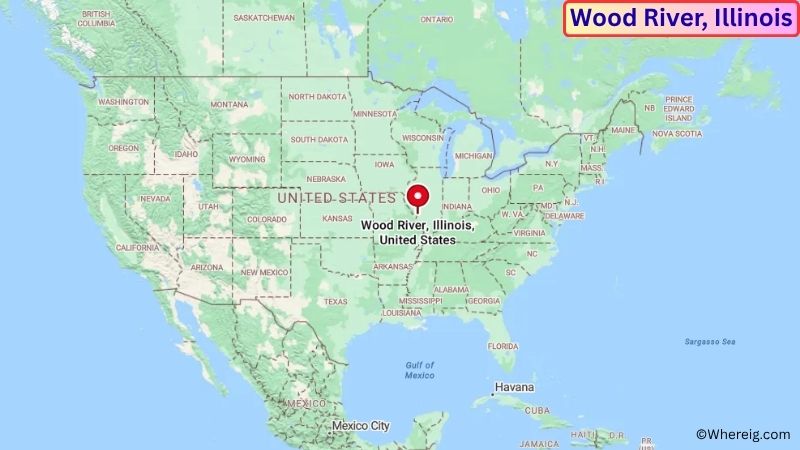
About Map: The map shows the location of Wood River in Madison County, in the U.S. state of Illinois.
Wood River Map, Illinois
About Wood River Map: The Google Map highlights the location of Wood River in Madison County, Illinois. Use the zoom, satellite, and street-view options to explore the city's neighborhoods, roads, and nearby places.
Where is Wood River Located?
Wood River is a city located in Madison County, Illinois, the United States. It is in southwestern Illinois along the Mississippi River, about 20 miles north of downtown St. Louis, 5 miles south of Alton, and approximately 15 miles west of Edwardsville. Wood River lies at approximately 38.861° North latitude and 90.098° West longitude. The city had 10,464 residents in the 2020 Census and covers about 7.13 square miles, or 18.47 square kilometers. Wood River was incorporated in 1908 and developed rapidly during the early 20th century because of the railroad, river transportation, petroleum refining, and other industrial activities. The city's location along the Mississippi River helped make it an important transportation and manufacturing center. Today, Wood River has residential neighborhoods, commercial areas, industrial facilities, and access to regional recreation areas. The nearby Mississippi River provides important wildlife habitat and opportunities for fishing, boating, and birdwatching. Nearby attractions include the Lewis and Clark Confluence Tower, National Great Rivers Museum, Pere Marquette State Park, and the Meeting of the Great Rivers Scenic Byway. Interstate 255, U.S. Route 67, and Illinois Route 143 provide major transportation connections to St. Louis, Alton, Edwardsville, and communities throughout southwestern Illinois.
Most Viewed US Maps
| USA Sttae Map | USA Region Map | USA Road Map |
| USA County Map | Where is USA in World Map? | US ZIP Code Map |
| USA Time Zones Map | US State and Capitals Map | USA Physical Map |
Find 4,400+ U.S. Cities by State - Explore Their Locations and Get Detailed Information
Wood River City Facts
| Fact | Details |
|---|---|
| City | Wood River |
| State | Illinois |
| County | Madison County |
| Country | United States |
| Region | Southwestern Illinois / Greater St. Louis |
| Incorporated | 1908 |
| Founded | 19th century |
| Total Area | 7.13 sq mi (18.47 sq km) |
| Land Area | 7.03 sq mi (18.21 sq km) |
| Water Area | 0.10 sq mi (0.26 sq km) |
| Elevation | Approximately 430 ft (131 m) |
| Population (2023 estimate) | Approximately 10,200 |
| Population (2020 Census) | 10,464 |
| Population Density | Approximately 1,488 people per sq mi |
| Time Zone | Central Time Zone (CST/CDT) |
| ZIP Code | 62095 |
| Area Code | 618 |
| Major Highways | Interstate 255, U.S. Route 67, Illinois Route 143 |
| Public Transit | Madison County Transit |
| Major Attractions | Lewis and Clark Confluence Tower, National Great Rivers Museum, Mississippi River, Pere Marquette State Park |
| Official Website | https://www.cityofwoodriver.com/ |
Distance from Wood River, IL to Nearby Cities
- East Alton, IL – 2 miles (3 km)
- Alton, IL – 5 miles (8 km)
- Roxana, IL – 3 miles (5 km)
- South Roxana, IL – 4 miles (6 km)
- Edwardsville, IL – 15 miles (24 km)
- Godfrey, IL – 8 miles (13 km)
- Granite City, IL – 10 miles (16 km)
- Collinsville, IL – 20 miles (32 km)
- St. Louis, MO – 20 miles (32 km)
- Florissant, MO – 15 miles (24 km)
- St. Charles, MO – 30 miles (48 km)
- Maryland Heights, MO – 25 miles (40 km)
- O'Fallon, IL – 30 miles (48 km)
- Belleville, IL – 30 miles (48 km)
- Troy, IL – 20 miles (32 km)
- Jerseyville, IL – 20 miles (32 km)
- Springfield, IL – 90 miles (145 km)
- Columbia, MO – 125 miles (201 km)
Top Attractions in Wood River
- Lewis and Clark Confluence Tower – A prominent observation tower in nearby Hartford offering views of the Mississippi and Missouri rivers and the surrounding landscape.
- National Great Rivers Museum – A museum in Alton focused on the Mississippi River, river ecology, navigation, wildlife, and the region's river history.
- Mississippi River – The river forms the western edge of the region and provides opportunities for fishing, boating, birdwatching, and scenic recreation.
- Pere Marquette State Park – A large state park north of Wood River featuring hiking trails, forests, bluffs, camping, fishing, and scenic views of the Illinois River.
- Audubon Center at Riverlands – A nearby nature center and wildlife area along the Mississippi River known for birdwatching, wetlands, and migratory waterfowl.
- Meeting of the Great Rivers Scenic Byway – A scenic driving route along the Mississippi River through Alton, Grafton, and surrounding river communities.
- Argosy Casino Alton – A riverfront entertainment destination in nearby Alton offering gaming, dining, and views of the Mississippi River.
- Lewis and Clark Historic Site – A nearby historic site in Hartford commemorating the expedition's winter camp before the Corps of Discovery traveled west.
- Cahokia Mounds State Historic Site – A major archaeological site near Collinsville preserving the remains of one of the largest prehistoric Native American settlements in North America.
- Gateway Arch National Park – A major St. Louis landmark across the Mississippi River featuring the Gateway Arch, museum exhibits, and riverfront history.
Airports Near Wood River, IL
- St. Louis Lambert International Airport (STL) – 20 miles
- St. Louis Downtown Airport (CPS) – 20 miles
- MidAmerica St. Louis Airport (BLV) – 30 miles
- Spirit of St. Louis Airport (SUS) – 35 miles
- Quincy Regional Airport (UIN) – 100 miles
Sources:
Population and area data sourced from the United States Census Bureau (2020 Census). General city information referenced from the official City of Wood River website and local government records.
Illinois Related Maps and Info
- Where is Arlington Heights
- Where is Bartlett
- Where is Belleville
- Where is Berwyn
- Where is Bloomington
- Where is Bolingbrook
- Where is Buffalo Grove
- Where is Carol Stream
- Where is Carpentersville
- Where is Champaign
- Where is Cicero
- Where is Crystal Lake
- Where is Decatur
- Where is DeKalb
- Where is Des Plaines
- Where is Downers Grove
- Where is Elgin
- Where is Elmhurst
- Where is Evanston
- Where is Glenview
- Where is Hanover Park
- Where is Hoffman Estates
- Where is Joliet
- Where is Lombard
- Where is Moline
- Where is Mount Prospect
- Where is Naperville
- Where is Normal
- Where is Oak Lawn
- Where is Oak Park
- Where is Orland Park
- Where is Palatine
- Where is Park Ridge
- Where is Peoria
- Where is Plainfield
- Where is Quincy
- Where is Rock Island
- Where is Rockford
- Where is Romeoville
- Where is Schaumburg
- Where is Skokie
- Where is Streamwood
- Where is Tinley Park
- Where is Urbana
- Where is Waukegan
- Where is Wheaton
- Where is Wheeling