
Where is Bolingbrook Located? - Bolingbrook is a city located in the Will, DuPage County of Illinois, United States. Bolingbrook lies between 41.69761 Degrees North latitudes and -88.0873 Degrees West longitudes.
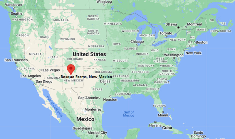
Location Map of Bosque Farms, New Mexico
Bolingbrook Map, Illinois, USA
Where is Bolingbrook?: The Google Map showing the location of Bolingbrook in the U.S. state of Illinois.
Where is Bolingbrook Located?
Bolingbrook is a village located in the Will County and DuPage County of Illinois, United States. Bolingbrook lies between 41.69761 Degrees North latitude and -88.0873 Degrees West longitude. According to the 2020 U.S. Census, the population of Bolingbrook village is 73,922 people and the village has a total area of 24.829 sq mi. The village has numerous parks and recreational facilities.
Most Viewed US Maps
| USA Sttae Map | USA Region Map | USA Road Map |
| USA County Map | Where is USA in World Map? | US ZIP Code Map |
| USA Time Zones Map | US State and Capitals Map | USA Physical Map |
Find 4,400+ U.S. Cities by State - Explore Their Locations and Get Detailed Information
Bolingbrook, Illinois Quick Facts
| Fact | Details |
|---|---|
| City | Bolingbrook |
| Counties | Will County and DuPage County |
| State | Illinois |
| State Capital | Springfield |
| Country | United States |
| US Region | Midwest |
| Latitude | 41.69761 N |
| Longitude | -88.0873 W |
| Elevation | 705 ft (215 m) |
| Land Area | 24.00 sq mi |
| Water Area | 0.14 sq mi |
| Total Area | 24.829 sq mi |
| Population (Census 2020) | 73,922 |
| Population Density | Approximately 3,080 per sq mi |
| ZIP Codes | 60440, 60490 |
| Area Code | 630 and 331 |
| Time Zone Standard | Central Standard Time (CST, UTC-6) |
| Time Zone Daylight | Central Daylight Time (CDT, UTC-5) |
| Currency | United States Dollar (USD) |
| FIPS Code | 17-07133 |
| Congressional District | Illinois' 11th Congressional District |
Nearby Cities and Towns to Bolingbrook, Illinois
- Romeoville, Illinois - 4 mi South
- Woodridge, Illinois - 5 mi North
- Darien, Illinois - 8 mi Northeast
- Lisle, Illinois - 8 mi North
- Naperville, Illinois - 9 mi West
- Downers Grove, Illinois - 10 mi North
- Plainfield, Illinois - 11 mi Southwest
- Joliet, Illinois - 16 mi South
- Aurora, Illinois - 20 mi West
- Chicago, Illinois - 30 mi Northeast
Bolingbrook, Illinois Climate and Weather Overview
| Month | Avg High (°F) | Avg Low (°F) | Avg Precipitation (in) |
|---|---|---|---|
| January | 31 | 16 | 1.8 |
| April | 59 | 39 | 3.7 |
| July | 84 | 65 | 4.0 |
| October | 62 | 43 | 2.8 |
| Annual | 59 | 41 | 36.5 |
| Climate Attribute | Details |
|---|---|
| Climate Classification | Hot-Summer Humid Continental (Köppen Dfa) |
| Annual Precipitation | Approximately 36.5 inches |
| Annual Sunshine Days | About 189 days |
| Severe Weather Risk | Moderate - Thunderstorms, tornadoes, winter snowstorms and occasional flooding |
| Annual Snowfall | Approximately 35 inches |
Driving Distances from Bolingbrook, Illinois
| City | State | Distance (mi) | Approx. Drive Time |
|---|---|---|---|
| Romeoville | Illinois | 4 | 10 min |
| Woodridge | Illinois | 5 | 10 min |
| Darien | Illinois | 8 | 15 min |
| Lisle | Illinois | 8 | 15 min |
| Naperville | Illinois | 9 | 18 min |
| Downers Grove | Illinois | 10 | 18 min |
| Plainfield | Illinois | 11 | 20 min |
| Joliet | Illinois | 16 | 25 min |
| Aurora | Illinois | 20 | 30 min |
| Chicago | Illinois | 30 | 40 min |
Transportation and Connectivity in Bolingbrook, Illinois
| Transportation | Details |
|---|---|
| Nearest Airport | Chicago Midway International Airport |
| IATA Code | MDW |
| Nearest International Airport | O'Hare International Airport |
| Major Highways | Interstate 55, Interstate 355, Illinois Route 53, Boughton Road |
| Rail Service | Nearby Metra commuter rail stations in Lisle, Naperville and Downers Grove |
| Local Transit | Pace Suburban Bus Service |
- Interstate 55 and Interstate 355 provide convenient access to Chicago, Joliet and the greater Chicago metropolitan area.
- Illinois Route 53 serves as a major north-south corridor through the community, linking residential, commercial and business districts.
- Chicago Midway International Airport is about 23 miles northeast, while O'Hare International Airport is about 30 miles north, offering extensive domestic and international flights.
- Pace Suburban Bus and nearby Metra commuter rail stations connect Bolingbrook with downtown Chicago and surrounding suburbs.
Key Landmarks and Places to Visit in Bolingbrook, Illinois
| Landmark | Type |
|---|---|
| The Promenade Bolingbrook | Shopping and Entertainment Center |
| Hidden Oaks Nature Center | Nature Center |
| Whalon Lake | Recreation Area |
| Pelican Harbor Aquatic Park | Water Park |
| Clow International Airport | General Aviation Airport |
| Lily Cache Greenway Trail | Hiking and Biking Trail |
| Bolingbrook Golf Club | Golf Course |
| Hidden Lakes Historic Trout Farm | Historic Recreation Area |
| Greene Valley Forest Preserve | Forest Preserve |
| Boughton Ridge Golf Course | Golf Course |
Colleges and Universities in Bolingbrook, Illinois
| Institution | Type | Level | Notable For |
|---|---|---|---|
| Lewis University | Private | University | Aviation, business and nursing |
| College of DuPage | Public | Community College | Transfer programs and career education |
| Joliet Junior College | Public | Community College | Workforce development and associate degrees |
| North Central College | Private | College | Liberal arts, business and education |
| Benedictine University | Private | University | Business, health sciences and education |
| Northern Illinois University - Naperville Campus | Public | University | Graduate business and education programs |
Waterbodies in Bolingbrook, Illinois
DuPage River, East Branch DuPage River, Lily Cache Creek, Whalon Lake, Hidden Lakes, Boughton Pond, Greene Valley Lake, Rock Run Creek, Springbrook Creek, I&M Canal.
Golf Courses in Bolingbrook, Illinois
Bolingbrook Golf Club, Boughton Ridge Golf Course, Naperbrook Golf Course, Seven Bridges Golf Club, Tamarack Golf Club, Mistwood Golf Club, Carillon Golf Club, Cog Hill Golf & Country Club.
Bolingbrook, Illinois - Key Historical Facts
- Bolingbrook was incorporated in 1965 after rapidly growing from a small farming community into one of Chicago's expanding suburban neighborhoods.
- The village experienced significant residential development during the 1960s and 1970s as families moved to the western suburbs of Chicago.
- Its strategic location near Interstate 55 and Interstate 355 encouraged commercial growth, distribution centers and corporate investment.
- Bolingbrook has developed into one of Illinois' largest villages, with diverse neighborhoods, modern business parks and extensive recreational facilities.
- The Promenade Bolingbrook and numerous parks have strengthened the community as a regional shopping and leisure destination.
- Today, Bolingbrook is known for its strong local economy, family-friendly environment, excellent transportation access and convenient location within the Chicago metropolitan area.
References
Illinois Related Maps and Info
- Where is Arlington Heights
- Where is Bartlett
- Where is Belleville
- Where is Berwyn
- Where is Bloomington
- Where is Bolingbrook
- Where is Buffalo Grove
- Where is Carol Stream
- Where is Carpentersville
- Where is Champaign
- Where is Cicero
- Where is Crystal Lake
- Where is Decatur
- Where is DeKalb
- Where is Des Plaines
- Where is Downers Grove
- Where is Elgin
- Where is Elmhurst
- Where is Evanston
- Where is Glenview
- Where is Hanover Park
- Where is Hoffman Estates
- Where is Joliet
- Where is Lombard
- Where is Moline
- Where is Mount Prospect
- Where is Naperville
- Where is Normal
- Where is Oak Lawn
- Where is Oak Park
- Where is Orland Park
- Where is Palatine
- Where is Park Ridge
- Where is Peoria
- Where is Plainfield
- Where is Quincy
- Where is Rock Island
- Where is Rockford
- Where is Romeoville
- Where is Schaumburg
- Where is Skokie
- Where is Streamwood
- Where is Tinley Park
- Where is Urbana
- Where is Waukegan
- Where is Wheaton
- Where is Wheeling