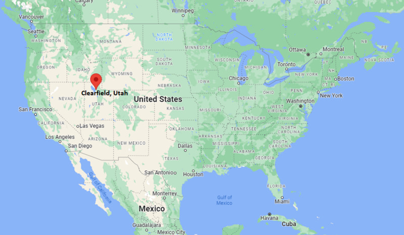
Where is Clearfield Located? - Clearfield is a city located in the Davis County of Utah, United States. Clearfield lies between 36.0331164 Degrees North latitudes and 86.7827772 Degrees West longitudes.
Location Map of Clearfield, Utah
Clearfield Map, Utah, USA
Where is Clearfield?: The Google Map showing the location of Clearfield in the U.S. state of Utah.
Where is Clearfield Located?
Clearfield is a city located in the Davis County of Utah, United States. Clearfield lies between 36.0331164 Degrees North latitudes and 86.7827772 Degrees West longitudes. According to 2020 U.S.census, the population of Clearfield city is 31909 people and the city has a total area of 7.71 sq mi. The city has numerous parks and recreational facilities.
Transportation and Connectivity in Clearfield, Utah
Feature
Details
Airport Name
Salt Lake City International Airport
IATA Code
SLC
Port
None
Major Highways
Interstate 15, State Route 193, State Route 126, State Route 108
Train/Amtrak Service
FrontRunner commuter rail station in Clearfield; nearest Amtrak station in Salt Lake City
Local Bus/Transit Service
Utah Transit Authority (UTA) bus and FrontRunner commuter rail
Interstate 15 - Main north-south freeway connecting Clearfield with Ogden, Salt Lake City, and Provo.
State Route 193 - Connects the city with Hill Air Force Base and Interstate 15.
State Route 126 - Serves local communities including Sunset, Clearfield, and Layton.
State Route 108 - Provides access to Syracuse, Clinton, and western Davis County.
FrontRunner commuter rail - Offers daily passenger service between Ogden, Clearfield, Salt Lake City, and Provo.
Key Landmarks and Places to Visit in Clearfield, Utah
Landmark Name
Type
Hill Aerospace Museum
Museum
Clearfield Aquatic and Fitness Center
Recreation Center
Steed Park
City Park
Fisher Park
Community Park
Antelope Island State Park
State Park
Great Salt Lake Shorelands Preserve
Nature Preserve
Layton Hills Mall
Shopping Center
Adams Canyon Trail
Hiking Trail
Farmington Bay Waterfowl Management Area
Wildlife Area
Hill Air Force Base
Military Installation
Colleges and Universities in Clearfield, Utah
Institution Name
Type
Level
Notable For
Weber State University - Davis Campus
Public
University
Regional higher education
Davis Technical College
Public
Community College
Career and technical training
University of Utah
Public
University
Research university
Utah State University
Public
University
Land-grant university
Davis School District
Public
K-12 District
Public education
Waterbodies in Clearfield, Utah
Great Salt Lake, Farmington Bay, Weber River, Kays Creek, Holmes Creek, Syracuse Pond, Jensen Nature Park Pond, Clinton Pond, Farmington Bay Wetlands, South Weber River
Golf Courses in Clearfield, Utah
Sun Hills Golf Course, Schneiter's Bluff Golf Course, Valley View Golf Course, Glen Eagle Golf Course, Davis Park Golf Course, Lakeside Golf Course, Eaglewood Golf Course, Barn Golf Club
Clearfield, Utah - Key Historical Facts
Clearfield was first settled in the 1870s as a farming community in northern Davis County.
The city experienced significant growth during World War II with the expansion of nearby Hill Air Force Base.
Clearfield officially incorporated as a city in 1922 and has continued to develop as part of the Wasatch Front metropolitan area.
The construction of Interstate 15 and the FrontRunner commuter rail strengthened Clearfield's role as a transportation hub.
Hill Air Force Base remains one of the region's largest employers and has had a lasting impact on the local economy.
Today, Clearfield is known for its family-friendly neighborhoods, outdoor recreation, and convenient access to Salt Lake City and Ogden.