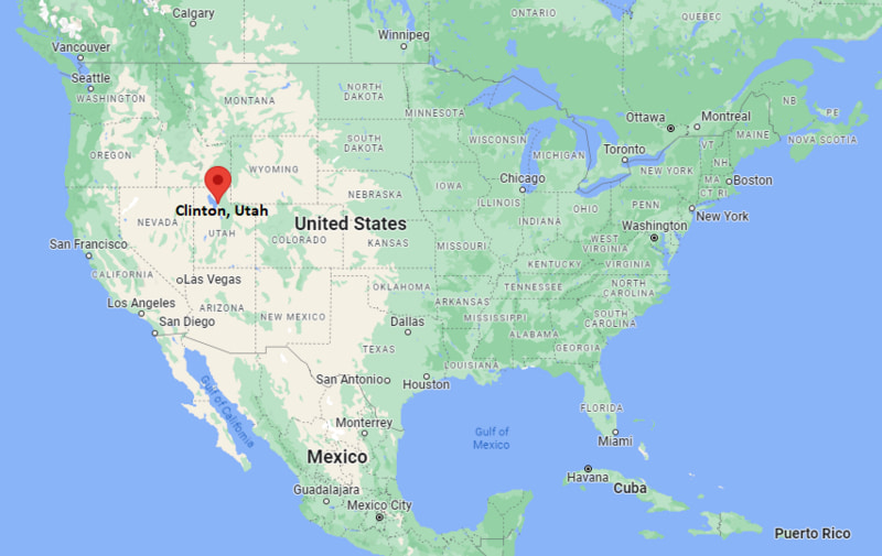
Where is Clinton Located? - Clinton is a city located in the Davis County of Utah, United States. Clinton lies between 35.0867577 Degrees North latitudes and 89.8100858 Degrees West longitudes.
Location Map of Clinton, Utah
Clinton Map, Utah, USA
Where is Clinton?: The Google Map showing the location of Clinton in the U.S. state of Utah.
Where is Clinton Located?
Clinton is a city located in the Davis County of Utah, United States. Clinton lies between 35.0867577 Degrees North latitudes and 89.8100858 Degrees West longitudes. According to 2020 U.S.census, the population of Clinton city is 23386 people and the city has a total area of 5.93 sq mi. The city has numerous parks and recreational facilities.
Nearest Amtrak station in Salt Lake City (California Zephyr route)
Local Bus/Transit Service
Utah Transit Authority (UTA) bus service
Interstate 15 - Main north-south corridor connecting Clinton with Salt Lake City and Ogden.
Utah State Route 126 - Key local road serving Clinton and connecting nearby Davis County communities.
Utah State Route 193 - East-west route linking Clinton with West Point and Syracuse.
US-89 (nearby) - Major regional highway connecting Davis County with northern Utah and Idaho routes.
Antelope Drive - Important local arterial road serving residential and commercial areas in Clinton.
Key Landmarks and Places to Visit in Clinton, Utah
Landmark Name
Type
Great Salt Lake Shorelands Preserve
Nature Preserve
Antelope Island State Park
State Park
Hill Aerospace Museum
Museum
Clinton City Park
City Park
Layton Commons Park
Public Park
Station Park (Farmington)
Shopping & Entertainment
Cherry Hill Water Park (nearby Kaysville)
Water Park
Ogden Nature Center
Nature Center
Lagoon Amusement Park
Amusement Park
Hill Air Force Base Aviation Museum Grounds
Military Museum Area
Colleges and Universities in Clinton, Utah
Institution Name
Type
Level
Notable For
Weber State University
Public
University
Health sciences and business
University of Utah
Public
University
Research and medicine
Utah State University
Public
University
Agriculture and engineering
Ogden-Weber Technical College
Public
Technical College
Career and technical training
Davis Technical College
Public
Technical College
Workforce development programs
Waterbodies in Clinton, Utah
Great Salt Lake, Farmington Bay, Weber River, Ogden River, Davis Creek, Holmes Creek, Kays Creek, Hammond Bay, Antelope Island wetlands, Bountiful Pond
Golf Courses in Clinton, Utah
Sun Hills Golf Course, Eagle Lake Golf Course, Glen Eagle Golf Course, Ogden Golf & Country Club, Lakeside Golf Course, Remuda Golf Course, Valley View Golf Course, Davis Park Golf Course
Clinton, Utah - Key Historical Facts
Clinton began as a small agricultural settlement in Davis County supported by irrigation farming and ranching.
The arrival of nearby railroad and highway routes helped connect the community to Ogden and Salt Lake City.
Post-World War II suburban expansion transformed Clinton into a residential community within the Wasatch Front.
The development of Hill Air Force Base nearby significantly influenced local employment and growth.
Clinton officially incorporated as a city in 1996, making it one of the newer municipalities in Davis County.
Today, Clinton is a fast-growing suburban city known for its family-oriented neighborhoods and proximity to major Utah employment centers.