
Orange Beach is a coastal city in southern Alabama, located in Baldwin County along the Gulf of Mexico. It is about 10 miles east of Gulf Shores and near the Florida state line. Known for its white-sand beaches, bays, and waterways, Orange Beach is a major Gulf Coast destination. Gulf State Park and Perdido Pass are among its best-known natural landmarks.
Location Map of Orange Beach, Baldwin County, Alabama
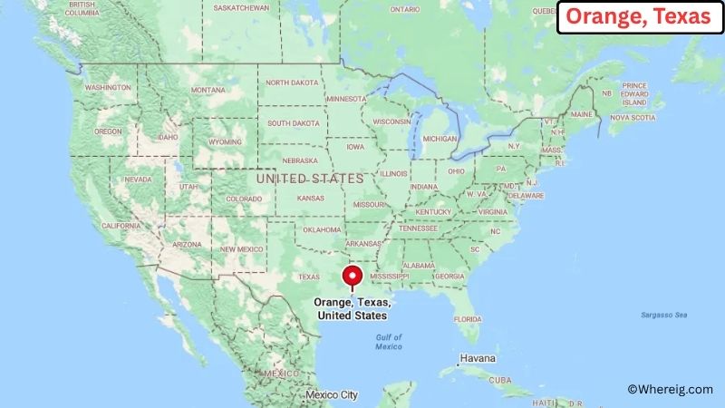
About Map: The map shows the location of Orange Beach in Baldwin County, in the U.S. state of Alabama.
Orange Beach Map, Alabama
About Orange Beach Map: The Google Map highlights the location of Orange Beach in Baldwin County, Alabama. Use the zoom, satellite, and street-view options to explore the city's neighborhoods, roads, and nearby places.
Where is Orange Beach Located?
Orange Beach is a city located in Baldwin County, Alabama, the United States. It lies along Alabama's Gulf Coast, about 10 miles east of Gulf Shores and roughly 35 miles southeast of Mobile. Pensacola, Florida, is about 25 miles east, while Foley is around 15 miles northwest. Orange Beach is positioned near 30.295° North latitude and 87.573° West longitude. The 2020 Census recorded 8,095 residents. The city covers about 15.98 square miles, or 41.39 square kilometers. Orange Beach sits between the Gulf of Mexico and a network of coastal bays and waterways. Its beaches, dunes, wetlands, and marine habitats are central to the local landscape. Gulf State Park extends along the nearby coast and offers beaches, trails, fishing, camping, and wildlife viewing. Perdido Pass is another important local landmark where waters from the back bays meet the Gulf. Orange Beach was incorporated in 1984. A unique fact about the city is its location near the Alabama-Florida state line and its mix of Gulf beaches, bay waters, and barrier-island landscapes. The city is also known for fishing, boating, and coastal recreation.
Most Viewed US Maps
| USA Sttae Map | USA Region Map | USA Road Map |
| USA County Map | Where is USA in World Map? | US ZIP Code Map |
| USA Time Zones Map | US State and Capitals Map | USA Physical Map |
Find 4,400+ U.S. Cities by State - Explore Their Locations and Get Detailed Information
Orange Beach City Facts
| City | Orange Beach |
| State | Alabama |
| County | Baldwin County |
| Country | United States |
| Region | Alabama Gulf Coast |
| Incorporated | 1984 |
| Founded | 1860s |
| Total Area | 15.98 sq mi (41.39 sq km) |
| Land Area | 14.22 sq mi (36.83 sq km) |
| Water Area | 1.76 sq mi (4.56 sq km) |
| Elevation | 7 ft (2 m) |
| Population (2023 estimate) | About 8,800 |
| Population (2020 Census) | 8,095 |
| Population Density | 569 people per sq mi |
| Time Zone | Central Time (CST/CDT) |
| ZIP Codes | 36561 |
| Area Code | 251 |
| Major Highways | AL-182, AL-161, and AL-180 |
| Public Transit | Coastal Alabama public transportation services |
| Major Attractions | Orange Beach, Gulf State Park, Perdido Pass, The Wharf, and Alabama Point East |
| Official Website | https://www.orangebeachal.gov/ |
Distance from Orange Beach, AL to Nearby Cities
- Gulf Shores, AL – 10 miles (16 km)
- Perdido Beach, AL – 5 miles (8 km)
- Foley, AL – 15 miles (24 km)
- Perdido Key, FL – 15 miles (24 km)
- Pensacola, FL – 25 miles (40 km)
- Fairhope, AL – 35 miles (56 km)
- Daphne, AL – 40 miles (64 km)
- Mobile, AL – 35 miles (56 km)
- Milton, FL – 35 miles (56 km)
- Spanish Fort, AL – 40 miles (64 km)
- Bay Minette, AL – 45 miles (72 km)
- Navarre, FL – 45 miles (72 km)
- Atmore, AL – 60 miles (97 km)
- Fort Walton Beach, FL – 75 miles (121 km)
- Destin, FL – 85 miles (137 km)
- Biloxi, MS – 85 miles (137 km)
- Montgomery, AL – 190 miles (306 km)
- New Orleans, LA – 200 miles (322 km)
Top Attractions in Orange Beach
- Orange Beach – A broad Gulf Coast beach known for soft sand, swimming, fishing, boating, and views of the Gulf of Mexico.
- Gulf State Park – A large coastal park with beaches, trails, freshwater lakes, fishing areas, camping, and wildlife habitat.
- Perdido Pass – A major waterway connecting the Gulf of Mexico with the back bays and a popular location for fishing and boating.
- Alabama Point East – A coastal area at the eastern end of Gulf State Park with beaches, dunes, boardwalks, and views of Perdido Pass.
- The Wharf – A waterfront entertainment and shopping area featuring restaurants, shops, events, and a large observation wheel.
- Coastal Arts Center of Orange Beach – A local arts center with galleries, workshops, and demonstrations highlighting regional artists.
- Orange Beach Waterfront Park – A public waterfront area with walking paths, open space, fishing access, and views across Wolf Bay.
- Alabama Gulf Coast Zoo – A nearby zoo in Gulf Shores featuring native and exotic animals, educational programs, and family exhibits.
Airports Near Orange Beach, AL
- Jack Edwards National Airport (JKA) – 10 miles
- Pensacola International Airport (PNS) – 30 miles
- Mobile Regional Airport (MOB) – 65 miles
- Destin-Fort Walton Beach Airport (VPS) – 75 miles
- Gulfport-Biloxi International Airport (GPT) – 95 miles
Sources:
Population and area data sourced from the United States Census Bureau (2020 Census). General city information referenced from the official Orange Beach city website and local government records.
Alabama Related Links
- Where is Alabaster
- Where is Albertville
- Where is Anniston
- Where is Athens
- Where is Auburn
- Where is Bessemer
- Where is Calera
- Where is Center Point
- Where is Chelsea
- Where is Cullman
- Where is Daphne
- Where is Decatur
- Where is Dothan
- Where is Enterprise
- Where is Fairhope
- Where is Florence
- Where is Foley
- Where is Fort Payne
- Where is Gadsden
- Where is Gardendale
- Where is Gulf Shores
- Where is Hartselle
- Where is Helena
- Where is Homewood
- Where is Hoover
- Where is Hueytown
- Where is Huntsville
- Where is Millbrook
- Where is Mobile
- Where is Mountain Brook
- Where is Muscle Shoals
- Where is Northport
- Where is Opelika
- Where is Oxford
- Where is Pelham
- Where is Phenix City
- Where is Prattville
- Where is Prichard
- Where is Saraland
- Where is Scottsboro
- Where is Selma
- Where is Talladega
- Where is Tillmans Corner
- Where is Troy
- Where is Trussville
- Where is Tuscaloosa
- Where is Vestavia Hills