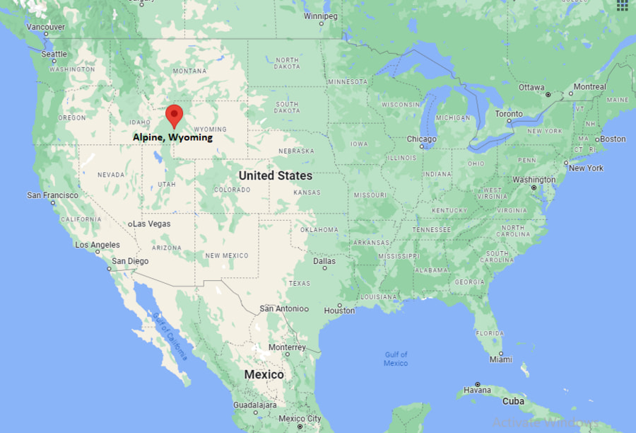
Where is Alpine Located? - Alpine is a city located in the Lincoln County of Wyoming, United States. Alpine lies between 43.17528 Degrees North latitudes and -111.034 Degrees West longitudes.
Location Map of Alpine, Wyoming
Alpine Map, Wyoming, USA
Where is Alpine?: The Google Map showing the location of Alpine in the U.S. state of Wyoming.
Where is Alpine Located?
Alpine is a town located in Lincoln County of Wyoming, United States. Alpine lies at approximately 43.17528 Degrees North latitude and -111.034 Degrees West longitude. According to the 2020 U.S. Census, the population of Alpine is 1,220 people and the town has a total area of 0.894 sq mi. The town has numerous parks and recreational facilities.
Transportation and Connectivity in Alpine, Wyoming
Nearest Airport
Jackson Hole Airport
IATA Code
JAC
Major Highways
US Highway 89, US Highway 26, US Highway 191
Rail Service
No Passenger Rail Service
Public Transit
Regional Shuttle and Seasonal Transportation Services
Alpine is located at the junction of US Highways 26, 89 and 191.
The town serves as a gateway to Jackson Hole and Grand Teton National Park.
Jackson Hole Airport is approximately 45 miles northeast.
Scenic highways connect Alpine with Idaho, Star Valley and northwestern Wyoming attractions.
Outdoor recreation and tourism are major contributors to the local economy.
Key Landmarks and Places to Visit in Alpine, Wyoming
Landmark Name
Type
Palisades Reservoir
Recreation Area
Snake River Canyon
Natural Attraction
Greys River Road
Scenic Drive
Alpine Mountain Days Festival Grounds
Community Attraction
Bridger-Teton National Forest
National Forest
Palisades Creek Trailhead
Hiking Area
Alpine Scenic Overlook
Viewpoint
Snake River Access Areas
Fishing and Boating Sites
Grey's River Valley
Outdoor Recreation Area
Grand Teton National Park Region
Nearby Attraction
Colleges and Universities Near Alpine, Wyoming
Institution Name
Type
Distance
Notable For
Central Wyoming College - Jackson Outreach
Community College
37 mi
Continuing and higher education programs
Brigham Young University-Idaho
Private University
82 mi
Undergraduate education
College of Eastern Idaho
Community College
68 mi
Career and technical programs
University of Wyoming Outreach Centers
Public University
Regional Access
Distance education
Idaho State University
Public University
115 mi
Research and professional programs
Waterbodies in and Near Alpine, Wyoming
Snake River, Palisades Reservoir, Greys River, Salt River, McCoy Creek, Palisades Creek, Black Canyon Creek, Hoback River, Willow Creek, Fall Creek
Golf Courses in and Near Alpine, Wyoming
Alpine Airpark Golf Course, Cedar Creek Golf Course, Star Valley View Golf Course, Teton Reserve Golf Course, Jackson Hole Golf and Tennis Club, The Links at Teton Peaks, Headwaters Golf Club, Pine Creek Golf Course
Alpine, Wyoming - Key Historical Facts
Alpine developed as a small settlement near the confluence of the Snake, Salt and Greys rivers.
The area served early ranchers, trappers and travelers moving through western Wyoming.
Its location along important transportation routes helped establish the town as a regional service center.
The construction of Palisades Dam and Reservoir contributed to recreation and tourism growth.
Outdoor activities such as fishing, boating, hiking and wildlife viewing became major attractions.
Today, Alpine is known as a scenic gateway to Jackson Hole, the Snake River Canyon and the Greater Yellowstone Ecosystem.