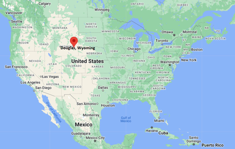
Where is Douglas Located? - Douglas is a city located in the Converse County of Wyoming, United States. Douglas lies between 48.4201105 Degrees North latitudes and 122.3374542 Degrees West longitudes.
Location Map of Douglas, Wyoming
Douglas Map, Wyoming, USA
Where is Douglas?: The Google Map showing the location of Douglas in the U.S. state of Wyoming.
Where is Douglas Located?
Douglas is a city located in the Converse County of Wyoming, United States. Douglas lies between 48.4201105 Degrees North latitudes and 122.3374542 Degrees West longitudes. According to 2020 U.S.census, the population of Douglas city is 6386 people and the city has a total area of 6.5 sq mi. The city has numerous parks and recreational facilities.
Transportation and Connectivity in Douglas, Wyoming
Transportation
Details
Airport Name
Converse County Airport
IATA Code
DGW
Port
No commercial port
Major Highways
Interstate 25, US Highway 20, US Highway 26, Wyoming Highway 59
Train/Passenger Rail
No passenger rail service
Local Bus/Transit Service
Regional transportation and local taxi services
Interstate 25 is the primary north-south highway connecting Douglas with Casper, Cheyenne, and Colorado.
US Highways 20 and 26 provide regional access across central and eastern Wyoming.
Wyoming Highway 59 links Douglas with Gillette and northeastern Wyoming's energy-producing region.
Converse County Airport supports general aviation, business travel, medical transport, and aerial firefighting operations.
Key Landmarks and Places to Visit in Douglas, Wyoming
Landmark Name
Type
Wyoming Pioneer Memorial Museum
History Museum
Douglas Railroad Interpretive Center
Railroad Museum
Ayres Natural Bridge Park
Natural Landmark
Jackalope Square
Public Plaza
Douglas City Park
Community Park
Bartling Park
Recreation Park
Converse County Fairgrounds
Event Venue
Fort Fetterman State Historic Site
Historic Site
Douglas Golf Club
Golf Course
North Platte River Recreation Area
Outdoor Recreation Area
Colleges and Universities in Douglas, Wyoming
Institution Name
Type
Level
Notable For
Eastern Wyoming College - Douglas Outreach Center
Public
Community College
Adult education, workforce training, and continuing education
Casper College
Public
Community College
Transfer programs, nursing, and technical education
University of Wyoming
Public
University
Research, engineering, agriculture, and business
Laramie County Community College
Public
Community College
Career and technical education
Western Wyoming Community College
Public
Community College
Transfer degrees and workforce development
Waterbodies in Douglas, Wyoming
North Platte River, La Prele Creek, Box Elder Creek, Deer Creek, Glendo Reservoir, Grayrocks Reservoir, Cottonwood Creek, Medicine Bow River
Golf Courses in Douglas, Wyoming
Douglas Golf Club, Glenrock Golf Club, Casper Country Club, Three Crowns Golf Club, Olive Glenn Golf & Country Club, Wheatland Golf Club
Douglas, Wyoming - Key Historical Facts
Douglas was founded in 1886 along the Fremont, Elkhorn and Missouri Valley Railroad and quickly became an important transportation and livestock shipping center.
The city was named after Illinois Senator Stephen A. Douglas, a prominent 19th-century American political leader.
During the late 1800s, nearby Fort Fetterman helped protect settlers, stage routes, and railroad construction across the Wyoming Territory.
Sheep ranching, cattle production, and railroad commerce played major roles in Douglas's early economic growth and regional importance.
The annual Wyoming State Fair, first held in Douglas in 1905, has become one of the state's premier agricultural and community events.
Today, Douglas serves as the county seat of Converse County and remains an important regional center for agriculture, energy production, tourism, and outdoor recreation.