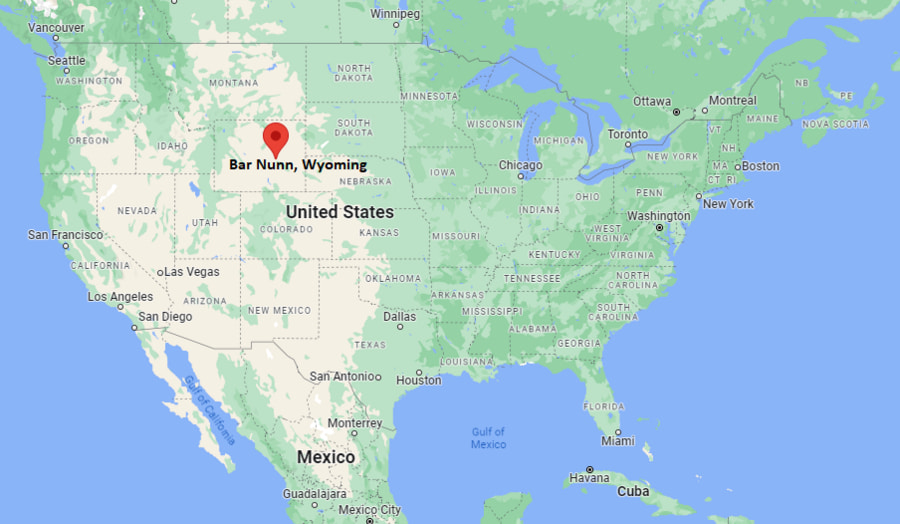
Where is Bar Nunn Located? - Bar Nunn is a city located in the Natrona County of Wyoming, United States. Bar Nunn lies between 42.91358 North latitudes and -106.343 West longitudes.
Location Map of Bar Nunn, Wyoming
Bar Nunn Map, Wyoming, USA
Where is Bar Nunn?: The Google Map showing the location of Bar Nunn in the U.S. state of Wyoming.
Where is Bar Nunn Located?
Bar Nunn is a town located in the Natrona County of Wyoming, United States. Bar Nunn lies at approximately 42.91358 Degrees North latitude and -106.343 Degrees West longitude. According to the 2020 U.S. Census, the population of Bar Nunn town is 2,981 people and the town has a total area of 2.099 sq mi. The town has numerous parks and recreational facilities.
Nearby Cities and Communities to Bar Nunn, Wyoming
Casper, Wyoming - 6 mi (10 km)
Mills, Wyoming - 10 mi (16 km)
Evansville, Wyoming - 12 mi (19 km)
Mountain View, Wyoming - 9 mi (14 km)
Midwest, Wyoming - 42 mi (68 km)
Glenrock, Wyoming - 32 mi (51 km)
Douglas, Wyoming - 54 mi (87 km)
Buffalo, Wyoming - 116 mi (187 km)
Worland, Wyoming - 105 mi (169 km)
Lander, Wyoming - 150 mi (241 km)
Bar Nunn, Wyoming Climate and Weather Overview
Month
Avg High
Avg Low
Avg Precipitation
January
37°F
16°F
0.5 in
April
57°F
29°F
1.1 in
July
88°F
54°F
1.2 in
October
61°F
33°F
0.8 in
Climate Attribute
Details
Climate Type
Cold Semi-Arid (BSk)
Annual Rainfall
Approximately 13 inches
Annual Sunshine
More than 230 sunny days
Average Snowfall
Approximately 55 inches annually
Main Weather Risks
Winter Storms, High Winds and Drought
Driving Distances from Bar Nunn, Wyoming
Destination
Distance
Distance (km)
Drive Time
Casper
6 mi
10 km
10 min
Mills
10 mi
16 km
15 min
Evansville
12 mi
19 km
18 min
Glenrock
32 mi
51 km
35 min
Midwest
42 mi
68 km
45 min
Douglas
54 mi
87 km
55 min
Worland
105 mi
169 km
2 hr
Buffalo
116 mi
187 km
2 hr
Lander
150 mi
241 km
2 hr 40 min
Transportation and Connectivity in Bar Nunn, Wyoming
Nearest Airport
Casper-Natrona County International Airport
IATA Code
CPR
Major Airport
Casper-Natrona County International Airport (CPR)
Major Highways
Interstate 25, U.S. Route 20/26, Wyoming Highway 258
Rail Service
Freight Rail Service in Casper Area
Public Transit
Casper Area Transit Nearby
Bar Nunn is part of the Casper Metropolitan Statistical Area.
The town was developed on the site of the former Wardwell Field airport.
Bar Nunn is one of Wyoming's fastest-growing small communities of recent decades.
Energy, healthcare, retail and construction are important employment sectors in the region.
The community offers a suburban setting with quick access to Casper's services and attractions.
Key Landmarks and Places to Visit in Bar Nunn, Wyoming
Landmark
Type
Wardwell Field Historic Area
Historic Site
Bar Nunn Community Center
Community Facility
Crossroads Park
Recreation Area
National Historic Trails Interpretive Center
Museum
Nicolaysen Art Museum
Art Museum
Casper Mountain Recreation Area
Outdoor Recreation Area
Fort Caspar Museum
Historic Museum
Platte River Parkway
Nature and Trail Area
Colleges and Universities Near Bar Nunn, Wyoming
Institution
Type
Distance
Notable For
Casper College
Community College
8 mi
Academic and workforce programs
University of Wyoming at Casper
Regional Campus
8 mi
Undergraduate and continuing education
Wyoming Medical Center School Programs
Healthcare Education
10 mi
Medical training
Central Wyoming College
Community College
150 mi
Career and technical education
University of Wyoming
Public University
180 mi
Research and higher education
Waterbodies in and Near Bar Nunn, Wyoming
North Platte River, Casper Creek, Garden Creek, Alcova Reservoir, Pathfinder Reservoir, Fremont Canyon Reservoir, Muddy Mountain Reservoir, Glendo Reservoir, Gray Reef Reservoir and Lake Cameahwait.
Golf Courses in and Near Bar Nunn, Wyoming
Three Crowns Golf Club, Casper Country Club, Paradise Valley Country Club, Municipal Golf Course at Casper, Olive Glenn Golf and Country Club, Kendrick Golf Course, Glenrock Golf Club and Powder Horn Golf Club.
Bar Nunn, Wyoming - Key Historical Facts
Bar Nunn was founded in the 1970s and named after rancher and businessman Romie Nunn.
The community was developed on the former Wardwell Field airport property.
The original airport served Casper before operations moved to the present Casper-Natrona County International Airport.
Residents incorporated Bar Nunn as a municipality in the early 1980s to improve local services.
The town experienced rapid growth during Wyoming's energy development boom.
Today, Bar Nunn is a residential community closely connected to Casper and Natrona County.