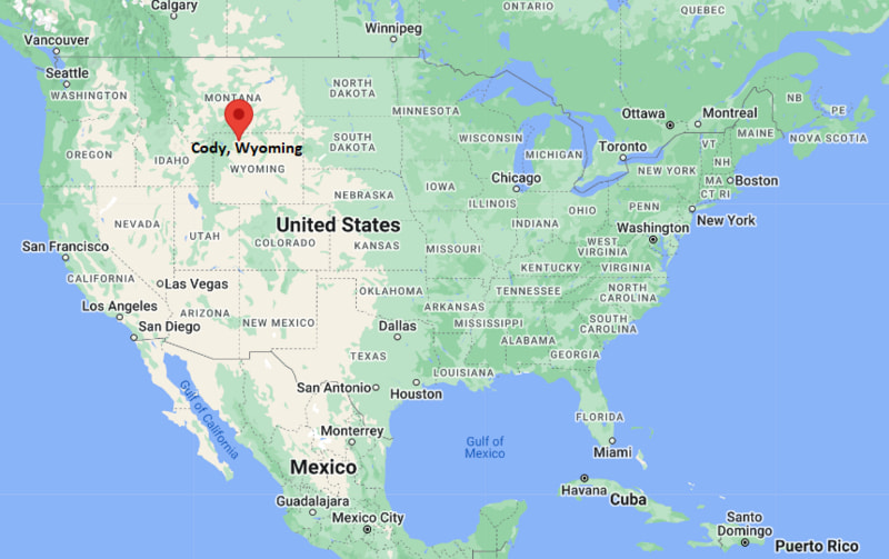
Where is Cody Located? - Cody is a city located in the Park County of Wyoming, United States. Cody lies between 47.103988 Degrees North latitudes and 122.4345661 Degrees West longitudes.
Location Map of Cody, Wyoming
Cody Map, Wyoming, USA
Where is Cody?: The Google Map showing the location of Cody in the U.S. state of Wyoming.
Where is Cody Located?
Cody is a city located in the Park County of Wyoming, United States. Cody lies between 47.103988 Degrees North latitudes and 122.4345661 Degrees West longitudes. According to 2020 U.S.census, the population of Cody city is 10028 people and the city has a total area of 10.22 sq mi. The city has numerous parks and recreational facilities.
No passenger rail service; nearest Amtrak station in Montana
Local Bus/Transit Service
Park County Public Transit and regional shuttle services
U.S. Highway 14 - Scenic route connecting Cody with Yellowstone National Park and northern Wyoming.
U.S. Highway 16 - Major east-west highway linking Cody with Worland and central Wyoming.
U.S. Highway 20 - Important route connecting Cody with Yellowstone National Park and eastern Wyoming.
Wyoming Highway 120 - Regional highway providing access to Meeteetse and Montana communities.
Sheridan Avenue - Cody's main downtown street with shops, restaurants, and historic attractions.
Key Landmarks and Places to Visit in Cody, Wyoming
Landmark Name
Type
Buffalo Bill Center of the West
Museum
Old Trail Town
Historic Site
Buffalo Bill Dam & Visitor Center
Historic Dam
Cody Nite Rodeo
Entertainment Venue
Buffalo Bill State Park
State Park
Cody Dug Up Gun Museum
Museum
Heart Mountain Interpretive Center
Historic Site
Shoshone National Forest
National Forest
Yellowstone National Park East Entrance
National Park Entrance
Cody Firearms Museum
Museum
Colleges and Universities in Cody, Wyoming
Institution Name
Type
Level
Notable For
Northwest College (Powell)
Public
Community College
Transfer and technical education
University of Wyoming
Public
University
Wyoming's flagship university
Northwest College Cody Center
Public
Community College
Continuing education courses
Central Wyoming College (regional access)
Public
Community College
Career and workforce training
Sheridan College (regional access)
Public
Community College
Technical and academic programs
Waterbodies in Cody, Wyoming
Shoshone River, Buffalo Bill Reservoir, North Fork Shoshone River, South Fork Shoshone River, Beck Lake, Alkali Creek, Sage Creek, Newton Creek, Greybull River, Yellowstone River (regional)
Golf Courses in Cody, Wyoming
Cody Country Club, Olive Glenn Golf & Country Club, Powell Golf Club, Foster Gulch Golf Course, Red Lodge Mountain Golf Course, Cottonwood Golf Club, Green Hills Golf Course, Bell Nob Golf Course
Cody, Wyoming - Key Historical Facts
Cody was founded in 1896 by legendary showman William F. "Buffalo Bill" Cody, whose vision helped establish the community as a gateway to Yellowstone.
The arrival of the Burlington Railroad in the early 1900s boosted tourism, ranching, and trade across northwestern Wyoming.
The construction of Buffalo Bill Dam in the early 20th century transformed irrigation and agriculture throughout the Bighorn Basin.
Cody has long been associated with the American West through rodeos, ranching traditions, and the legacy of Buffalo Bill.
The city became an important stop for visitors traveling to Yellowstone National Park via the park's East Entrance.
Today, Cody is recognized for its Western heritage, world-class museums, outdoor recreation, and proximity to Yellowstone National Park.