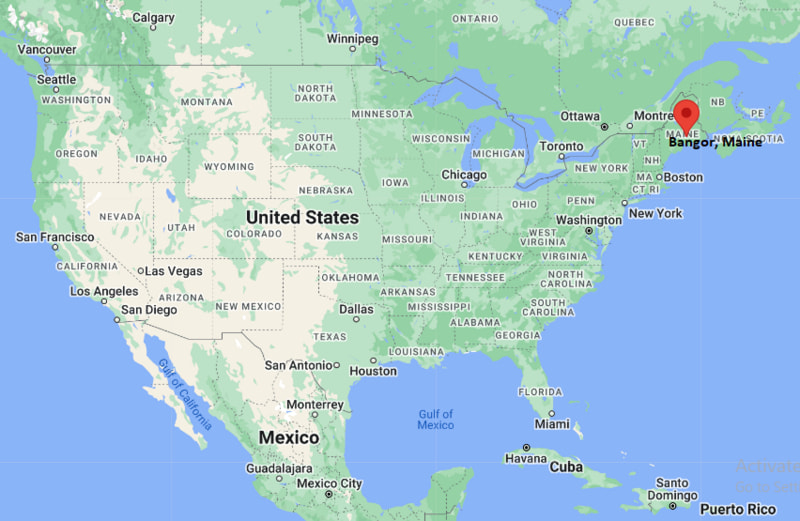
Where is Bangor Located? - Bangor is a city located in the Penobscot County of Maine, United States. Bangor lies between 44.8242 Degrees North latitudes and -68.7918 Degrees West longitudes.
Location Map of Bangor, Maine
Bangor Map, Maine, USA
Where is Bangor?: The Google Map showing the location of Bangor in the U.S. state of Maine.
Where is Bangor Located?
Bangor is a city located in the Penobscot County of Maine, United States. Bangor lies at approximately 44.8242 Degrees North latitude and -68.7918 Degrees West longitude. According to the 2020 U.S. Census, the population of Bangor city is 31,753 people and the city has a total area of 34.595 sq mi. The city has numerous parks and recreational facilities.
Interstate 95, U.S. Route 1A, U.S. Route 2, U.S. Route 202
Rail Service
Freight Rail Service
Public Transit
Community Connector Bus System
Bangor is the largest city in northern and eastern Maine.
The city serves as a regional center for healthcare, education, government and commerce.
Bangor developed as a major lumber and shipping hub during the nineteenth century.
The city is located along the Penobscot River and serves as a gateway to Maine's North Woods.
Author Stephen King has long been associated with Bangor and many local landmarks inspired settings in his novels.
Key Landmarks and Places to Visit in Bangor, Maine
Landmark
Type
Paul Bunyan Statue
Historic Landmark
Bangor Waterfront
Riverfront Attraction
Maine Discovery Museum
Museum
Cole Land Transportation Museum
Museum
Mount Hope Cemetery
Historic Cemetery
Stephen King's House Area
Literary Attraction
Bangor City Forest
Nature Area
Cross Insurance Center
Events and Entertainment Venue
Colleges and Universities Near Bangor, Maine
Institution
Type
Distance
Notable For
Husson University
Private University
2 mi
Business and healthcare programs
University of Maine
Public University
10 mi
Research and engineering
Eastern Maine Community College
Community College
3 mi
Technical and workforce education
University of Maine at Augusta - Bangor Campus
Public University
2 mi
Continuing education programs
Beal University
Private University
1 mi
Healthcare and career-focused education
Waterbodies in and Near Bangor, Maine
Penobscot River, Kenduskeag Stream, Pushaw Lake, Phillips Lake, Chemo Pond, Brewer Lake, Green Lake, Branch Lake, Stillwater River and Graham Lake.
Golf Courses in and Near Bangor, Maine
Bangor Municipal Golf Course, Penobscot Valley Country Club, Rocky Knoll Country Club, Hermon Meadow Golf Club, Pine Hill Golf Club, Lucerne Golf Club, Orono Golf Club and Kebo Valley Golf Club.
Bangor, Maine - Key Historical Facts
Bangor was incorporated as a town in 1791 and became a city in 1834.
During the nineteenth century, Bangor became one of the world's leading lumber ports.
The Penobscot River played a major role in transporting timber from Maine's forests.
The city was heavily rebuilt following the Great Fire of 1911.
Bangor became an important military and aviation center during the twentieth century.
Today, the city serves as the economic and cultural hub of eastern Maine.