
Where is Bondurant Located? - Bondurant is a city located in the Polk County of Iowa, United States. Bondurant lies between 41.70166 Degrees North latitudes and -93.4527 Degrees West longitudes.
Location Map of Bondurant, Iowa
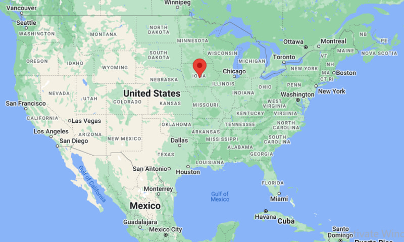
Bondurant Map, Iowa, USA
Where is Bondurant?: The Google Map showing the location of Bondurant in the U.S. state of Iowa.
Where is Bondurant Located?
Bondurant is a city located in the Polk County of Iowa, United States. Bondurant lies between 41.70166 Degrees North latitude and -93.4527 Degrees West longitude. According to the 2020 U.S. Census, the population of Bondurant city is 7,706 people and the city has a total area of 8.756 sq mi. The city has numerous parks and recreational facilities.
Most Viewed US Maps
| USA Sttae Map | USA Region Map | USA Road Map |
| USA County Map | Where is USA in World Map? | US ZIP Code Map |
| USA Time Zones Map | US State and Capitals Map | USA Physical Map |
Find 4,400+ U.S. Cities by State - Explore Their Locations and Get Detailed Information
Bondurant, Iowa Quick Facts
| Fact | Details |
|---|---|
| City | Bondurant |
| County | Polk County |
| State | Iowa |
| State Capital | Des Moines |
| Country | United States |
| US Region | Midwest |
| Latitude | 41.70166 N |
| Longitude | -93.4527 W |
| Elevation | 902 ft (275 m) |
| Land Area | 9.52 sq mi |
| Water Area | 0.04 sq mi |
| Total Area | 8.756 sq mi |
| Population (Census 2020) | 7,365 |
| Population Density | Approximately 774 per sq mi |
| ZIP Code | 50035 |
| Area Code | 515 |
| Time Zone Standard | Central Standard Time (CST, UTC-6) |
| Time Zone Daylight | Central Daylight Time (CDT, UTC-5) |
| Currency | United States Dollar (USD) |
| FIPS Code | 19-07795 |
| Congressional District | Iowa's 3rd Congressional District |
Nearby Cities and Towns to Bondurant, Iowa
- Altoona, Iowa - 5 mi South
- Pleasant Hill, Iowa - 8 mi Southwest
- Ankeny, Iowa - 12 mi Northwest
- Mitchellville, Iowa - 5 mi East
- Des Moines, Iowa - 14 mi West
- Johnston, Iowa - 18 mi Northwest
- Urbandale, Iowa - 19 mi West
- Newton, Iowa - 21 mi East
- Grimes, Iowa - 22 mi Northwest
- Indianola, Iowa - 28 mi South
Bondurant, Iowa Climate and Weather Overview
| Month | Avg High (°F) | Avg Low (°F) | Avg Precipitation (in) |
|---|---|---|---|
| January | 30 | 13 | 1.0 |
| April | 61 | 40 | 3.7 |
| July | 86 | 67 | 4.4 |
| October | 64 | 43 | 2.6 |
| Annual | 60 | 41 | 35.5 |
| Climate Attribute | Details |
|---|---|
| Climate Classification | Hot-Summer Humid Continental (Köppen Dfa) |
| Annual Precipitation | Approximately 35.5 inches |
| Annual Sunshine Days | About 204 days |
| Severe Weather Risk | Moderate - Thunderstorms, tornadoes, hail, winter snow and ice storms |
| Annual Snowfall | Approximately 31 inches |
Driving Distances from Bondurant, Iowa
| City | State | Distance (mi) | Approx. Drive Time |
|---|---|---|---|
| Altoona | Iowa | 5 | 10 min |
| Mitchellville | Iowa | 5 | 10 min |
| Pleasant Hill | Iowa | 8 | 15 min |
| Ankeny | Iowa | 12 | 18 min |
| Des Moines | Iowa | 14 | 20 min |
| Johnston | Iowa | 18 | 25 min |
| Urbandale | Iowa | 19 | 28 min |
| Newton | Iowa | 21 | 25 min |
| Grimes | Iowa | 22 | 30 min |
| Indianola | Iowa | 28 | 35 min |
Transportation and Connectivity in Bondurant, Iowa
| Transportation | Details |
|---|---|
| Nearest Airport | Des Moines International Airport |
| IATA Code | DSM |
| Major Highways | Interstate 80, U.S. Route 65, Iowa Highway 330, Northeast Hubbell Avenue |
| Rail Service | Union Pacific freight rail service |
| Local Transit | Des Moines Area Regional Transit Authority (DART) services nearby |
- Interstate 80 passes just south of Bondurant, providing direct access to Des Moines, Iowa City and Omaha.
- Iowa Highway 330 connects the city with Interstate 35 and communities in central Iowa.
- Des Moines International Airport, approximately 23 miles southwest, offers domestic flights to major U.S. destinations.
- Bondurant's location within the Des Moines metropolitan area provides residents with convenient access to employment centers, shopping, healthcare and educational institutions.
Key Landmarks and Places to Visit in Bondurant, Iowa
| Landmark | Type |
|---|---|
| Lake Petocka | Recreation Lake |
| Bondurant Regional Trailhead | Trail Access Point |
| Chichaqua Valley Trail | Multi-Use Trail |
| Lakeview Sports Complex | Sports Complex |
| Thomas Mitchell Park | County Park |
| Terrace Hills Golf Course | Golf Course |
| Outlets of Des Moines | Shopping Center |
| Prairie Meadows Casino, Racetrack & Hotel | Entertainment Venue |
| Adventureland Resort | Amusement Park |
| Iowa State Fairgrounds | Event Venue |
Colleges and Universities in Bondurant, Iowa
| Institution | Type | Level | Notable For |
|---|---|---|---|
| Des Moines Area Community College - Ankeny Campus | Public | Community College | Career training, technical education and transfer programs |
| Grand View University | Private | University | Business, nursing and liberal arts |
| Drake University | Private | University | Law, pharmacy and business |
| Iowa State University | Public | Research University | Engineering, agriculture and veterinary medicine |
| Simpson College | Private | College | Liberal arts and education |
| University of Iowa - Des Moines Programs | Public | Professional Programs | Medicine, public health and continuing education |
Waterbodies in Bondurant, Iowa
Lake Petocka, Fourmile Creek, Mud Creek, Camp Creek, Des Moines River, South Skunk River, Saylorville Lake, Easter Lake, Chichaqua Bottoms wetlands, Copper Creek.
Golf Courses in Bondurant, Iowa
Terrace Hills Golf Course, Toad Valley Golf Course, Otter Creek Golf Course, Copper Creek Golf Club, Woodland Hills Golf Course, Jester Park Golf Course, Waveland Golf Course, Briarwood Golf Club.
Bondurant, Iowa - Key Historical Facts
- Bondurant was founded in 1884 following the construction of the Chicago, Rock Island and Pacific Railroad through the area.
- The city was named after Alexander C. Bondurant, a local farmer and early landowner who contributed property for the railroad.
- Agriculture played a central role in Bondurant's early economy, with corn, soybean and livestock farming supporting local growth.
- During the late twentieth and early twenty-first centuries, Bondurant experienced rapid residential development as part of the expanding Des Moines metropolitan area.
- The community has maintained its small-town atmosphere while adding new schools, parks, neighborhoods and commercial businesses.
- Today, Bondurant is known for its family-friendly neighborhoods, strong school system, recreational trails and convenient access to the greater Des Moines region.
References
Iowa Related Maps and Info
| Iowa Map | Iowa County Map | Iowa Cities Map |
| Iowa Zipcodes | Where is Iowa | Airports in Iowa |
| Iowa Area Codes | Iowa Blank Map | Iowa River Map |
| Iowa Physical Map | Iowa Road Map | Where is Where is Des Moines |
- Where is Altoona
- Where is Ames
- Where is Ankeny
- Where is Bettendorf
- Where is Bondurant
- Where is Boone
- Where is Burlington
- Where is Carroll
- Where is Cedar Falls
- Where is Cedar Rapids
- Where is Clinton
- Where is Clive
- Where is Coralville
- Where is Council Bluffs
- Where is Davenport
- Where is Denison
- Where is Dubuque
- Where is Fairfield
- Where is Fort Dodge
- Where is Fort Madison
- Where is Grimes
- Where is Grinnell
- Where is Indianola
- Where is Iowa City
- Where is Johnston
- Where is Keokuk
- Where is Le Mars
- Where is Marion
- Where is Marshalltown
- Where is Mason City
- Where is Mount Pleasant
- Where is Muscatine
- Where is Newton
- Where is North Liberty
- Where is Norwalk
- Where is Oskaloosa
- Where is Ottumwa
- Where is Pella
- Where is Perry
- Where is Pleasant Hill
- Where is Sioux Center
- Where is Sioux City
- Where is Spencer
- Where is Storm Lake
- Where is Urbandale
- Where is Waterloo
- Where is Waukee
- Where is Waverly
- Where is West Des Moines