
Where is Bettendorf Located? - Bettendorf is a city located in the Scott County of Iowa, United States. Bettendorf lies between 41.55087 Degrees North latitudes and -90.4942 Degrees West longitudes.
Location Map of Big Sky, Montana
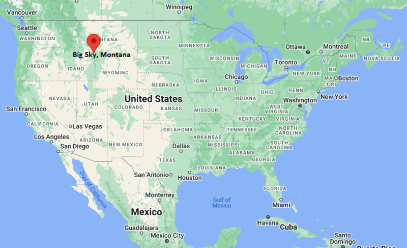
Bettendorf Map, Iowa, USA
Where is Bettendorf?: The Google Map showing the location of Bettendorf in the U.S. state of Iowa.
Where is Bettendorf Located?
Bettendorf is a city located in the Scott County of Iowa, United States. Bettendorf lies between 41.55087 Degrees North latitude and -90.4942 Degrees West longitude. According to the 2020 U.S. Census, the population of Bettendorf city is 39,102 people and the city has a total area of 22.444 sq mi. The city has numerous parks and recreational facilities.
Most Viewed US Maps
| USA Sttae Map | USA Region Map | USA Road Map |
| USA County Map | Where is USA in World Map? | US ZIP Code Map |
| USA Time Zones Map | US State and Capitals Map | USA Physical Map |
Find 4,400+ U.S. Cities by State - Explore Their Locations and Get Detailed Information
Bettendorf, Iowa Quick Facts
| Fact | Details |
|---|---|
| City | Bettendorf |
| County | Scott County |
| State | Iowa |
| State Capital | Des Moines |
| Country | United States |
| US Region | Midwest |
| Latitude | 41.55087 N |
| Longitude | -90.4942 W |
| Elevation | 591 ft (180 m) |
| Land Area | 22.66 sq mi |
| Water Area | 0.61 sq mi |
| Total Area | 22.444 sq mi |
| Population (Census 2020) | 39,102 |
| Population Density | Approximately 1,725 per sq mi |
| ZIP Codes | 52722, 52726 |
| Area Code | 563 |
| Time Zone Standard | Central Standard Time (CST, UTC-6) |
| Time Zone Daylight | Central Daylight Time (CDT, UTC-5) |
| Currency | United States Dollar (USD) |
| FIPS Code | 19-06220 |
| Congressional District | Iowa's 1st Congressional District |
Nearby Cities and Communities to Bettendorf, Iowa
- Davenport, Iowa - 4 mi West
- Moline, Illinois - 7 mi South
- East Moline, Illinois - 8 mi Southeast
- Riverdale, Iowa - 4 mi South
- Le Claire, Iowa - 10 mi East
- Eldridge, Iowa - 12 mi North
- Rock Island, Illinois - 10 mi Southwest
- Silvis, Illinois - 11 mi Southeast
- Blue Grass, Iowa - 13 mi West
- Clinton, Iowa - 40 mi Northeast
Bettendorf, Iowa Climate and Weather Overview
| Month | Avg High (°F) | Avg Low (°F) | Avg Rainfall (in) |
|---|---|---|---|
| January | 30 | 14 | 1.4 |
| April | 61 | 40 | 3.8 |
| July | 85 | 66 | 4.3 |
| October | 64 | 43 | 2.8 |
| Annual | 60 | 41 | 37.0 |
| Climate Attribute | Details |
|---|---|
| Climate Classification | Hot-Summer Humid Continental (Köppen Dfa) |
| Annual Rainfall | Approximately 37 inches |
| Annual Sunshine Days | About 199 days |
| Hurricane/Tornado Risk | Moderate - Thunderstorms, tornadoes and winter snowstorms |
| Snowfall | Approximately 30 inches annually |
Driving Distances from Bettendorf, Iowa
| City | State | Distance (mi) | Approx. Drive Time |
|---|---|---|---|
| Davenport | Iowa | 4 | 10 min |
| Riverdale | Iowa | 4 | 10 min |
| Moline | Illinois | 7 | 15 min |
| East Moline | Illinois | 8 | 15 min |
| Le Claire | Iowa | 10 | 15 min |
| Rock Island | Illinois | 10 | 18 min |
| Silvis | Illinois | 11 | 20 min |
| Eldridge | Iowa | 12 | 20 min |
| Blue Grass | Iowa | 13 | 22 min |
| Clinton | Iowa | 40 | 45 min |
Transportation and Connectivity in Bettendorf, Iowa
| Transportation | Details |
|---|---|
| Airport Name | Quad Cities International Airport |
| IATA Code | MLI |
| Port | Port of Davenport (regional Mississippi River port) |
| Major Highways | Interstate 74, Interstate 80, U.S. Route 67, U.S. Route 6 |
| Train/Amtrak Service | Nearest Amtrak station at Galesburg, Illinois |
| Local Bus/Transit Service | MetroLINK public transit |
- Interstate 74 connects Bettendorf with Moline, Davenport and other Quad Cities communities across the Mississippi River.
- Interstate 80 provides east-west access across Iowa and northern Illinois.
- MetroLINK operates regional bus service connecting Bettendorf with Davenport, Moline, Rock Island and surrounding communities.
- Quad Cities International Airport is approximately 10 miles south of Bettendorf and offers regular commercial flights to major U.S. destinations.
Key Landmarks and Places to Visit in Bettendorf, Iowa
| Landmark | Type |
|---|---|
| Isle Casino Hotel Bettendorf | Casino and Hotel |
| The Waterfront Convention Center | Convention Center |
| Family Museum | Children's Museum |
| Duck Creek Parkway | Recreation Trail |
| Crow Creek Park | Community Park |
| Veterans Memorial Park | Memorial Park |
| Mississippi Riverfront | Scenic Riverfront |
| Figge Art Museum | Art Museum |
| Vander Veer Botanical Park | Botanical Garden |
| John Deere Pavilion | Agricultural Museum |
Colleges and Universities in Bettendorf, Iowa
| Institution | Type | Level | Notable For |
|---|---|---|---|
| Scott Community College | Public | Community College | Career education and university transfer programs |
| St. Ambrose University | Private | University | Business, nursing and liberal arts |
| Palmer College of Chiropractic | Private | Professional College | Chiropractic education and research |
| Augustana College | Private | College | Liberal arts and sciences |
| Black Hawk College | Public | Community College | Technical and workforce education |
| Western Illinois University - Quad Cities | Public | University | Business, engineering and graduate programs |
Waterbodies in Bettendorf, Iowa
Mississippi River, Duck Creek, Crow Creek, Sylvan Slough, Credit Island Slough, Lost Grove Lake, Lake George, West Lake Park Lake, Wapsipinicon River, Rock River.
Golf Courses in Bettendorf, Iowa
Palmer Hills Golf Course, Crow Valley Golf Club, TPC Deere Run, Emeis Golf Course, Highland Springs Golf Course, Red Hawk Golf Course, Oakwood Country Club, Byron Hills Golf Course.
Bettendorf, Iowa - Key Historical Facts
- Bettendorf was founded during the mid-nineteenth century along the Mississippi River and was originally known as Lillienthal before being renamed in honor of the Bettendorf brothers.
- William and Joseph Bettendorf established a successful manufacturing business that produced railroad car components and helped transform the city into an important industrial center.
- The city's location on the Mississippi River encouraged commerce, transportation and steady economic growth throughout the twentieth century.
- Bettendorf became one of the four principal communities of the Quad Cities metropolitan area, sharing strong economic and cultural ties with neighboring cities in Iowa and Illinois.
- Modern Bettendorf has expanded with residential neighborhoods, business parks, recreational trails and riverfront development.
- Today, the city is recognized for its high quality of life, excellent schools, outdoor recreation, healthcare services and vibrant Mississippi River waterfront.
References
Iowa Related Maps and Info
| Iowa Map | Iowa County Map | Iowa Cities Map |
| Iowa Zipcodes | Where is Iowa | Airports in Iowa |
| Iowa Area Codes | Iowa Blank Map | Iowa River Map |
| Iowa Physical Map | Iowa Road Map | Where is Where is Des Moines |
- Where is Altoona
- Where is Ames
- Where is Ankeny
- Where is Bettendorf
- Where is Bondurant
- Where is Boone
- Where is Burlington
- Where is Carroll
- Where is Cedar Falls
- Where is Cedar Rapids
- Where is Clinton
- Where is Clive
- Where is Coralville
- Where is Council Bluffs
- Where is Davenport
- Where is Denison
- Where is Dubuque
- Where is Fairfield
- Where is Fort Dodge
- Where is Fort Madison
- Where is Grimes
- Where is Grinnell
- Where is Indianola
- Where is Iowa City
- Where is Johnston
- Where is Keokuk
- Where is Le Mars
- Where is Marion
- Where is Marshalltown
- Where is Mason City
- Where is Mount Pleasant
- Where is Muscatine
- Where is Newton
- Where is North Liberty
- Where is Norwalk
- Where is Oskaloosa
- Where is Ottumwa
- Where is Pella
- Where is Perry
- Where is Pleasant Hill
- Where is Sioux Center
- Where is Sioux City
- Where is Spencer
- Where is Storm Lake
- Where is Urbandale
- Where is Waterloo
- Where is Waukee
- Where is Waverly
- Where is West Des Moines