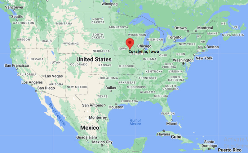
Where is Coralville Located? - Coralville is a city located in the Johnson County of Iowa, United States. Coralville lies between 30.0035 Degrees North latitudes and 91.8187 Degrees West longitudes.
Location Map of Coralville, Iowa
Coralville Map, Iowa, USA
Where is Coralville?: The Google Map showing the location of Coralville in the U.S. state of Iowa.
Where is Coralville Located?
Coralville is a city located in the Johnson County of Iowa, United States. Coralville lies between 30.0035 Degrees North latitudes and 91.8187 Degrees West longitudes. According to 2020 U.S.census, the population of Coralville city is 22318 people and the city has a total area of 12.56 sq mi. The city has numerous parks and recreational facilities.
Distance from Coralville, Iowa to Other Cities in Iowa and Nearby States
Iowa City, IA – 2 miles (3 km)
North Liberty, IA – 6 miles (10 km)
Tiffin, IA – 7 miles (11 km)
Cedar Rapids, IA – 25 miles (40 km)
Marion, IA – 30 miles (48 km)
Waterloo, IA – 95 miles (153 km)
Davenport, IA – 70 miles (113 km)
Des Moines, IA – 115 miles (185 km)
Chicago, IL – 220 miles (354 km)
Madison, WI – 170 miles (274 km)
Minneapolis, MN – 300 miles (483 km)
Omaha, NE – 290 miles (467 km)
Coralville, Iowa Climate and Weather Overview
Month
Avg High (°F)
Avg Low (°F)
Avg Rainfall (in)
January
31
14
1.2
April
62
41
3.6
July
86
66
4.3
October
65
45
2.7
Annual
62
44
36.8
Climate Attribute
Details
Köppen Climate Classification
Humid Continental (Dfa)
Annual Rainfall
~36 inches
Annual Sunshine Days
~200 days
Tornado Risk
Moderate (seasonal spring–summer)
Snowfall
Moderate winter snowfall
Driving Distances from Coralville, Iowa
City
State
Distance (mi)
Approx. Drive Time
Iowa City
Iowa
2
5 min
North Liberty
Iowa
6
10 min
Cedar Rapids
Iowa
25
30 min
Des Moines
Iowa
115
1 hr 50 min
Davenport
Iowa
70
1 hr 15 min
Waterloo
Iowa
95
1 hr 40 min
Chicago
Illinois
220
3 hr 30 min
Madison
Wisconsin
170
2 hr 45 min
Omaha
Nebraska
290
4 hr 30 min
Minneapolis
Minnesota
300
4 hr 45 min
Transportation and Connectivity in Coralville, Iowa
Nearest Airport
The Eastern Iowa Airport (CID)
IATA Code
CID
Major Highways
I-80, U.S. Route 218, U.S. Route 6, IA-965
Rail Service
No direct passenger rail (nearest Amtrak: Mt. Pleasant / Galesburg stations)
Public Transit
Coralville Transit, Iowa City Transit
I-80 is the main east-west interstate connecting Coralville with Des Moines and Chicago.
U.S. Route 218 runs south through the Iowa City metropolitan area toward Missouri.
U.S. Route 6 serves as a key local connector between Coralville, Iowa City, and surrounding suburbs.
IA-965 links Coralville directly with Iowa City and nearby commercial districts.
The Eastern Iowa Airport (CID) provides regional and national flight connections.
Key Landmarks and Places to Visit in Coralville, Iowa
Landmark Name
Type
Iowa River Landing
Mixed-use District
Xtream Arena & GreenState Family Fieldhouse
Sports & Events Venue
Coralville Lake
Reservoir / Recreation Area
Coral Ridge Mall
Shopping Mall
Iowa Children’s Museum
Museum
Devonian Fossil Gorge
Geological Site
Clear Creek Trail
Recreation Trail
City Park
Community Park
Brown Deer Golf Club Area (nearby)
Recreation
North Ridge Park
Park
Places to Visit in Coralville, Iowa
Landmark Name
Type
Iowa River Landing
Entertainment District
Coral Ridge Mall
Shopping Center
Xtream Arena
Sports Venue
Iowa Children’s Museum
Family Attraction
Coralville Lake
Recreation Area
Devonian Fossil Gorge
Natural Attraction
Clear Creek Trail
Walking / Biking Trail
North Ridge Park
Park
City Park Coralville
Public Park
Brown Deer Golf Area (nearby)
Outdoor Recreation
Colleges and Universities Near Coralville, Iowa
Institution Name
Type
Distance
Notable For
University of Iowa
Public University
2 mi
Research & medical programs
Iowa Wesleyan (regional presence)
Private University
70+ mi
Liberal arts education
Kirkwood Community College
Public College
25 mi
Technical & career programs
Coe College
Private College
25 mi
Liberal arts
Mount Mercy University
Private University
30 mi
Business & healthcare studies
Waterbodies in and Near Coralville, Iowa
Coralville Lake, Iowa River, Clear Creek, Muddy Creek, Old Man’s Creek, North Branch Iowa River, Hawkeye Wildlife Area wetlands, Turkey Creek, Rapid Creek
Golf Courses Near Coralville, Iowa
Brown Deer Golf Club, Finkbine Golf Course, Airport National Golf Course, Pleasant Valley Golf Course, Amana Colonies Golf Club, Ellis Park Golf Course, Hunters Ridge Golf Course, Saddleback Ridge Golf Course
Coralville, Iowa - Key Historical Facts
Coralville developed in the mid-1800s as a river-based settlement along the Iowa River.
The city grew significantly after the arrival of railroads in the late 19th century.
Coralville Lake was created in the 1950s as part of flood control efforts by the U.S. Army Corps of Engineers.
The completion of Interstate 80 boosted commercial and residential growth in the region.
The city became closely tied to the University of Iowa’s expansion in nearby Iowa City.
Today, Coralville is a major part of the Iowa City metropolitan area with strong retail and event infrastructure.