
Where is Bosque Farms Located? - Bosque Farms is a city located in the Valencia County of New Mexico, United States. Bosque Farms lies between 34.87637 Degrees North latitudes and -106.698 Degrees West longitudes.
Location Map of Boulder, Colorado
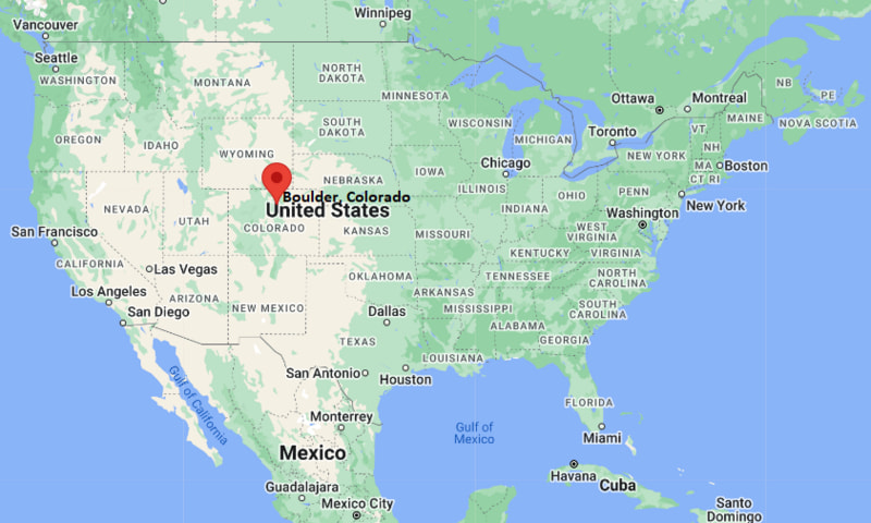
Bosque Farms Map, New Mexico, USA
Where is Bosque Farms?: The Google Map showing the location of Bosque Farms in the U.S. state of New Mexico.
Where is Bosque Farms Located?
Bosque Farms is a village located in the Valencia County of New Mexico, United States. Bosque Farms lies between 34.87637 Degrees North latitude and -106.698 Degrees West longitude. According to the 2020 U.S. Census, the population of Bosque Farms village is 4,020 people and the village has a total area of 3.935 sq mi. The village has numerous parks and recreational facilities.
Most Viewed US Maps
| USA Sttae Map | USA Region Map | USA Road Map |
| USA County Map | Where is USA in World Map? | US ZIP Code Map |
| USA Time Zones Map | US State and Capitals Map | USA Physical Map |
Find 4,400+ U.S. Cities by State - Explore Their Locations and Get Detailed Information
Bosque Farms, New Mexico Quick Facts
| Fact | Details |
|---|---|
| Village | Bosque Farms |
| County | Valencia County |
| State | New Mexico |
| State Capital | Santa Fe |
| Country | United States |
| US Region | Southwest |
| Latitude | 34.87637 N |
| Longitude | -106.698 W |
| Elevation | 4,866 ft (1,483 m) |
| Land Area | 3.935 sq mi |
| Water Area | 0.00 sq mi |
| Total Area | 3.935 sq mi |
| Population (Census 2020) | 4,020 |
| Population Density | Approximately 1,022 per sq mi |
| ZIP Codes | 87042, 87068 |
| Area Code | 505 |
| Time Zone Standard | Mountain Standard Time (MST, UTC-7) |
| Time Zone Daylight | Mountain Daylight Time (MDT, UTC-6) |
| Currency | United States Dollar (USD) |
| FIPS Code | 35-08580 |
| Congressional District | New Mexico's 2nd Congressional District |
Nearby Cities and Towns to Bosque Farms, New Mexico
- Peralta, New Mexico - 2 mi South
- Los Lunas, New Mexico - 5 mi South
- Belen, New Mexico - 12 mi South
- Valencia, New Mexico - 7 mi South
- Isleta Village Proper, New Mexico - 10 mi North
- Albuquerque, New Mexico - 21 mi North
- Rio Communities, New Mexico - 15 mi South
- South Valley, New Mexico - 18 mi North
- Corrales, New Mexico - 31 mi North
- Bernalillo, New Mexico - 42 mi North
Bosque Farms, New Mexico Climate and Weather Overview
| Month | Avg High (°F) | Avg Low (°F) | Avg Precipitation (in) |
|---|---|---|---|
| January | 49 | 24 | 0.5 |
| April | 70 | 39 | 0.6 |
| July | 92 | 65 | 1.7 |
| October | 73 | 42 | 1.0 |
| Annual | 72 | 42 | 10.2 |
| Climate Attribute | Details |
|---|---|
| Climate Classification | Cold Semi-Arid (Köppen BSk) |
| Annual Precipitation | Approximately 10.2 inches |
| Annual Sunshine Days | About 278 days |
| Severe Weather Risk | Low to Moderate - Summer thunderstorms, strong winds and occasional winter snow |
| Annual Snowfall | Approximately 7 inches |
Driving Distances from Bosque Farms, New Mexico
| City | State | Distance (mi) | Approx. Drive Time |
|---|---|---|---|
| Peralta | New Mexico | 2 | 5 min |
| Los Lunas | New Mexico | 5 | 10 min |
| Valencia | New Mexico | 7 | 12 min |
| Isleta Village Proper | New Mexico | 10 | 15 min |
| Belen | New Mexico | 12 | 18 min |
| Rio Communities | New Mexico | 15 | 20 min |
| South Valley | New Mexico | 18 | 25 min |
| Albuquerque | New Mexico | 21 | 30 min |
| Corrales | New Mexico | 31 | 40 min |
| Bernalillo | New Mexico | 42 | 50 min |
Transportation and Connectivity in Bosque Farms, New Mexico
| Transportation | Details |
|---|---|
| Nearest Airport | Albuquerque International Sunport |
| IATA Code | ABQ |
| Major Highways | New Mexico State Road 47, New Mexico State Road 6, Interstate 25 (nearby) |
| Rail Service | Rio Metro Rail Runner Express station nearby in Los Lunas |
| Local Transit | Rio Metro regional transit services |
- New Mexico State Road 47 is the primary route through Bosque Farms, connecting the village with Los Lunas, Belen and Albuquerque.
- Interstate 25, located a few miles east, provides direct access to Albuquerque, Santa Fe and Las Cruces.
- Albuquerque International Sunport, approximately 25 miles north, offers commercial flights to major destinations across the United States.
- Rio Metro Rail Runner Express provides commuter rail service from nearby Los Lunas to Albuquerque and Santa Fe, making regional travel convenient.
Key Landmarks and Places to Visit in Bosque Farms, New Mexico
| Landmark | Type |
|---|---|
| Bosque Farms Rodeo Arena | Event Venue |
| Bosque Farms Heritage Foundation Museum | Local History Museum |
| Rio Grande Bosque | Nature Area |
| Los Lunas Museum of Heritage and Arts | History Museum |
| Valencia County Fairgrounds | Event Venue |
| Whitfield Wildlife Conservation Area | Wildlife Area |
| El Cerro de Los Lunas Preserve | Nature Preserve |
| Tome Hill Park | Historic Landmark |
| Isleta Lakes | Fishing and Recreation Area |
| Rio Grande Nature Trail | Hiking and Birdwatching Trail |
Colleges and Universities in Bosque Farms, New Mexico
| Institution | Type | Level | Notable For |
|---|---|---|---|
| University of New Mexico - Valencia Campus | Public | Branch Campus | Transfer programs, workforce training and technical education |
| University of New Mexico | Public | Research University | Engineering, medicine and business |
| Central New Mexico Community College | Public | Community College | Career education and technical programs |
| New Mexico Highlands University - Rio Rancho Center | Public | University | Education and graduate studies |
| Southwestern Indian Polytechnic Institute | Public | Technical College | STEM and technical education |
| Western New Mexico University - Albuquerque | Public | University | Business, education and healthcare programs |
Waterbodies in Bosque Farms, New Mexico
Rio Grande, Peralta Drain, Los Chavez Drain, Isleta Lakes, Jaral Lateral, Valencia Main Canal, Bosque wetlands, Belen Highline Canal, San Juan Drain, Rio Grande floodplain channels.
Golf Courses in Bosque Farms, New Mexico
Isleta Eagle Golf Club, Puerto del Sol Golf Course, Los Altos Golf Course, Ladera Golf Course, Paradise Hills Golf Club, Paako Ridge Golf Club, Sandia Golf Club, University of New Mexico Championship Golf Course.
Bosque Farms, New Mexico - Key Historical Facts
- Bosque Farms was established during the early twentieth century as an agricultural community in the fertile Rio Grande Valley.
- The village officially incorporated in 1974 while maintaining its rural atmosphere and strong farming traditions.
- Local agriculture has historically focused on alfalfa, orchards, livestock and small family-owned farms supported by irrigation from the Rio Grande.
- Its proximity to Albuquerque encouraged steady residential growth while preserving the area's equestrian culture and open spaces.
- Annual rodeos, fairs and community events celebrate the village's agricultural heritage and western traditions.
- Today, Bosque Farms is known for its rural lifestyle, horse properties, scenic Rio Grande bosque, outdoor recreation and convenient access to the Albuquerque metropolitan area.
References
New Mexico Maps & Info
- Where is Alamogordo
- Where is Artesia
- Where is Aztec
- Where is Belen
- Where is Bernalillo
- Where is Bloomfield
- Where is Bosque Farms
- Where is Carlsbad
- Where is Chaparral
- Where is Clovis
- Where is Corrales
- Where is Deming
- Where is Edgewood
- Where is El Cerro Mission
- Where is Eldorado at Santa Fe
- Where is Farmington
- Where is Gallup
- Where is Grants
- Where is Hobbs
- Where is Holloman AFB
- Where is Las Cruces
- Where is Los Alamos
- Where is Los Chaves
- Where is Los Lunas
- Where is Los Ranchos de Albuquerque
- Where is Lovington
- Where is Meadow Lake
- Where is North Hobbs
- Where is North Valley
- Where is Paradise Hills
- Where is Placitas
- Where is Portales
- Where is Raton
- Where is Rio Rancho
- Where is Roswell
- Where is Ruidoso
- Where is Santa Fe
- Where is Santa Teresa
- Where is Shiprock
- Where is Silver City
- Where is Socorro
- Where is South Valley
- Where is Sunland Park
- Where is Taos
- Where is Truth or Consequences
- Where is Tucumcari
- Where is White Rock
- Where is Zuni Pueblo