
Where is Brookhaven Located? - Brookhaven is a city located in the Delaware County of West Virginia, United States. Brookhaven lies between 38.98205 Degrees North latitudes and -77.5386 Degrees West longitudes.
Location Map of Brunswick, Maine
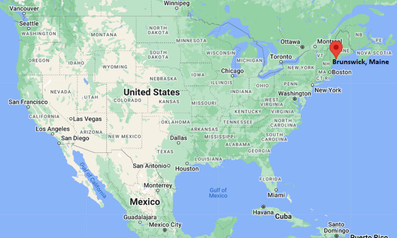
Brookhaven Map, West Virginia, USA
Where is Brookhaven?: The Google Map showing the location of Brookhaven in the U.S. state of West Virginia.
Where is Brookhaven Located?
Brookhaven is a city located in the Monongalia County of West Virginia, United States. Brookhaven lies between 38.98205 Degrees North latitude and -77.5386 Degrees West longitude. According to the 2020 U.S. Census, the population of Brookhaven city is 5,707 people and the city has a total area of 5.806 sq mi. The city has numerous parks and recreational facilities.
Most Viewed US Maps
| USA Sttae Map | USA Region Map | USA Road Map |
| USA County Map | Where is USA in World Map? | US ZIP Code Map |
| USA Time Zones Map | US State and Capitals Map | USA Physical Map |
Find 4,400+ U.S. Cities by State - Explore Their Locations and Get Detailed Information
Brookhaven, West Virginia Quick Facts
| Fact | Details |
|---|---|
| City | Brookhaven |
| County | Monongalia County |
| State | West Virginia |
| Country | United States |
| Region | North Central West Virginia |
| Metro Area | Morgantown Metropolitan Statistical Area |
| Established | |
| Incorporated | |
| 2020 Census Population | 5,707 |
| Land Area | 5.806 sq mi (15.036 sq km) |
| Population Density | 617.5 people per sq mi |
| Latitude | 38.98205 |
| Longitude | -77.5386 |
| FIPS Code | 5410420 |
| County FIPS | 54061 |
| ZIP Code | 26508 |
| Area Code | 304, 681 |
| Time Zone | Eastern Time (ET) (UTC−5/UTC−4) |
| Major Highways | U.S. Route 19, Interstate 79 (nearby), Interstate 68 (nearby) |
| Public Transit | Mountain Line Transit Authority, Route 8 Brookhaven |
| School District | Monongalia County Schools |
| Nearby Major City | Morgantown |
| Airport | Morgantown Municipal Airport (MGW) |
| Major Attractions | |
| Official Website | Monongalia County Government |
Nearby Cities and Towns to Brookhaven, West Virginia
- Morgantown, West Virginia - 5 mi North
- Westover, West Virginia - 6 mi North
- Granville, West Virginia - 4 mi North
- Star City, West Virginia - 5 mi North
- Clarksburg, West Virginia - 40 mi South
- Fairmont, West Virginia - 20 mi South
- Kingwood, West Virginia - 25 mi East
- Bruceton Mills, West Virginia - 18 mi East
- Uniontown, Pennsylvania - 30 mi North
- Point Marion, Pennsylvania - 22 mi North
Brookhaven, West Virginia Climate and Weather Overview
| Month | Avg High (F) | Avg Low (F) | Avg Precipitation (in) |
|---|---|---|---|
| January | 38 | 22 | 3.1 |
| April | 62 | 40 | 3.5 |
| July | 84 | 62 | 4.2 |
| October | 65 | 45 | 3.2 |
| Annual | 62 | 43 | 42.0 |
| Climate Attribute | Details |
|---|---|
| Climate Classification | Humid Continental (Köppen Dfb) |
| Annual Snowfall | 35–45 inches |
| Annual Precipitation | Approximately 42 inches |
| Severe Weather Risk | Moderate - winter snow, thunderstorms, occasional flooding |
| Annual Sunshine Days | About 160–180 days |
Driving Distances from Brookhaven, West Virginia
| City | State | Distance (mi) | Approx. Drive Time |
|---|---|---|---|
| Morgantown | West Virginia | 5 | 10 min |
| Fairmont | West Virginia | 20 | 25 min |
| Clarksburg | West Virginia | 40 | 45 min |
| Uniontown | Pennsylvania | 30 | 40 min |
| Washington | Pennsylvania | 55 | 1 hr 10 min |
| Pittsburgh | Pennsylvania | 75 | 1 hr 30 min |
| Elkins | West Virginia | 70 | 1 hr 30 min |
| Charleston | West Virginia | 130 | 2 hr 10 min |
| Harrisburg | Pennsylvania | 140 | 2 hr 20 min |
| Columbus | Ohio | 185 | 3 hr |
Transportation and Connectivity in Brookhaven, West Virginia
| Transportation | Details |
|---|---|
| Nearest Airport | Morgantown Municipal Airport |
| IATA Code | MGW |
| Nearest Major Airport | Pittsburgh International Airport |
| Major Highways | Interstate 68, U.S. Route 19, U.S. Route 119 |
| Rail Service | Freight rail (regional CSX lines) |
| Local Transit | Morgantown Personal Rapid Transit (nearby WVU system) |
- I-68 connects the area westward toward Maryland and eastward into central West Virginia.
- U.S. Route 19 is a key north–south corridor through the Morgantown region.
- Pittsburgh International Airport is the primary major air hub for long-distance travel.
- Morgantown PRT system provides unique local transit near West Virginia University.
Key Landmarks and Places to Visit in Brookhaven, West Virginia
| Landmark | Type |
|---|---|
| Coopers Rock State Forest (nearby) | State Forest |
| West Virginia University Core Arboretum | Nature Preserve |
| Morgantown Riverfront Trail | Recreation Trail |
| Caperton Trail | Multi-use Trail |
| Monongalia County Ballpark | Sports Venue |
| Mountaineer Field at Milan Puskar Stadium | Football Stadium |
| Dorsey’s Knob Park | Scenic Overlook |
| West Virginia Botanic Garden (nearby) | Botanical Garden |
| Deckers Creek Trail | Rail Trail |
| Historic Downtown Morgantown | Historic District |
Colleges and Universities in Brookhaven, West Virginia
| Institution | Type | Level | Notable For |
|---|---|---|---|
| West Virginia University | Public | Research University | Engineering, medicine, law, business, agriculture |
| Fairmont State University (regional) | Public | University | Aviation, business, education, criminal justice |
| Shepherd University (regional) | Public | University | Liberal arts, sciences, education |
| West Virginia University Institute of Technology (regional) | Public | Technical University | Engineering and applied sciences |
| Pierpont Community & Technical College | Public | Community College | Career training and associate degrees |
| Carnegie Mellon University (regional access) | Private | Research University | Computer science, engineering, robotics |
Waterbodies in Brookhaven, West Virginia
Monongahela River, Cheat River, Deckers Creek, Cobun Creek, Dunkard Creek (regional), Cheat Lake, Tygart Valley River (regional), West Fork River (regional), Dorsey’s Run, Lake Lynn (nearby reservoir).
Golf Courses in Brookhaven, West Virginia
Mountaineer Golf Course, Lakeview Golf Resort Course (nearby Cheat Lake), Green Hills Country Club, The Pines Country Club (regional), Moundsville Country Club (regional), Preston Country Club, Alpine Lake Resort Golf Course (regional), Bridgeport Country Club.
Brookhaven, West Virginia - Key Historical Facts
- Brookhaven developed as part of the greater Morgantown region, which grew around coal mining and rail transport in the 19th century.
- The surrounding Monongalia County area expanded rapidly due to West Virginia University’s establishment in 1867.
- The region played a key role in Appalachian industrial growth, especially coal and natural gas industries.
- Transportation corridors like I-68 and rail lines helped connect the area to Pennsylvania and Ohio markets.
- Suburban development around Morgantown led to residential communities such as Brookhaven.
- Today, it is part of a growing academic and service-based economy anchored by WVU.
References
West Virginia Maps and Info
| West Virginia Map | Counties in West Virginia | Cities in West Virginia |
| West Virginia Zipcodes | Airports in West Virginia | US Zip code Map |
| West Virginia Area Codes | West Virginia River Map | - |
- Where is Barboursville
- Where is Beckley
- Where is Blennerhassett
- Where is Bluefield
- Where is Bridgeport
- Where is Brookhaven
- Where is Buckhannon
- Where is Charles Town
- Where is Charleston
- Where is Cheat Lake
- Where is Clarksburg
- Where is Cross Lanes
- Where is Culloden
- Where is Dunbar
- Where is Elkins
- Where is Fairmont
- Where is Grafton
- Where is Huntington
- Where is Hurricane
- Where is Inwood
- Where is Keyser
- Where is Lewisburg
- Where is Martinsburg
- Where is Morgantown
- Where is Moundsville
- Where is New Martinsville
- Where is Nitro
- Where is Oak Hill
- Where is Parkersburg
- Where is Pea Ridge
- Where is Pleasant Valley
- Where is Point Pleasant
- Where is Princeton
- Where is Ranson corporation
- Where is Ravenswood
- Where is Ripley
- Where is Shady Spring
- Where is Shannondale
- Where is Sissonville
- Where is South Charleston
- Where is St. Albans
- Where is Teays Valley
- Where is Vienna
- Where is Weirton
- Where is Welch
- Where is Weston
- Where is Westover
- Where is Wheeling
- Where is Williamson
- Where is Williamstown