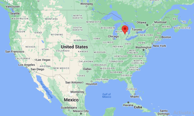
Where is Burton Located? - Burton is a city located in the Genesee County of Michigan, United States. Burton lies between 45.8191203 Degrees North latitudes and 108.414855 Degrees West longitudes.
Location Map of Burton, Michigan
Burton Map, Michigan, USA
Where is Burton?: The Google Map showing the location of Burton in the U.S. state of Michigan.
Where is Burton Located?
Burton is a city located in the Genesee County of Michigan, United States. Burton lies between 45.8191203 Degrees North latitudes and 108.414855 Degrees West longitudes. According to 2020 U.S.census, the population of Burton city is 29715 people and the city has a total area of 23.36 sq mi. The city has numerous parks and recreational facilities.
Transportation and Connectivity in Burton, Michigan
Transportation
Details
Airport Name
Bishop International Airport
IATA Code
FNT
Port
Not Applicable
Major Highways
Interstate 69, Interstate 475, Interstate 75 (nearby), Center Road (M-54)
Train/Amtrak Service
Nearest Amtrak station in Flint
Local Bus/Transit Service
Mass Transportation Authority (MTA) Flint
Interstate 69 - Major east-west route connecting Burton with Flint, Lansing and Port Huron.
Interstate 475 - Provides quick access through the Flint metropolitan area.
Interstate 75 - Nearby interstate linking Burton with Detroit, Saginaw and northern Michigan.
M-54 (Center Road/Dort Highway) - Principal commercial corridor serving Burton and neighboring communities.
Bishop International Airport - Regional airport offering convenient passenger and cargo services.
Key Landmarks and Places to Visit in Burton, Michigan
Landmark Name
Type
For-Mar Nature Preserve & Arboretum
Nature Preserve
Kelly Lake Park
Community Park
Stepping Stone Falls
Scenic Attraction
Crossroads Village & Huckleberry Railroad
Historic Village
Flint Institute of Arts
Art Museum
Sloan Museum of Discovery
Museum
Longway Planetarium
Planetarium
Genesee Valley Center
Shopping Mall
Bluebell Beach
Beach
Thread Lake Park
City Park
Colleges and Universities in Burton, Michigan
Institution Name
Type
Level
Notable For
Mott Community College
Public
Community College
Career and transfer education
University of Michigan-Flint
Public
University
Research and healthcare programs
Kettering University
Private
University
Engineering and cooperative education
Baker College of Flint
Private
University
Career-focused degree programs
Bentley Community Schools
Public
K-12 District
Public education services
Waterbodies in Burton, Michigan
Thread Lake, Kelly Lake, Kearsley Creek, Flint River, Holloway Reservoir, Gilkey Creek, Mott Lake, Cass River
Golf Courses in Burton, Michigan
Southmoor Golf Club, IMA Brookwood Golf Club, Flint Golf Club, Swartz Creek Golf Course, Sugarbush Golf Club, Atlas Valley Golf Club, Warwick Hills Golf & Country Club, The Captain's Club at Woodfield
Burton, Michigan - Key Historical Facts
Burton was originally settled in the early nineteenth century as part of Burton Township before becoming an incorporated city in 1972.
The community developed alongside Flint as agriculture gradually gave way to residential neighborhoods and manufacturing.
The expansion of the automotive industry throughout Genesee County brought new residents and businesses to Burton during the twentieth century.
Its location near major highways helped the city grow into an important suburban community within the Flint metropolitan area.
Burton has invested in parks, recreation, and public services while maintaining strong ties to the region's manufacturing economy.
Today, the city offers a mix of residential neighborhoods, local businesses, outdoor recreation, and convenient access to educational and cultural attractions in nearby Flint.