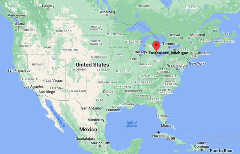
Where is Eastpointe Located? - Eastpointe is a city located in the Macomb County of Michigan, United States. Eastpointe lies between 46.6095274 Degrees North latitudes and 111.9194649 Degrees West longitudes.
Location Map of Eastpointe, Michigan
Eastpointe Map, Michigan, USA
Where is Eastpointe?: The Google Map showing the location of Eastpointe in the U.S. state of Michigan.
Where is Eastpointe Located?
Eastpointe is a city located in the Macomb County of Michigan, United States. Eastpointe lies between 46.6095274 Degrees North latitudes and 111.9194649 Degrees West longitudes. According to 2020 U.S.census, the population of Eastpointe city is 34318 people and the city has a total area of 5.16 sq mi. The city has numerous parks and recreational facilities.
SMART (Suburban Mobility Authority for Regional Transportation)
Interstate 94 — Major east-west interstate connecting Eastpointe with Detroit, Port Huron, and Chicago.
Interstate 696 — Regional freeway providing quick access across northern Metro Detroit.
M-3 (Gratiot Avenue) — Historic commercial corridor linking downtown Detroit with Macomb County.
M-97 (Groesbeck Highway) — Important north-south route connecting Eastpointe with Warren, Clinton Township, and Mount Clemens.
Places to Visit in Eastpointe, Michigan
Landmark Name
Type
Spindler Park
Community Park
Kennedy Memorial Park
City Park
Detroit Zoo
Zoo
Lake St. Clair Metropark
Metro Park
Ford House
Historic Estate
Edsel and Eleanor Ford House
Historic Site
Detroit Institute of Arts
Art Museum
Belle Isle Park
Island Park
Motown Museum
Museum
Anna Scripps Whitcomb Conservatory
Botanical Conservatory
Colleges and Universities in Eastpointe, Michigan
Institution Name
Type
Level
Notable For
Macomb Community College
Public
Community College
Career and technical education
Wayne State University
Public
University
Research and healthcare
Oakland University
Public
University
Engineering and business
University of Detroit Mercy
Private
University
Law and dentistry
Lawrence Technological University
Private
University
Engineering and architecture
Oakland Community College
Public
Community College
Transfer and workforce programs
Davenport University
Private
University
Business and technology
Eastpointe Community Schools
Public
K–12 District
Local public education
Waterbodies in Eastpointe, Michigan
Lake St. Clair, Detroit River, Fox Creek, Conner Creek, Milk River, Clinton River, Red Run Drain, Bear Creek
Golf Courses in Eastpointe, Michigan
Rammler Golf Club, Chandler Park Golf Course, Lochmoor Club, Plum Brook Golf Club, Maple Lane Golf Club, Fern Hill Golf Club, Sycamore Hills Golf Club, Lake St. Clair Golf Course
Eastpointe, Michigan — Key Historical Facts
Eastpointe was originally established as the Village of Halfway because it was located roughly halfway between Detroit and Mount Clemens along Gratiot Avenue.
The community incorporated as the City of East Detroit in 1929 during a period of rapid suburban growth in Metro Detroit.
In 1992, residents voted to rename the city Eastpointe to create a distinct identity and reduce confusion with neighboring Detroit.
The city's development was closely tied to the expansion of the automobile industry and the growth of Macomb County after World War II.
Gratiot Avenue has long served as Eastpointe's main commercial corridor, supporting local businesses and regional transportation.
Today, Eastpointe is a diverse suburban community known for its convenient location, neighborhood parks, and easy access to downtown Detroit and Lake St. Clair.