
Easthampton is a city in Hampshire County in western Massachusetts, near the Connecticut River and the foothills of Mount Tom. It is about 10 miles northwest of Springfield and 5 miles south of Northampton. The city is known for its former textile mills, historic mill district, arts community, and scenic setting in the Pioneer Valley.
Location Map of Easthampton, Hampshire County, Massachusetts
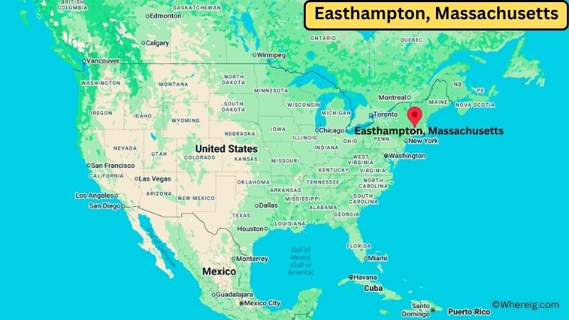
About Map: The map shows the location of Easthampton in Hampshire County, in the U.S. state of Massachusetts.
Easthampton Map, Massachusetts
About Easthampton Map: The Google Map highlights the location of Easthampton in Hampshire County, Massachusetts. Use the zoom, satellite, and street-view options to explore the city's neighborhoods, roads, and nearby places.
Where is Easthampton Located?
Easthampton is a city located in Hampshire County, Massachusetts, the United States. It is situated in the Pioneer Valley of western Massachusetts, about 10 miles northwest of Springfield and approximately 5 miles south of Northampton. Easthampton lies at about 42.27° North latitude and 72.67° West longitude. The 2020 Census recorded 16,053 residents. The city covers approximately 13.02 square miles (33.72 square kilometers), including about 12.55 square miles of land and 0.47 square miles of water. Easthampton developed around textile manufacturing and water-powered mills along the Manhan River. The city was incorporated in 1809 and became a city in 1996. Its industrial past remains visible in the historic mill buildings that now house studios, galleries, shops, restaurants, and community spaces. Mount Tom rises to the south and provides a distinctive natural backdrop. Nearby attractions include Mount Tom State Reservation, the Manhan Rail Trail, and the Connecticut River. Easthampton's location also provides easy access to Northampton, Amherst, and the larger Springfield area.
Most Viewed US Maps
| USA Sttae Map | USA Region Map | USA Road Map |
| USA County Map | Where is USA in World Map? | US ZIP Code Map |
| USA Time Zones Map | US State and Capitals Map | USA Physical Map |
Find 4,400+ U.S. Cities by State - Explore Their Locations and Get Detailed Information
Easthampton City Facts
| City | Easthampton |
| State | Massachusetts |
| County | Hampshire County |
| Country | United States |
| Region | Pioneer Valley / Western Massachusetts |
| Incorporated | 1809 |
| Founded | 1664 |
| Total Area | 13.02 sq mi (33.72 sq km) |
| Land Area | 12.55 sq mi (32.50 sq km) |
| Water Area | 0.47 sq mi (1.22 sq km) |
| Elevation | About 200 ft (61 m) |
| Population (2023 estimate) | Approximately 15,900 |
| Population (2020 Census) | 16,053 |
| Population Density | 1,279 people per sq mi |
| Time Zone | Eastern Time Zone (EST/EDT) |
| ZIP Codes | 01027 |
| Area Code | 413 |
| Major Highways | Massachusetts Route 10, Massachusetts Route 141, Interstate 91 |
| Public Transit | PVTA bus service |
| Major Attractions | Historic Mill District, Mount Tom State Reservation, Manhan Rail Trail, Arcadia Wildlife Sanctuary |
| Official Website | https://www.easthamptonma.gov/ |
Distance from Easthampton, MA to Nearby Cities
- Northampton, MA – 5 miles (8 km)
- Holyoke, MA – 6 miles (10 km)
- South Hadley, MA – 7 miles (11 km)
- Amherst, MA – 12 miles (19 km)
- Springfield, MA – 10 miles (16 km)
- Westfield, MA – 15 miles (24 km)
- Greenfield, MA – 25 miles (40 km)
- Chicopee, MA – 8 miles (13 km)
- West Springfield, MA – 10 miles (16 km)
- Palmer, MA – 25 miles (40 km)
- Worcester, MA – 65 miles (105 km)
- Pittsfield, MA – 50 miles (80 km)
- Springfield, MA – 10 miles (16 km)
- Hartford, CT – 35 miles (56 km)
- Albany, NY – 90 miles (145 km)
- Boston, MA – 100 miles (161 km)
- Providence, RI – 100 miles (161 km)
- New Haven, CT – 75 miles (121 km)
Top Attractions in Easthampton
- Historic Mill District – A former industrial area along the Manhan River that now includes art studios, galleries, shops, restaurants, and creative businesses.
- Manhan Rail Trail – A popular multi-use trail following a former railroad corridor through Easthampton and nearby communities.
- Mount Tom State Reservation – A nearby protected mountain area with hiking trails, scenic overlooks, forests, and wildlife habitat.
- Arcadia Wildlife Sanctuary – A protected natural area in nearby Easthampton and Northampton with wetlands, fields, forests, and walking trails.
- Connecticut River – A major New England river flowing near Easthampton and providing scenic views and wildlife habitat.
- Mount Tom – A prominent mountain ridge south of Easthampton offering hiking and views across the Connecticut River Valley.
- Pascommuck Conservation Area – A local natural area with wooded trails and views of the Connecticut River valley.
- Emily Dickinson Museum – A nearby Amherst attraction preserving the homes and legacy of poet Emily Dickinson.
Airports Near Easthampton
- Westover Metropolitan Airport (CEF) – 10 miles
- Bradley International Airport (BDL) – 30 miles
- Westfield-Barnes Regional Airport (BAF) – 20 miles
- Albany International Airport (ALB) – 95 miles
Sources:
Population and area data sourced from the United States Census Bureau (2020 Census). General city information referenced from the official City of Easthampton website and local government records.
Massachusetts Related Maps and Info
- Where is Attleboro
- Where is Barnstable Town
- Where is Beverly
- Where is Braintree Town
- Where is Brockton
- Where is Brookline
- Where is Cambridge
- Where is Chelsea
- Where is Chicopee
- Where is Everett
- Where is Fall River
- Where is Fitchburg
- Where is Franklin Town
- Where is Gloucester
- Where is Haverhill
- Where is Holyoke
- Where is Lawrence
- Where is Leominster
- Where is Lowell
- Where is Lynn
- Where is Malden
- Where is Marlborough
- Where is Medford
- Where is Melrose
- Where is Methuen Town
- Where is Milton
- Where is Needham
- Where is New Bedford
- Where is Newton
- Where is Northampton
- Where is Norwood
- Where is Peabody
- Where is Pittsfield
- Where is Quincy
- Where is Revere
- Where is Saugus
- Where is Somerville
- Where is Taunton
- Where is Waltham
- Where is Watertown Town
- Where is Wellesley
- Where is Westfield
- Where is Weymouth Town
- Where is Woburn
- Where is Worcester