
Espanola is a city in northern New Mexico's Rio Grande Valley and part of the Santa Fe metropolitan area. It is about 30 miles north of Santa Fe and 30 miles south of Taos, between the Jemez and Sangre de Cristo mountains. The city is known for its deep Hispanic and Native American heritage, Northern New Mexico College, and nearby historic pueblos.
Location Map of Espanola, Rio Arriba County, New Mexico
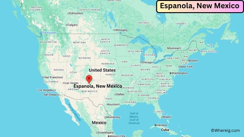
About Map: The map shows the location of Espanola in Rio Arriba County, in the U.S. state of New Mexico.
Espanola Map, New Mexico
About Espanola Map: The Google Map highlights the location of Espanola in Rio Arriba County, New Mexico. Use the zoom, satellite, and street-view options to explore the city's neighborhoods, roads, and nearby places.
Where is Espanola Located?
Espanola is a city located in Rio Arriba County, New Mexico, the United States. The city is primarily in Rio Arriba County, with a portion extending into Santa Fe County. It sits in the Espanola Valley near the meeting of the Rio Grande, Rio Chama, and Santa Cruz River. Espanola is about 30 miles north of Santa Fe, 30 miles south of Taos, and about 25 miles west of Los Alamos. It is positioned at approximately 36.004° North latitude and 106.070° West longitude. The city covers about 8.34 square miles, or 21.61 square kilometers, including water. The 2020 Census recorded 10,526 residents, while a 2023 estimate put the population at about 10,431. Espanola stands at roughly 5,591 feet above sea level. Its long Hispanic and Pueblo heritage, combined with its history as a railroad community, gives the city a distinctive place in northern New Mexico.
Most Viewed US Maps
| USA Sttae Map | USA Region Map | USA Road Map |
| USA County Map | Where is USA in World Map? | US ZIP Code Map |
| USA Time Zones Map | US State and Capitals Map | USA Physical Map |
Find 4,400+ U.S. Cities by State - Explore Their Locations and Get Detailed Information
Espanola City Facts
| City | Espanola |
|---|---|
| State | New Mexico |
| County | Rio Arriba County and Santa Fe County |
| Country | United States |
| Region | Northern New Mexico, Espanola Valley |
| Incorporated | 1925 |
| Founded | 1880 |
| Total Area | 8.34 sq mi (21.61 sq km) |
| Land Area | 8.22 sq mi (21.30 sq km) |
| Water Area | 0.12 sq mi (0.31 sq km) |
| Elevation | 5,591 ft (1,704 m) |
| Population (2023 estimate) | 10,431 |
| Population (2020 Census) | 10,526 |
| Population Density | 1,280.2 people per sq mi |
| Time Zone | Mountain Time (MST/MDT) |
| ZIP Codes | 87532, 87533 |
| Area Code | 505 |
| Major Highways | U.S. Route 84, U.S. Route 285, New Mexico State Road 68 |
| Public Transit | North Central Regional Transit District |
| Major Attractions | Northern New Mexico College, Bond House Museum, Espanola Valley, Santa Clara Pueblo, Ohkay Owingeh Pueblo |
| Official Website | https://www.espanolanmusa.org/ |
Distance from Espanola, NM to Nearby Cities
- Santa Cruz, NM – 4 miles (6 km)
- Los Alamos, NM – 25 miles (40 km)
- Santa Fe, NM – 30 miles (48 km)
- Taos, NM – 30 miles (48 km)
- Pojoaque, NM – 13 miles (21 km)
- Chimayo, NM – 10 miles (16 km)
- Los Alamos, NM – 25 miles (40 km)
- Bernalillo, NM – 55 miles (89 km)
- Albuquerque, NM – 85 miles (137 km)
- Las Vegas, NM – 65 miles (105 km)
- Mora, NM – 55 miles (89 km)
- Pecos, NM – 50 miles (80 km)
- Taos Ski Valley, NM – 55 miles (89 km)
- Abiquiu, NM – 40 miles (64 km)
- Chama, NM – 75 miles (121 km)
- Farmington, NM – 160 miles (257 km)
- Gallup, NM – 175 miles (282 km)
- Durango, CO – 180 miles (290 km)
Top Attractions in Espanola
- Northern New Mexico College – A public college with a long history in northern New Mexico and a campus in Espanola.
- Bond House Museum – A historic home and museum connected to the Bond family and the city's commercial development.
- Espanola Valley – A scenic valley along the Rio Grande surrounded by the Jemez and Sangre de Cristo mountain ranges.
- Ohkay Owingeh Pueblo – A historic Tewa Pueblo immediately north of Espanola with deep cultural and historical connections to the region.
- Santa Clara Pueblo – A nearby Tewa community south of Espanola known for its pottery, cultural traditions, and natural landscapes.
- Rio Grande – The major river running through the Espanola Valley and an important part of the area's agriculture and history.
- Santa Cruz de la Canada – A historic community south of Espanola with Spanish colonial roots and the historic Santa Cruz church.
- El Santuario de Chimayo – A famous historic religious site in nearby Chimayo known for its Spanish colonial architecture and pilgrimage tradition.
- Bandelier National Monument – A nearby archaeological and natural area featuring ancestral Pueblo dwellings, canyon scenery, and hiking trails.
- Los Alamos National Laboratory and Bradbury Science Museum – A major scientific site and museum in nearby Los Alamos with exhibits on science and the area's history.
Airports Near Espanola
- Santa Fe Regional Airport (SAF) – 30 miles
- Los Alamos County Airport (LAM) – 27 miles
- Taos Regional Airport (SKX) – 50 miles
- Albuquerque International Sunport (ABQ) – 85 miles
- Double Eagle II Airport (AEG) – 78 miles
Sources:
Population and area data sourced from the United States Census Bureau (2020 Census). General city information referenced from the official City of Espanola website and local government records.
New Mexico Maps & Info
- Where is Alamogordo
- Where is Artesia
- Where is Aztec
- Where is Belen
- Where is Bernalillo
- Where is Bloomfield
- Where is Bosque Farms
- Where is Carlsbad
- Where is Chaparral
- Where is Clovis
- Where is Corrales
- Where is Deming
- Where is Edgewood
- Where is El Cerro Mission
- Where is Eldorado at Santa Fe
- Where is Farmington
- Where is Gallup
- Where is Grants
- Where is Hobbs
- Where is Holloman AFB
- Where is Las Cruces
- Where is Los Alamos
- Where is Los Chaves
- Where is Los Lunas
- Where is Los Ranchos de Albuquerque
- Where is Lovington
- Where is Meadow Lake
- Where is North Hobbs
- Where is North Valley
- Where is Paradise Hills
- Where is Placitas
- Where is Portales
- Where is Raton
- Where is Rio Rancho
- Where is Roswell
- Where is Ruidoso
- Where is Santa Fe
- Where is Santa Teresa
- Where is Shiprock
- Where is Silver City
- Where is Socorro
- Where is South Valley
- Where is Sunland Park
- Where is Taos
- Where is Truth or Consequences
- Where is Tucumcari
- Where is White Rock
- Where is Zuni Pueblo