
Where is Fritz Creek Located? - Fritz Creek is a city located in the Kenai Peninsula Borough County of Alaska, United States. Fritz Creek lies between 32.3909 Degrees North latitudes and 110.9665 Degrees West longitudes.
Location Map of Fritz Creek, Alaska
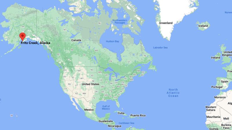
Fritz Creek Map, Alaska, USA
Where is Fritz Creek?: The Google Map showing the location of Fritz Creek in the U.S. state of Alaska.
Where is Fritz Creek Located?
Fritz Creek is a city located in the Kenai Peninsula Borough County of Alaska, United States. Fritz Creek lies between 32.3909 Degrees North latitudes and 110.9665 Degrees West longitudes. According to 2020 U.S.census, the population of Fritz Creek city is 2248 people and the city has a total area of 53.96 sq mi. The city has numerous parks and recreational facilities.
Most Viewed US Maps
| USA Sttae Map | USA Region Map | USA Road Map |
| USA County Map | Where is USA in World Map? | US ZIP Code Map |
| USA Time Zones Map | US State and Capitals Map | USA Physical Map |
Find 4,400+ U.S. Cities by State - Explore Their Locations and Get Detailed Information
Fritz Creek, Alaska Quick Facts
| Property | Information |
|---|---|
| City | Fritz Creek (Census-Designated Place) |
| County | Kenai Peninsula Borough |
| State | Alaska |
| State Capital | Juneau |
| US Region | West |
| Latitude | 59.7289°N |
| Longitude | 151.2876°W |
| Elevation | 164 ft (50 m) |
| Land Area | 57.37 sq mi |
| Water Area | 0.78 sq mi |
| Total Area | 58.15 sq mi |
| Population (2020 Census) | 2,107 |
| Population Density | 37 per sq mi |
| ZIP Codes | 99603 |
| Area Code | 907 |
| Time Zone Standard | Alaska Standard Time (AKST, UTC−9) |
| Time Zone Daylight | Alaska Daylight Time (AKDT, UTC−8) |
| Currency | United States Dollar (USD) |
| FIPS Code | 02-27640 |
| Congressional District | Alaska At-Large Congressional District |
Nearby Cities to Fritz Creek, Alaska
- Homer, Alaska - Southwest - 8 mi
- Anchor Point, Alaska - North - 17 mi
- Diamond Ridge, Alaska - West - 9 mi
- Kachemak City, Alaska - South - 12 mi
- Halibut Cove, Alaska - South - 15 mi
- Nanwalek, Alaska - Southwest - 27 mi
- Seldovia, Alaska - South - 18 mi (via ferry)
- Nikolaevsk, Alaska - Northwest - 43 mi
- Ninilchik, Alaska - North - 47 mi
- Soldotna, Alaska - North - 76 mi
Driving Distances from Fritz Creek, Alaska
| City | State | Distance (mi) | Approx. Drive Time |
|---|---|---|---|
| Homer | Alaska | 8 | 12 minutes |
| Diamond Ridge | Alaska | 9 | 15 minutes |
| Anchor Point | Alaska | 17 | 22 minutes |
| Nikolaevsk | Alaska | 43 | 50 minutes |
| Ninilchik | Alaska | 47 | 55 minutes |
| Soldotna | Alaska | 76 | 1 hour 30 minutes |
| Kenai | Alaska | 87 | 1 hour 40 minutes |
| Sterling | Alaska | 93 | 1 hour 45 minutes |
| Cooper Landing | Alaska | 141 | 2 hours 45 minutes |
| Seward | Alaska | 171 | 3 hours 25 minutes |
Transportation and Connectivity in Fritz Creek, Alaska
| Mode | Details |
|---|---|
| Airport Name | Homer Airport |
| IATA Code | HOM |
| Port | Homer Harbor (nearby) |
| Major Highways | Sterling Highway (AK-1), East End Road |
| Train/Amtrak Service | No passenger rail service |
| Local Bus/Transit Service | Limited regional shuttle and seasonal transportation services |
- Sterling Highway (AK-1) is the primary route connecting Fritz Creek with Homer, Soldotna, Kenai, and the rest of the Kenai Peninsula.
- East End Road provides access to residential communities, Kachemak Bay State Park trailheads, and scenic recreation areas east of Homer.
What are top Places to Visit in Fritz Creek, Alaska
| Landmark Name | Type |
|---|---|
| Wynn Nature Center | Nature Center |
| Eveline State Recreation Site | State Recreation Site |
| Kachemak Bay State Park | State Park |
| Homer Spit | Natural Attraction |
| Alaska Islands and Ocean Visitor Center | Visitor Center |
| Center for Alaskan Coastal Studies | Nature Center |
| Bear Creek Winery | Winery |
| Pratt Museum | Museum |
| Bishop's Beach | Beach |
| Carl E. Wynn Nature Trail | Nature Trail |
Colleges and Universities in Fritz Creek, Alaska
| Institution Name | Type | Level | Notable For |
|---|---|---|---|
| Kachemak Bay Campus, Kenai Peninsula College | Public | Community College | University of Alaska academic and workforce programs |
| Kenai Peninsula College | Public | Community College | Career and transfer education |
| University of Alaska Anchorage | Public | University | Research and professional education |
| Alaska Pacific University | Private | University | Environmental and outdoor studies |
| Kenai Peninsula Borough School District | Public | K–12 District | Public education serving Fritz Creek |
Waterbodies in Fritz Creek, Alaska
Fritz Creek, Kachemak Bay, Cook Inlet, Diamond Creek, Anchor River, Beluga Lake, China Poot Bay, Grewingk Glacier Lake
Golf Courses in Fritz Creek, Alaska
Fireweed Meadows Golf Course, Bird Homestead Golf Course, Kenai Golf Course, Birch Ridge Golf Course, Soldotna Creek Park Disc Golf Course
Fritz Creek, Alaska — Key Historical Facts
- Fritz Creek developed as a small rural community east of Homer along the scenic southern coastline of the Kenai Peninsula.
- The area has long supported homesteading, commercial fishing, small-scale farming, and tourism because of its fertile land and proximity to Kachemak Bay.
- Its location near Kachemak Bay State Park made Fritz Creek an important gateway for hiking, wildlife viewing, and outdoor recreation.
- The community has maintained its rural character while benefiting from the economic and cultural opportunities available in nearby Homer.
- Today, Fritz Creek is known for its scenic landscapes, abundant wildlife, outdoor recreation, and access to some of Alaska's most spectacular coastal environments.
References
Alaska Related Links
- Where is Fairbanks
- Where is Juneau
- Where is Knik-Fairview
- Where is Badger
- Where is College
- Where is Meadow Lakes
- Where is Wasilla
- Where is Tanaina
- Where is Kalifornsky
- Where is Sitka
- Where is Ketchikan
- Where is Kenai
- Where is Bethel
- Where is Steele Creek
- Where is Chena Ridge
- Where is Sterling
- Where is Palmer
- Where is Gateway
- Where is Homer
- Where is Kodiak
- Where is Fishhook
- Where is Farmers Loop
- Where is Nikiski
- Where is Soldotna
- Where is Unalaska
- Where is Valdez
- Where is Big Lake
- Where is Nome
- Where is Butte
- Where is Farm Loop
- Where is Goldstream
- Where is Kotzebue
- Where is Seward
- Where is Cordova
- Where is Eielson AFB
- Where is Ester
- Where is Deltana
- Where is Fritz Creek
- Where is North Pole
- Where is Point MacKenzie
- Where is Dillingham
- Where is Willow
- Where is Bear Creek
- Where is Ridgeway
- Where is Anchor Point
- Where is Wrangell
- Where is Kodiak Station
- Where is Akutan