
Where is Knik-Fairview Located? - Knik-Fairview is a city located in the Matanuska-Susitna County of Alaska, United States. Knik-Fairview lies between 64.8957 Degrees North latitudes and 147.6928 Degrees West longitudes.
Location Map of Knik-Fairview, Alaska
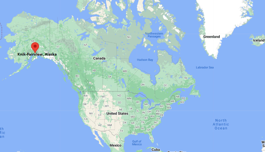
Knik-Fairview Map, Alaska, USA
Where is Knik-Fairview?: The Google Map showing the location of Knik-Fairview in the U.S. state of Alaska.
Where is Knik-Fairview Located?
Knik-Fairview is a city located in the Matanuska-Susitna Borough of Alaska, United States. Knik-Fairview lies between 64.8957 Degrees North latitudes and 147.6928 Degrees West longitudes. According to 2020 U.S.census, the population of Knik-Fairview city is 19297 people and the city has a total area of 83.21 sq mi. The city has numerous parks and recreational facilities.
Most Viewed US Maps
| USA Sttae Map | USA Region Map | USA Road Map |
| USA County Map | Where is USA in World Map? | US ZIP Code Map |
| USA Time Zones Map | US State and Capitals Map | USA Physical Map |
Find 4,400+ U.S. Cities by State - Explore Their Locations and Get Detailed Information
Knik-Fairview, Alaska Quick Facts
| Property | Details |
|---|---|
| Community | Knik-Fairview (Census-Designated Place) |
| Borough | Matanuska-Susitna Borough |
| State | Alaska |
| State Capital | Juneau |
| US Region | Western United States |
| Latitude | 61.5128° N |
| Longitude | 149.7447° W |
| Elevation | 233 ft (71 m) |
| Land Area | 73.54 sq mi |
| Water Area | 1.37 sq mi |
| Total Area | 74.91 sq mi |
| Population (2020 Census) | 19,297 |
| Population Density | Approximately 262 per sq mi |
| ZIP Code | 99654 |
| Area Code | 907 |
| Time Zone Standard | Alaska Standard Time (AKST, UTC−9) |
| Time Zone Daylight | Alaska Daylight Time (AKDT, UTC−8) |
| Currency | United States Dollar (USD) |
| FIPS Code | 02-40645 |
| Congressional District | Alaska At-Large Congressional District |
Transportation and Connectivity in Knik-Fairview
| Category | Details |
|---|---|
| Nearest Airport | Ted Stevens Anchorage International Airport |
| IATA Code | ANC |
| Nearest Regional Airport | Wasilla Airport |
| Major Highways | Knik-Goose Bay Road, Parks Highway (AK-3), Glenn Highway (AK-1) |
| Rail Service | Nearest Alaska Railroad passenger service at Wasilla Depot |
| Public Transit | Matanuska-Susitna Community Transit (regional service) |
- Knik-Goose Bay Road: The primary roadway connecting Knik-Fairview with Wasilla, Palmer, and surrounding communities.
- Parks Highway (AK-3): Provides access south to Anchorage and north toward Denali National Park and Fairbanks.
- Alaska Railroad: Passenger rail services are available from nearby Wasilla, offering connections across Southcentral Alaska.
- Ted Stevens Anchorage International Airport: The nearest major airport, located about 45 miles south of the community.
Top Places to Visit in Knik-Fairview, Alaska
| Landmark Name | Type |
|---|---|
| Knik Museum and Mushers Hall of Fame | Museum |
| Knik River Public Use Area | Outdoor Recreation Area |
| Settlers Bay Golf Course | Golf Course |
| Nancy Lake State Recreation Area | State Recreation Area |
| Hatcher Pass (nearby) | Scenic Mountain Pass |
| Matanuska River | River |
| Wasilla Lake | Lake |
| Iditarod Trail Headquarters | Historic Site |
| Finger Lake | Lake |
| Palmer Visitor Information Center | Visitor Center |
Driving Distances from Knik-Fairview, Alaska to Nearby Cities
| City | State | Distance (mi) | Approx. Drive Time |
|---|---|---|---|
| Wasilla | Alaska | 8 | 15 minutes |
| Palmer | Alaska | 17 | 25 minutes |
| Houston | Alaska | 16 | 25 minutes |
| Big Lake | Alaska | 18 | 30 minutes |
| Anchorage | Alaska | 43 | 55 minutes |
| Eagle River | Alaska | 36 | 45 minutes |
| Sutton | Alaska | 41 | 50 minutes |
| Willow | Alaska | 42 | 50 minutes |
| Talkeetna | Alaska | 86 | 1 hour 40 minutes |
| Fairbanks | Alaska | 315 | 5 hours 45 minutes |
Colleges and Universities near Knik-Fairview, Alaska
| Institution Name | Type | Level | Notable For |
|---|---|---|---|
| University of Alaska Anchorage – Mat-Su College | Public | Community College | Associate degrees, workforce training, and university transfer programs |
| University of Alaska Anchorage | Public | Research University | Engineering, health sciences, business, and research |
| Alaska Pacific University | Private | University | Environmental sciences, outdoor leadership, and liberal arts |
| Charter College – Anchorage | Private | Career College | Healthcare, business, and information technology |
| Wayland Baptist University – Anchorage Campus | Private | University | Adult education, business, and management programs |
Waterbodies in Knik-Fairview, Alaska
Knik River, Knik Arm, Matanuska River, Finger Lake, Wasilla Lake, Big Lake, Lucile Lake, Goose Bay
Stadiums in Knik-Fairview
Menard Sports Center, Wasilla High School Stadium, Palmer High School Athletic Complex, Alaska State Fairgrounds Event Arena, Matanuska-Susitna Borough Sports Complex
Knik-Fairview, Alaska — Key Historical Facts
- Knik-Fairview is located in the historic Knik region, which served as an important trading and transportation center during Alaska's early territorial period.
- The community developed significantly after World War II as improved road networks connected the Matanuska-Susitna Valley with Anchorage.
- Population growth accelerated in the late twentieth and early twenty-first centuries as the Mat-Su Borough became one of Alaska's fastest-growing regions.
- Knik-Fairview remains primarily a residential community while benefiting from nearby employment centers in Wasilla, Palmer, and Anchorage.
- Today, the area is known for outdoor recreation, scenic mountain views, access to rivers and trails, and its proximity to Knik Glacier and other Southcentral Alaska attractions.
References
- Matanuska-Susitna Borough
- U.S. Census Bureau
- University of Alaska Anchorage
- Mat-Su College
- Alaska Department of Natural Resources
Alaska Related Links
- Where is Fairbanks
- Where is Juneau
- Where is Knik-Fairview
- Where is Badger
- Where is College
- Where is Meadow Lakes
- Where is Wasilla
- Where is Tanaina
- Where is Kalifornsky
- Where is Sitka
- Where is Ketchikan
- Where is Kenai
- Where is Bethel
- Where is Steele Creek
- Where is Chena Ridge
- Where is Sterling
- Where is Palmer
- Where is Gateway
- Where is Homer
- Where is Kodiak
- Where is Fishhook
- Where is Farmers Loop
- Where is Nikiski
- Where is Soldotna
- Where is Unalaska
- Where is Valdez
- Where is Big Lake
- Where is Nome
- Where is Butte
- Where is Farm Loop
- Where is Goldstream
- Where is Kotzebue
- Where is Seward
- Where is Cordova
- Where is Eielson AFB
- Where is Ester
- Where is Deltana
- Where is Fritz Creek
- Where is North Pole
- Where is Point MacKenzie
- Where is Dillingham
- Where is Willow
- Where is Bear Creek
- Where is Ridgeway
- Where is Anchor Point
- Where is Wrangell
- Where is Kodiak Station
- Where is Akutan