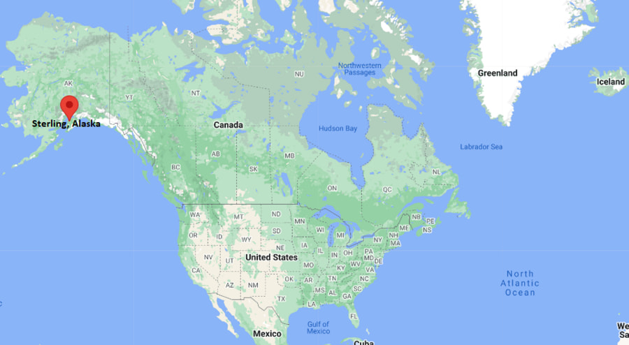
Where is Sterling Located? - Sterling is a city located in the Arenac County of Alaska, United States. Sterling lies between 61.3759 Degrees North latitudes and 150.0292 Degrees West longitudes.
Location Map of Sterling, Alaska

Sterling Map, Alaska, USA
Where is Sterling?: The Google Map showing the location of Sterling in the U.S. state of Alaska.
Where is Sterling Located?
Sterling is a city located in the Arenac County of Alaska, United States. Sterling lies between 61.3759 Degrees North latitudes and 150.0292 Degrees West longitudes. According to 2020 U.S.census, the population of Sterling city is 5918 people and the city has a total area of 77.78 sq mi. The city has numerous parks and recreational facilities.
Most Viewed US Maps
Sterling City Facts, Alaska
#N/AAlaska Related Links
Location Map of Alaska Cities
- Where is Fairbanks
- Where is Juneau
- Where is Knik-Fairview
- Where is Badger
- Where is College
- Where is Meadow Lakes
- Where is Wasilla
- Where is Tanaina
- Where is Kalifornsky
- Where is Sitka
- Where is Ketchikan
- Where is Kenai
- Where is Bethel
- Where is Steele Creek
- Where is Chena Ridge
- Where is Sterling
- Where is Palmer
- Where is Gateway
- Where is Homer
- Where is Kodiak
- Where is Fishhook
- Where is Farmers Loop
- Where is Nikiski
- Where is Soldotna
- Where is Unalaska
- Where is Valdez
- Where is Big Lake
- Where is Nome
- Where is Butte
- Where is Farm Loop
- Where is Goldstream
- Where is Kotzebue
- Where is Seward
- Where is Cordova
- Where is Eielson AFB
- Where is Ester
- Where is Deltana
- Where is Fritz Creek
- Where is North Pole
- Where is Point MacKenzie
- Where is Dillingham
- Where is Willow
- Where is Bear Creek
- Where is Ridgeway
- Where is Anchor Point
- Where is Wrangell
- Where is Kodiak Station
- Where is Akutan
