
Quincy is a city in central Washington and part of the Columbia Basin in Grant County. It sits about 85 miles east of Wenatchee and 95 miles west of Spokane. The city is known for its fertile irrigated farmland, Columbia River Gorge scenery, nearby Gorge Amphitheatre, and its role as an agricultural and technology center in the Columbia Basin.
Location Map of Quincy, Grant County, Washington
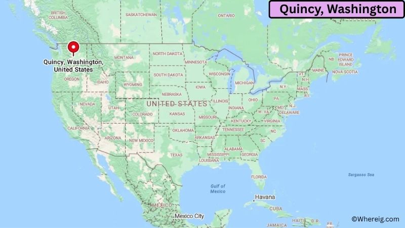
About Map: The map shows the location of Quincy in Grant County, in the U.S. state of Washington.
Quincy Map, Washington
About Quincy Map: The Google Map highlights the location of Quincy in Grant County, Washington. Use the zoom, satellite, and street-view options to explore the city's neighborhoods, roads, and nearby places.
Where is Quincy Located?
Quincy is a city located in Grant County, Washington, the United States. It lies in central Washington's Columbia Basin, about 85 miles east of Wenatchee and roughly 95 miles west of Spokane. Moses Lake is around 25 miles east, while Ephrata is about 20 miles north. Quincy is positioned near 47.234° North latitude and 119.852° West longitude. The 2020 Census recorded 7,543 residents. The city covers about 5.92 square miles, or 15.33 square kilometers. Quincy was incorporated in 1907 and developed rapidly after irrigation projects transformed the dry Columbia Basin into productive farmland. Today, the surrounding area produces potatoes, apples, wheat, corn, and other crops. The city is also known for its connection to the technology industry, with several large data centers operating in the region because of relatively low-cost electricity and access to major infrastructure. A famous nearby attraction is the Gorge Amphitheatre, a large outdoor concert venue overlooking the Columbia River. The Columbia River itself provides opportunities for boating, fishing, hiking, and scenic recreation. A unique fact about Quincy is the contrast between its desert-like natural landscape and highly productive irrigated farmland. Interstate 90 provides a major east-west connection to Seattle, Spokane, Moses Lake, and other communities across Washington.
Most Viewed US Maps
| USA Sttae Map | USA Region Map | USA Road Map |
| USA County Map | Where is USA in World Map? | US ZIP Code Map |
| USA Time Zones Map | US State and Capitals Map | USA Physical Map |
Find 4,400+ U.S. Cities by State - Explore Their Locations and Get Detailed Information
Quincy City Facts
| City | Quincy |
| State | Washington |
| County | Grant County |
| Country | United States |
| Region | Columbia Basin and Central Washington |
| Incorporated | 1907 |
| Founded | 1892 |
| Total Area | 5.92 sq mi (15.33 sq km) |
| Land Area | 5.90 sq mi (15.28 sq km) |
| Water Area | 0.02 sq mi (0.05 sq km) |
| Elevation | 1,270 ft (387 m) |
| Population (2023 estimate) | About 8,000 |
| Population (2020 Census) | 7,543 |
| Population Density | 1,278 people per sq mi |
| Time Zone | Pacific Time (PST/PDT) |
| ZIP Codes | 98848 |
| Area Code | 509 |
| Major Highways | I-90, WA-28, and WA-281 |
| Public Transit | Grant Transit Authority |
| Major Attractions | Gorge Amphitheatre, Quincy Valley, Columbia River, and Crescent Bar Recreation Area |
| Official Website | https://www.quincywashington.us/ |
Distance from Quincy, WA to Nearby Cities
- Ephrata, WA – 20 miles (32 km)
- Moses Lake, WA – 25 miles (40 km)
- George, WA – 15 miles (24 km)
- Soap Lake, WA – 30 miles (48 km)
- Wenatchee, WA – 85 miles (137 km)
- East Wenatchee, WA – 85 miles (137 km)
- Ellensburg, WA – 55 miles (89 km)
- Othello, WA – 50 miles (80 km)
- Warden, WA – 40 miles (64 km)
- Royal City, WA – 35 miles (56 km)
- Yakima, WA – 105 miles (169 km)
- Kennewick, WA – 130 miles (209 km)
- Pasco, WA – 125 miles (201 km)
- Richland, WA – 130 miles (209 km)
- Spokane, WA – 95 miles (153 km)
- Seattle, WA – 175 miles (282 km)
- Bellingham, WA – 230 miles (370 km)
- Walla Walla, WA – 160 miles (257 km)
Top Attractions in Quincy
- Gorge Amphitheatre – A major outdoor concert venue set above the Columbia River, known for its dramatic canyon views and large music festivals.
- Quincy Valley – The irrigated agricultural valley surrounding the city produces potatoes, apples, wheat, corn, and other crops.
- Columbia River – The river near Quincy provides opportunities for boating, fishing, kayaking, wildlife viewing, and scenic recreation.
- Crescent Bar Recreation Area – A popular Columbia River recreation destination with boating, fishing, swimming, golf, camping, and hiking.
- Frenchman Coulee – A nearby geological area with dramatic basalt cliffs, hiking trails, and scenic views of the Columbia Basin.
- Ancient Lakes – A nearby natural area with lakes, basalt cliffs, waterfalls, hiking trails, and desert landscapes.
- Quincy Valley Historical Society Museum – A local museum preserving artifacts, photographs, agricultural equipment, and stories from the area's history.
- Columbia National Wildlife Refuge – A large protected area northeast of Quincy with wetlands, lakes, grasslands, wildlife habitat, and birdwatching opportunities.
Airports Near Quincy, WA
- Pangborn Memorial Airport (EAT) – 85 miles
- Grant County International Airport (MWH) – 30 miles
- Yakima Air Terminal–McAllister Field (YKM) – 105 miles
- Tri-Cities Airport (PSC) – 125 miles
- Spokane International Airport (GEG) – 105 miles
Sources:
Population and area data sourced from the United States Census Bureau (2020 Census). General city information referenced from the official Quincy city website and local government records.
Washington Maps and Info
- Where is Auburn
- Where is Bellevue
- Where is Bellingham
- Where is Bothell
- Where is Bremerton
- Where is Burien
- Where is Camas
- Where is Edmonds
- Where is Everett
- Where is Federal Way
- Where is Frederickson
- Where is Graham
- Where is Issaquah
- Where is Kennewick
- Where is Kent
- Where is Kirkland
- Where is Lacey
- Where is Lake Stevens
- Where is Lakewood
- Where is Longview
- Where is Lynnwood
- Where is Maple Valley
- Where is Marysville
- Where is Mill Creek East
- Where is Mount Vernon
- Where is Olympia
- Where is Orchards
- Where is Parkland
- Where is Pasco
- Where is Pullman
- Where is Puyallup
- Where is Redmond
- Where is Renton
- Where is Richland
- Where is Sammamish
- Where is SeaTac
- Where is Shoreline
- Where is South Hill
- Where is Spanaway
- Where is Spokane Valley
- Where is Tacoma
- Where is Tumwater
- Where is University Place
- Where is Vancouver
- Where is Walla Walla
- Where is Wenatchee
- Where is Yakima