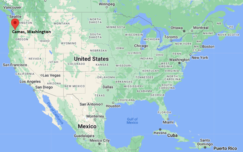
Where is Camas Located? - Camas is a city located in the Clark County of Washington, United States. Camas lies between 45.60577 Degrees North latitudes and -122.414 Degrees West longitudes.
Location Map of Camas, Washington
Camas Map, Washington, USA
Where is Camas?: The Google Map showing the location of Camas in the U.S. state of Washington.
Where is Camas Located?
Camas is a city located in the Clark County of Washington, United States. Camas lies between 45.60577 Degrees North latitude and -122.414 Degrees West longitude. According to the 2020 U.S. Census, the population of Camas city is 26,065 people and the city has a total area of 16.24 sq mi. The city has numerous parks and recreational facilities.
Transportation and Connectivity in Camas, Washington
Transportation
Details
Airport Name
Portland International Airport
IATA Code
PDX
Port
Port of Camas-Washougal
Major Highways
State Route 14, State Route 500, Interstate 205 (nearby)
Train/Amtrak Service
Nearest Amtrak station in Vancouver, Washington
Local Bus/Transit Service
C-TRAN
State Route 14 is the primary east-west highway connecting Camas with Vancouver, Washougal, and communities along the Columbia River Gorge.
Interstate 205 provides convenient access to Portland, Portland International Airport, and the greater metropolitan area.
The Port of Camas-Washougal supports regional manufacturing, river commerce, and industrial development.
C-TRAN operates local and commuter bus routes connecting Camas with Vancouver and surrounding Clark County communities.
Portland International Airport, about 15 miles away, provides domestic and international air service throughout the Pacific Northwest.
Key Landmarks and Places to Visit in Camas, Washington
Landmark Name
Type
Lacamas Lake Regional Park
Regional Park
Lacamas Heritage Trail
Hiking Trail
Crown Park
Community Park
Downtown Camas
Historic District
Liberty Theatre
Historic Theater
Round Lake Park
Nature Park
Washougal River Greenway
Scenic Recreation Area
Steigerwald Lake National Wildlife Refuge
Wildlife Refuge
Cottonwood Beach
Riverfront Park
Port of Camas-Washougal Marina
Marina
Colleges and Universities in Camas, Washington
Institution Name
Type
Level
Notable For
Clark College
Public
Community College
Transfer and workforce education
Washington State University Vancouver
Public
University
Research and graduate programs
Portland State University
Public
University
Urban research and professional education
University of Portland
Private
University
Liberal arts and engineering
Camas School District
Public
K-12 District
Public education services
Waterbodies in Camas, Washington
Columbia River, Lacamas Lake, Round Lake, Washougal River, Lacamas Creek, Fallen Leaf Lake, Prune Hill Lake, Steigerwald Lake
Golf Courses in Camas, Washington
Camas Meadows Golf Club, Orchard Hills Golf Club, Green Mountain Golf Course, Royal Oaks Country Club, Heron Lakes Golf Club, Camas-Washougal Country Club, Lewis River Golf Course, Tri-Mountain Golf Course
Camas, Washington - Key Historical Facts
Camas was incorporated in 1906 and grew around the paper mill established by the Crown Willamette Paper Company in the late nineteenth century.
The city's name comes from the camas flower, a native plant that was an important food source for Indigenous peoples of the Pacific Northwest.
For more than a century, paper manufacturing remained the city's primary industry and shaped its economic development.
Its location along the Columbia River encouraged trade, transportation, and industrial expansion throughout the twentieth century.
Residential growth increased significantly as Camas became part of the Portland metropolitan area while preserving its historic downtown and natural surroundings.
Today, Camas is known for its highly rated schools, scenic parks, outdoor recreation, thriving downtown, and strong technology and manufacturing sectors.