
Where is Spokane Valley Located? - Spokane Valley is a city located in the Spokane County of Washington, United States. Spokane Valley lies between 40.0443989 Degrees North latitudes and 111.7321518 Degrees West longitudes.
Location Map of Spokane Valley, Washington
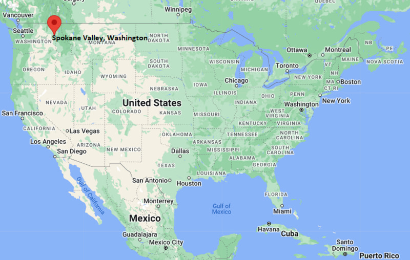
Spokane Valley Map, Washington, USA
Where is Spokane Valley?: The Google Map showing the location of Spokane Valley in the U.S. state of Washington.
Where is Spokane Valley Located?
Spokane Valley is a city located in the Spokane County of Washington, United States. Spokane Valley lies between 40.0443989 Degrees North latitudes and 111.7321518 Degrees West longitudes. According to 2020 U.S.census, the population of Spokane Valley city is 102976 people and the city has a total area of 37.72 sq mi. The city has numerous parks and recreational facilities.
Most Viewed US Maps
| USA Sttae Map | USA Region Map | USA Road Map |
| USA County Map | Where is USA in World Map? | US ZIP Code Map |
| USA Time Zones Map | US State and Capitals Map | USA Physical Map |
Find 4,400+ U.S. Cities by State - Explore Their Locations and Get Detailed Information
Spokane Valley, Washington Quick Facts
| Attribute | Details |
|---|---|
| City | Spokane Valley |
| County | Spokane County |
| State | Washington |
| State Capital | Olympia |
| US Region | Western United States |
| Latitude | 47.6732° N |
| Longitude | 117.2394° W |
| Elevation | 1,928 ft (588 m) |
| Land Area (sq mi) | 38.06 |
| Water Area (sq mi) | 0.00 |
| Total Area (sq mi) | 38.06 |
| Population (2020 Census) | 102,976 |
| Population Density (per sq mi) | 2,705.5 |
| ZIP Codes | 99016, 99027, 99206, 99212, 99216 |
| Area Code | 509 |
| Time Zone Standard | Pacific Standard Time (PST), UTC−8 |
| Time Zone Daylight | Pacific Daylight Time (PDT), UTC−7 |
| Currency | United States Dollar (USD) |
| FIPS Code | 5367167 |
| Congressional District | 5th Congressional District |
Transportation and Connectivity in Spokane Valley
| Transportation Feature | Details |
|---|---|
| Airport Name | Spokane International Airport provides commercial air service. |
| IATA Code | GEG |
| Port | No direct port access; inland transportation hub in eastern Washington. |
| Major Highways | Interstate 90, U.S. Highway 395, and Washington State Route 27 |
| Train/Amtrak Service | Amtrak Empire Builder service is available from Spokane Station. |
| Local Bus/Transit Service | Spokane Transit Authority provides regional bus service. |
- Spokane Valley is located in eastern Spokane County, Washington.
- The city is located east of Spokane along the Spokane River valley.
- Interstate 90 provides major east-west transportation access through the city.
- Spokane Valley is a regional center for business, retail, healthcare, and outdoor recreation in eastern Washington.
Top Places to Visit in Spokane Valley, Washington
| Landmark Name | Type |
|---|---|
| Mirabeau Meadows Park | Community Park |
| Centennial Trail | Walking and Cycling Trail |
| Spokane Valley Heritage Museum | History Museum |
| Discovery Playground | Family Recreation Area |
| Plantes Ferry Sports Complex | Sports Facility |
| Liberty Lake Regional Park | Regional Park |
| Saltese Flats Wetlands Conservation Area | Nature Preserve |
| Dishman Hills Natural Area | Natural Recreation Area |
| Manito Park | Urban Park |
| Riverfront Park | City Park |
Driving Distances from Spokane Valley, Washington to Nearby Cities
| City | State | Distance (mi) | Approx. Drive Time |
|---|---|---|---|
| Spokane | Washington | 10 | 15 min |
| Liberty Lake | Washington | 10 | 15 min |
| Cheney | Washington | 30 | 35 min |
| Coeur d'Alene | Idaho | 35 | 40 min |
| Pullman | Washington | 75 | 1 hr 30 min |
| Lewiston | Idaho | 120 | 2 hr |
| Wenatchee | Washington | 150 | 3 hr |
| Seattle | Washington | 280 | 4 hr 30 min |
| Boise | Idaho | 430 | 6 hr 30 min |
| Portland | Oregon | 350 | 5 hr 30 min |
Colleges and Universities near Spokane Valley, Washington
| Institution Name | Type | Level | Notable For |
|---|---|---|---|
| Eastern Washington University | Public | University | Business, education, health sciences, and liberal arts programs |
| Gonzaga University | Private | University | Law, business, engineering, education, and academic programs |
| Washington State University Spokane | Public | University | Health sciences, medicine, and research programs |
| Community Colleges of Spokane | Public | Community College | Technical education, workforce training, and transfer programs |
Waterbodies in Spokane Valley, Washington
Spokane River, Shelley Lake, Liberty Lake, Newman Lake, and nearby Spokane Valley waterways
Golf Courses near Spokane Valley, Washington
MeadowWood Golf Course, Liberty Lake Golf Course, Esmeralda Golf Course, and nearby Spokane-area golf facilities
Key Landmarks and Places to Visit in Spokane Valley, Washington
| Landmark Name | Type |
|---|---|
| Spokane Valley Heritage Museum | History Museum |
| Mirabeau Meadows Park | Community Park |
| Centennial Trail | Walking and Cycling Trail |
| Dishman Hills Natural Area | Nature Preserve |
| Saltese Flats Wetlands Conservation Area | Wildlife and Nature Area |
| Plantes Ferry Sports Complex | Sports Facility |
| Liberty Lake Regional Park | Regional Park |
| Riverfront Park | Urban Park |
| Manito Park | Botanical and Urban Park |
| Mount Spokane State Park | State Park |
Waterbodies in Spokane Valley, Washington
Spokane River, Shelley Lake, Liberty Lake, Newman Lake, and nearby Spokane Valley waterways
Golf Courses near Spokane Valley, Washington
MeadowWood Golf Course, Liberty Lake Golf Course, Esmeralda Golf Course, and nearby Spokane-area golf facilities
Spokane Valley, Washington — Key Historical Facts
- Spokane Valley developed along the Spokane River corridor with early settlement based on agriculture, timber, and transportation.
- The area was historically part of the Spokane tribal region before European-American settlement.
- Railroads and irrigation projects helped support agricultural growth in the Spokane Valley during the late 19th and early 20th centuries.
- Residential and commercial development expanded rapidly during the 20th century as the Spokane metropolitan area grew.
- Spokane Valley was officially incorporated as a city in 2003 and became one of the largest cities in eastern Washington.
References
- City of Spokane Valley Official Website
- Spokane County Government
- U.S. Census Bureau
- Washington State Parks
- Visit Spokane Tourism
- Eastern Washington University
Washington Maps and Info
- Where is Auburn
- Where is Bellevue
- Where is Bellingham
- Where is Bothell
- Where is Bremerton
- Where is Burien
- Where is Camas
- Where is Edmonds
- Where is Everett
- Where is Federal Way
- Where is Frederickson
- Where is Graham
- Where is Issaquah
- Where is Kennewick
- Where is Kent
- Where is Kirkland
- Where is Lacey
- Where is Lake Stevens
- Where is Lakewood
- Where is Longview
- Where is Lynnwood
- Where is Maple Valley
- Where is Marysville
- Where is Mill Creek East
- Where is Mount Vernon
- Where is Olympia
- Where is Orchards
- Where is Parkland
- Where is Pasco
- Where is Pullman
- Where is Puyallup
- Where is Redmond
- Where is Renton
- Where is Richland
- Where is Sammamish
- Where is SeaTac
- Where is Shoreline
- Where is South Hill
- Where is Spanaway
- Where is Spokane Valley
- Where is Tacoma
- Where is Tumwater
- Where is University Place
- Where is Vancouver
- Where is Walla Walla
- Where is Wenatchee
- Where is Yakima