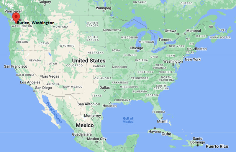
Where is Burien Located? - Burien is a city located in the King County of Washington, United States. Burien lies between 47.47038 Degrees North latitudes and -122.347 Degrees West longitudes.
Location Map of Burien, Washington
Burien Map, Washington, USA
Where is Burien?: The Google Map showing the location of Burien in the U.S. state of Washington.
Where is Burien Located?
Burien is a city located in the King County of Washington, United States. Burien lies between 47.47038 Degrees North latitude and -122.347 Degrees West longitude. According to the 2020 U.S. Census, the population of Burien city is 52,066 people and the city has a total area of 11.19 sq mi. The city has numerous parks and recreational facilities.
Transportation and Connectivity in Burien, Washington
Transportation
Details
Airport Name
Seattle-Tacoma International Airport
IATA Code
SEA
Port
Port of Seattle (nearby)
Major Highways
State Route 509, State Route 518, Interstate 5 (nearby), Interstate 405 (nearby)
Train/Amtrak Service
Nearest Amtrak station at Seattle King Street Station
Local Bus/Transit Service
King County Metro Transit and nearby Link Light Rail connections
State Route 509 - Main north-south highway connecting Burien with Seattle, SeaTac and Tacoma.
State Route 518 - Provides direct access between Burien, Interstate 5 and Seattle-Tacoma International Airport.
Interstate 5 - Located just east of the city, connecting Burien with Seattle, Tacoma and the Pacific Northwest.
Interstate 405 - Nearby freeway offering convenient access to Bellevue, Renton and the Eastside suburbs.
Seattle-Tacoma International Airport - Located minutes from downtown Burien, providing domestic and international air service.
Key Landmarks and Places to Visit in Burien, Washington
Landmark Name
Type
Seahurst Park
Waterfront Park
Olde Burien
Historic District
Highline SeaTac Botanical Garden
Botanical Garden
Salmon Creek Ravine Park
Nature Park
Dottie Harper Park
Community Park
Burien Town Square Park
City Park
Lake Burien School Memorial Park
Memorial Park
North SeaTac Park
Regional Park
Angle Lake Park
Lakeside Park
Museum of Flight
Museum
Colleges and Universities in Burien, Washington
Institution Name
Type
Level
Notable For
Highline College
Public
Community College
Transfer and workforce programs
South Seattle College
Public
Community College
Career and technical education
Seattle University
Private
University
Jesuit higher education
University of Washington - Seattle
Public
University
Research and professional programs
Highline Public Schools
Public
K-12 District
Public education services
Waterbodies in Burien, Washington
Puget Sound, Miller Creek, Salmon Creek, Lake Burien, Angle Lake, Des Moines Creek, Duwamish River, Elliott Bay
Golf Courses in Burien, Washington
Rainier Golf and Country Club, Foster Golf Links, Jefferson Park Golf Course, West Seattle Golf Course, Riverbend Golf Complex, Glen Acres Golf and Country Club, Maplewood Golf Course, Bellevue Golf Course
Burien, Washington - Key Historical Facts
Burien developed in the late nineteenth century as a farming and logging community along the eastern shore of Puget Sound.
The arrival of rail transportation helped connect the area with Seattle and encouraged residential and commercial growth.
After World War II, Burien expanded rapidly as suburban neighborhoods developed near Seattle-Tacoma International Airport.
The city officially incorporated in 1993, becoming one of King County's newest municipalities.
Olde Burien remains the heart of the community, featuring local businesses, public events, and historic character.
Today, Burien is known for its waterfront parks, diverse population, thriving arts scene, and convenient location between Seattle and Tacoma.