
Ridgefield is a growing city in southwestern Washington, located in Clark County along the Lewis River and near the Columbia River. It sits about 25 miles north of Portland, Oregon, and 20 miles north of Vancouver. The city is known for Ridgefield National Wildlife Refuge, its historic downtown, agricultural landscape, and easy access to the Columbia River Gorge.
Location Map of Ridgefield, Clark County, Washington
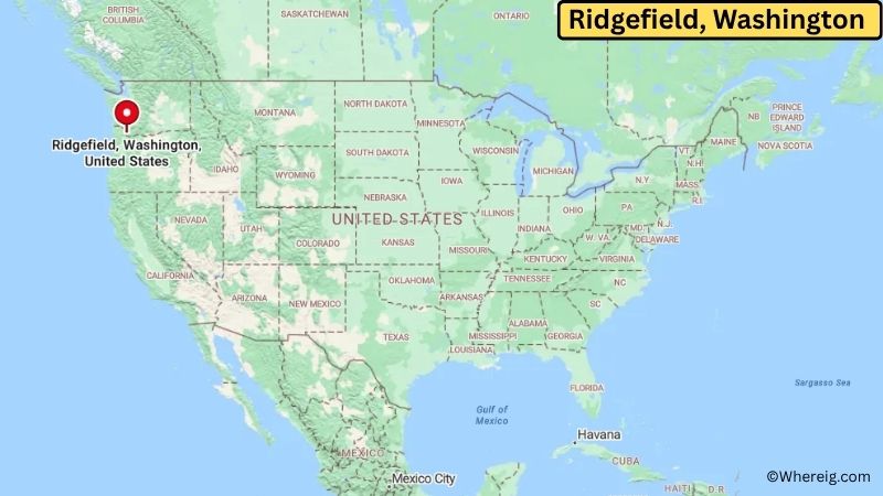
About Map: The map shows the location of Ridgefield in Clark County, in the U.S. state of Washington.
Ridgefield Map, Washington
About Ridgefield Map: The Google Map highlights the location of Ridgefield in Clark County, Washington. Use the zoom, satellite, and street-view options to explore the city's neighborhoods, roads, and nearby places.
Where is Ridgefield Located?
Ridgefield is a city located in Clark County, Washington, the United States. It lies in southwestern Washington near the confluence of the Lewis and Columbia rivers, about 25 miles north of Portland, Oregon, and roughly 20 miles north of Vancouver, Washington. Battle Ground is around 15 miles northeast, while Woodland is about 15 miles north. Ridgefield is positioned near 45.816° North latitude and 122.743° West longitude. The 2020 Census recorded 10,319 residents. The city covers about 8.72 square miles, or 22.58 square kilometers. Ridgefield was incorporated in 1909 and developed from an agricultural and river community into a growing suburb within the Portland-Vancouver metropolitan area. The surrounding lowlands contain farms, wetlands, forests, and river habitats. Ridgefield National Wildlife Refuge is the city's best-known natural attraction and protects thousands of acres of wetlands and grasslands that provide habitat for migratory birds and other wildlife. The refuge is especially known for its seasonal populations of waterfowl and opportunities for wildlife viewing. A unique feature of Ridgefield is its location near both the Columbia River and the Lewis River, giving the community access to a varied river and wetland landscape. The city's historic downtown contains older buildings, local businesses, and community landmarks. Interstate 5 provides a major transportation route to Vancouver, Portland, and other communities in southwestern Washington and northern Oregon.
Most Viewed US Maps
| USA Sttae Map | USA Region Map | USA Road Map |
| USA County Map | Where is USA in World Map? | US ZIP Code Map |
| USA Time Zones Map | US State and Capitals Map | USA Physical Map |
Find 4,400+ U.S. Cities by State - Explore Their Locations and Get Detailed Information
Ridgefield City Facts
| City | Ridgefield |
| State | Washington |
| County | Clark County |
| Country | United States |
| Region | Southwestern Washington and Portland-Vancouver Metropolitan Area |
| Incorporated | 1909 |
| Founded | 1890s |
| Total Area | 8.72 sq mi (22.58 sq km) |
| Land Area | 8.59 sq mi (22.25 sq km) |
| Water Area | 0.13 sq mi (0.34 sq km) |
| Elevation | 30 ft (9 m) |
| Population (2023 estimate) | About 15,000 |
| Population (2020 Census) | 10,319 |
| Population Density | 1,201 people per sq mi |
| Time Zone | Pacific Time (PST/PDT) |
| ZIP Codes | 98642 |
| Area Code | 360 and 564 |
| Major Highways | I-5, WA-501, and WA-503 nearby |
| Public Transit | C-TRAN |
| Major Attractions | Ridgefield National Wildlife Refuge, ilani, Ridgefield Pioneer Church, and historic downtown Ridgefield |
| Official Website | https://ridgefieldwa.us/ |
Distance from Ridgefield, WA to Nearby Cities
- La Center, WA – 8 miles (13 km)
- Battle Ground, WA – 15 miles (24 km)
- Woodland, WA – 15 miles (24 km)
- Vancouver, WA – 20 miles (32 km)
- Washougal, WA – 30 miles (48 km)
- Longview, WA – 45 miles (72 km)
- Kelso, WA – 45 miles (72 km)
- Portland, OR – 25 miles (40 km)
- Hillsboro, OR – 40 miles (64 km)
- Beaverton, OR – 35 miles (56 km)
- Gresham, OR – 40 miles (64 km)
- Oregon City, OR – 45 miles (72 km)
- Salem, OR – 80 miles (129 km)
- Olympia, WA – 100 miles (161 km)
- Tacoma, WA – 135 miles (217 km)
- Seattle, WA – 160 miles (257 km)
- Astoria, OR – 70 miles (113 km)
- The Dalles, OR – 100 miles (161 km)
Top Attractions in Ridgefield
- Ridgefield National Wildlife Refuge – A large protected wetland and grassland area along the Columbia River offering wildlife viewing, birdwatching, photography, and scenic drives.
- Ridgefield National Wildlife Refuge Auto Tour Route – A seasonal driving route through refuge habitats with opportunities to see waterfowl, shorebirds, deer, and other wildlife.
- ilani – A large entertainment and resort complex near Ridgefield featuring restaurants, events, and other visitor facilities.
- Ridgefield Pioneer Church – A historic local church building that reflects the city's early community history.
- Historic Downtown Ridgefield – The downtown area contains local shops, restaurants, community buildings, and historic sites.
- Ridgefield Kayak Launch – A local access point for exploring nearby waterways and wetlands by paddlecraft.
- Vancouver Lake Regional Park – A nearby regional park with a lake, walking trails, picnic areas, boating, and wildlife habitat.
- Lewis River – The river near Ridgefield provides opportunities for fishing, boating, wildlife viewing, and scenic recreation.
- Fort Vancouver National Historic Site – A major regional historic attraction in nearby Vancouver preserving the remains of an important 19th-century trading post and military site.
Airports Near Ridgefield, WA
- Portland International Airport (PDX) – 30 miles
- Pearson Field Airport (VUO) – 20 miles
- Southwest Washington Regional Airport (KLS) – 45 miles
- Scappoose Industrial Airpark (SPB) – 30 miles
- Salem-Willamette Valley Airport (SLE) – 80 miles
Sources:
Population and area data sourced from the United States Census Bureau (2020 Census). General city information referenced from the official Ridgefield city website and local government records.
Washington Maps and Info
- Where is Auburn
- Where is Bellevue
- Where is Bellingham
- Where is Bothell
- Where is Bremerton
- Where is Burien
- Where is Camas
- Where is Edmonds
- Where is Everett
- Where is Federal Way
- Where is Frederickson
- Where is Graham
- Where is Issaquah
- Where is Kennewick
- Where is Kent
- Where is Kirkland
- Where is Lacey
- Where is Lake Stevens
- Where is Lakewood
- Where is Longview
- Where is Lynnwood
- Where is Maple Valley
- Where is Marysville
- Where is Mill Creek East
- Where is Mount Vernon
- Where is Olympia
- Where is Orchards
- Where is Parkland
- Where is Pasco
- Where is Pullman
- Where is Puyallup
- Where is Redmond
- Where is Renton
- Where is Richland
- Where is Sammamish
- Where is SeaTac
- Where is Shoreline
- Where is South Hill
- Where is Spanaway
- Where is Spokane Valley
- Where is Tacoma
- Where is Tumwater
- Where is University Place
- Where is Vancouver
- Where is Walla Walla
- Where is Wenatchee
- Where is Yakima