
District Heights is a city in Prince George's County in suburban Maryland, just southeast of Washington, D.C. The community is part of the Washington metropolitan area and lies near Suitland, Capitol Heights, and Forestville. Its location provides access to the nation's capital while retaining a residential city setting. District Heights was incorporated in 1936 and became a city in 1962.
Location Map of District Heights, Prince George's County, Maryland
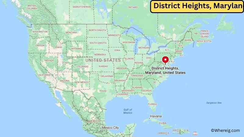
About Map: The map shows the location of District Heights in Prince George's County, in the U.S. state of Maryland.
District Heights Map, Maryland
About District Heights Map: The Google Map highlights the location of District Heights in Prince George's County, Maryland. Use the zoom, satellite, and street-view options to explore the city's neighborhoods, roads, and nearby places.
Where is District Heights Located?
District Heights is a city located in Prince George's County, Maryland, the United States. It is in the Washington metropolitan area, about 10 miles southeast of downtown Washington, D.C., and close to Suitland, Capitol Heights, and Forestville. The city lies at approximately 38.86° North latitude and 76.89° West longitude. The 2020 Census recorded 5,959 residents. District Heights covers about 0.87 square miles (2.25 square kilometers), all of which is land. The city sits on elevated ground in the suburban area east of Washington, D.C. Nearby attractions include the Smithsonian museums and National Mall in Washington, D.C., as well as Watkins Regional Park in Prince George's County. District Heights was incorporated in 1936 and was named for its elevated location near the District of Columbia. Residential development expanded in the community during the 1940s and 1950s as the Washington metropolitan area grew.
Most Viewed US Maps
| USA Sttae Map | USA Region Map | USA Road Map |
| USA County Map | Where is USA in World Map? | US ZIP Code Map |
| USA Time Zones Map | US State and Capitals Map | USA Physical Map |
Find 4,400+ U.S. Cities by State - Explore Their Locations and Get Detailed Information
District Heights City Facts
| City | District Heights |
| State | Maryland |
| County | Prince George's County |
| Country | United States |
| Region | Washington Metropolitan Area |
| Incorporated | 1936 |
| Founded | 1930s |
| Total Area | 0.87 sq mi (2.25 sq km) |
| Land Area | 0.87 sq mi (2.25 sq km) |
| Water Area | 0.00 sq mi |
| Elevation | About 280 ft (85 m) |
| Population (2023 estimate) | Approximately 5,940 |
| Population (2020 Census) | 5,959 |
| Population Density | 6,889 people per sq mi |
| Time Zone | Eastern Time Zone (EST/EDT) |
| ZIP Codes | 20747 |
| Area Code | 301, 240 |
| Major Highways | Maryland Route 4, Pennsylvania Avenue, Suitland Parkway, Capital Beltway (I-495) |
| Public Transit | Washington Metropolitan Area Transit Authority (Metrobus and Metrorail) |
| Major Attractions | National Mall, Smithsonian museums, Watkins Regional Park, Suitland Parkway |
| Official Website | https://districtheights.org/ |
Distance from District Heights, MD to Nearby Cities
- Capitol Heights, MD – 3 miles (5 km)
- Suitland, MD – 4 miles (6 km)
- Forestville, MD – 4 miles (6 km)
- Morningside, MD – 5 miles (8 km)
- Temple Hills, MD – 6 miles (10 km)
- Camp Springs, MD – 6 miles (10 km)
- Andrews, MD – 7 miles (11 km)
- Hyattsville, MD – 8 miles (13 km)
- Washington, DC – 10 miles (16 km)
- Upper Marlboro, MD – 12 miles (19 km)
- Alexandria, VA – 15 miles (24 km)
- College Park, MD – 14 miles (23 km)
- Greenbelt, MD – 16 miles (26 km)
- Bowie, MD – 18 miles (29 km)
- Silver Spring, MD – 17 miles (27 km)
- Arlington, VA – 18 miles (29 km)
- Rockville, MD – 25 miles (40 km)
- Annapolis, MD – 32 miles (51 km)
Top Attractions in District Heights
- Watkins Regional Park – A large Prince George's County park with trails, playgrounds, gardens, and recreational facilities.
- National Mall – Washington, D.C.'s central park area featuring major monuments, memorials, and museums.
- Smithsonian National Museum of African American History and Culture – A Smithsonian museum documenting African American history and culture.
- United States Capitol – The historic seat of the U.S. Congress, located in Washington, D.C.
- National Museum of Natural History – A Smithsonian museum with exhibits covering natural history, wildlife, geology, and science.
- National Air and Space Museum – A major Smithsonian museum featuring historic aircraft, spacecraft, and aviation exhibits.
- Suitland Parkway – A historic parkway connecting southeastern Washington, D.C., with Prince George's County.
- Oxon Hill Manor – A historic estate and park overlooking the Potomac River in nearby Oxon Hill.
Airports Near District Heights
- Ronald Reagan Washington National Airport (DCA) – 13 miles
- College Park Airport (CGS) – 15 miles
- Andrews Regional Airport (ADW) – 8 miles
- Baltimore/Washington International Thurgood Marshall Airport (BWI) – 33 miles
Sources:
Population and area data sourced from the United States Census Bureau (2020 Census). General city information referenced from the official City of District Heights website and local government records.
Maryland Related Maps and Info
- Where is Annapolis
- Where is Aspen Hill
- Where is Bel Air North
- Where is Bel Air South
- Where is Baltimore
- Where is Bethesda
- Where is Bowie
- Where is Carney
- Where is Catonsville
- Where is Chillum
- Where is Clarksburg
- Where is Clinton
- Where is College Park
- Where is Columbia
- Where is Crofton
- Where is Dundalk
- Where is Eldersburg
- Where is Elkridge
- Where is Ellicott City
- Where is Essex
- Where is Frederick
- Where is Gaithersburg
- Where is Germantown
- Where is Glen Burnie
- Where is Hagerstown
- Where is Laurel
- Where is Middle River
- Where is Milford Mill
- Where is Montgomery Village
- Where is North Bethesda
- Where is North Laurel
- Where is Odenton
- Where is Olney
- Where is Owings Mills
- Where is Parkville
- Where is Pasadena
- Where is Perry Hall
- Where is Pikesville
- Where is Potomac
- Where is Randallstown
- Where is Rockville
- Where is Salisbury
- Where is Severn
- Where is Severna Park
- Where is Silver Spring
- Where is South Laurel
- Where is Towson
- Where is Waldorf
- Where is Wheaton
- Where is Woodlawn