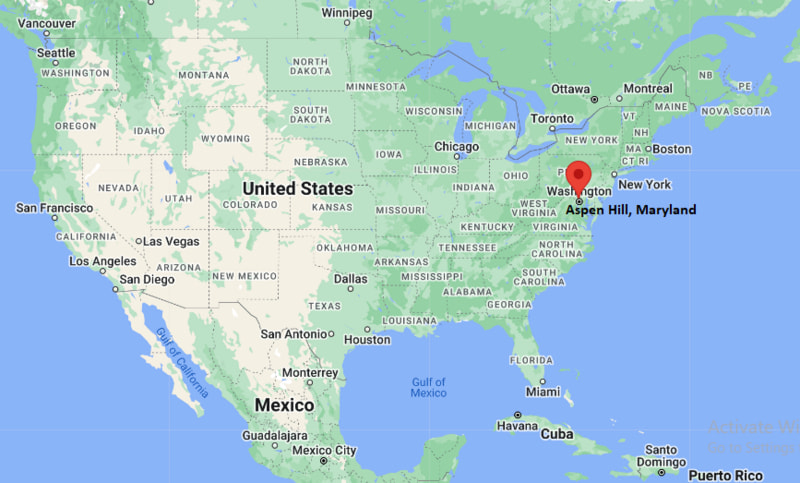
Where is Aspen Hill Located? - Aspen Hill is a city located in the Montgomery County of Maryland, United States. Aspen Hill lies between 39.07955 Degrees North latitudes and -77.073 Degrees West longitudes.
Location Map of Aspen Hill, Maryland
Aspen Hill Map, Maryland, USA
Where is Aspen Hill?: The Google Map showing the location of Aspen Hill in the U.S. state of Maryland.
Where is Aspen Hill Located?
Aspen Hill is a city located in the Montgomery County of Maryland, United States. Aspen Hill lies at approximately 39.07955 Degrees North latitude and -77.073 Degrees West longitude. According to the 2020 U.S. Census, the population of Aspen Hill CDP is 51,063 people and the community has a total area of 9.68 sq mi. The community has numerous parks and recreational facilities.
Aspen Hill is a large suburban community in Montgomery County, north of Washington, DC.
The area is primarily residential and offers convenient access to major employment centers in the Washington metropolitan region.
Healthcare, education, government services and retail are major employment sectors.
The community is served by nearby Glenmont and Wheaton Metro stations.
Aspen Hill is known for its diverse population and well-established neighborhoods.
Key Landmarks and Places to Visit in Aspen Hill, Maryland
Landmark Name
Type
Brookside Gardens
Botanical Garden
Wheaton Regional Park
Regional Park
Matthew Henson State Park
State Park
Aspen Hill Local Park
Community Park
Glenmont Shopping Area
Commercial District
Brookside Nature Center
Nature Center
Rock Creek Regional Park
Recreation Area
Downtown Silver Spring
Entertainment District
Strathmore
Arts Center
National Capital Trolley Museum
Museum
Colleges and Universities Near Aspen Hill, Maryland
Institution Name
Type
Distance
Notable For
Montgomery College - Rockville Campus
Community College
8 mi
Transfer and workforce programs
University of Maryland
Public University
12 mi
Research and higher education
Strayer University
Private University
8 mi
Business and professional studies
American University
Private University
12 mi
International affairs and law
Georgetown University
Private University
15 mi
Research and public policy
Waterbodies in and Near Aspen Hill, Maryland
Rock Creek, Northwest Branch Anacostia River, Sligo Creek, Lake Frank, Lake Needwood, Triadelphia Reservoir, Little Seneca Lake, Rocky Gorge Reservoir, Pine Lake, Wheaton Branch
Golf Courses in and Near Aspen Hill, Maryland
Needwood Golf Course, Northwest Golf Course, Manor Country Club, Hampshire Greens Golf Course, Argyle Country Club, Falls Road Golf Course, Laytonsville Golf Course, Blue Mash Golf Course
Aspen Hill, Maryland - Key Historical Facts
Aspen Hill developed primarily during the mid-twentieth century as Washington's suburbs expanded northward.
The community grew rapidly after World War II due to housing development and improved transportation links.
Montgomery County's population boom helped transform Aspen Hill from a rural area into a major suburban community.
The opening of regional highways and Metro connections strengthened ties with Washington, DC.
The area became known for its diverse residential neighborhoods and strong public school system.
Today, Aspen Hill is one of the largest census-designated communities in Montgomery County. :contentReference[oaicite:0]{index=0}