
Where is Dundalk Located? - Dundalk is a city located in the Baltimore County of Maryland, United States. Dundalk lies between 44.8619645 Degrees North latitudes and 93.5323103 Degrees West longitudes.
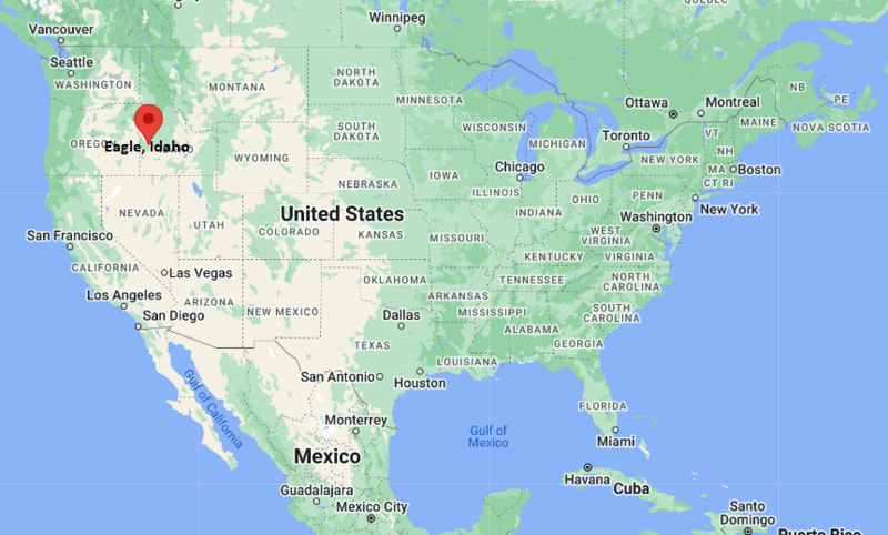
Location Map of Eagle, Idaho
Dundalk Map, Maryland, USA
Where is Dundalk?: The Google Map showing the location of Dundalk in the U.S. state of Maryland.
Where is Dundalk Located?
Dundalk is a city located in the Baltimore County of Maryland, United States. Dundalk lies between 44.8619645 Degrees North latitudes and 93.5323103 Degrees West longitudes. According to 2020 U.S.census, the population of Dundalk city is 67796 people and the city has a total area of 13.07 sq mi. The city has numerous parks and recreational facilities.
Most Viewed US Maps
| USA Sttae Map | USA Region Map | USA Road Map |
| USA County Map | Where is USA in World Map? | US ZIP Code Map |
| USA Time Zones Map | US State and Capitals Map | USA Physical Map |
Find 4,400+ U.S. Cities by State - Explore Their Locations and Get Detailed Information
Dundalk, Maryland Quick Facts
| Property | Details |
|---|---|
| Community | Dundalk (Census-Designated Place) |
| County | Baltimore County |
| State | Maryland |
| State Capital | Annapolis |
| US Region | Southern United States (Mid-Atlantic) |
| Latitude | 39.2507°N |
| Longitude | 76.5205°W |
| Elevation | 23 ft (7 m) |
| Land Area | 16.52 sq mi |
| Water Area | 1.38 sq mi |
| Total Area | 17.90 sq mi |
| Population (2020 Census) | 71,996 |
| Population Density | About 4,358 per sq mi |
| ZIP Codes | 21222 |
| Area Codes | 410, 443, 667 |
| Time Zone Standard | Eastern Standard Time (EST), UTC -5 |
| Time Zone Daylight | Eastern Daylight Time (EDT), UTC -4 |
| Currency | United States Dollar (USD) |
| FIPS Code | 24-24475 |
| Congressional District | Maryland's 2nd Congressional District |
Nearby Cities to Dundalk, Maryland
- Baltimore, Maryland - Northwest - 7 mi
- Essex, Maryland - East - 5 mi
- Middle River, Maryland - Northeast - 9 mi
- Rosedale, Maryland - North - 5 mi
- Parkville, Maryland - North - 10 mi
- Towson, Maryland - North - 13 mi
- Glen Burnie, Maryland - South - 13 mi
- Catonsville, Maryland - West - 14 mi
- Annapolis, Maryland - South - 28 mi
- Bel Air, Maryland - Northeast - 27 mi
Dundalk, Maryland Climate and Weather Overview
| Month | Avg High (°F) | Avg Low (°F) | Avg Rainfall (in) |
|---|---|---|---|
| January | 43 | 28 | 3.2 |
| April | 66 | 45 | 3.3 |
| July | 88 | 71 | 3.8 |
| October | 68 | 49 | 3.3 |
| Annual | 66 | 48 | 42.3 |
| Climate Attribute | Details |
|---|---|
| Climate Classification (Köppen) | Humid Subtropical (Cfa) |
| Annual Rainfall | About 42.3 inches |
| Annual Sunshine Days | Approximately 213 days |
| Hurricane/Tornado Risk | Low hurricane risk; low tornado risk |
| Snowfall | About 20 inches annually |
Driving Distances from Dundalk, Maryland
| City | State | Distance (mi) | Approx. Drive Time |
|---|---|---|---|
| Essex | Maryland | 5 | 10 min |
| Rosedale | Maryland | 5 | 10 min |
| Baltimore | Maryland | 7 | 15 min |
| Middle River | Maryland | 9 | 15 min |
| Parkville | Maryland | 10 | 18 min |
| Towson | Maryland | 13 | 22 min |
| Glen Burnie | Maryland | 13 | 22 min |
| Catonsville | Maryland | 14 | 25 min |
| Bel Air | Maryland | 27 | 35 min |
| Annapolis | Maryland | 28 | 35 min |
Transportation and Connectivity in Dundalk, Maryland
| Transportation | Details |
|---|---|
| Airport Name | Baltimore/Washington International Thurgood Marshall Airport |
| IATA Code | BWI |
| Port | Port of Baltimore |
| Major Highways | Interstate 95, Interstate 695 (Baltimore Beltway), Maryland Route 151, Maryland Route 157 |
| Train/Passenger Rail | MARC and Amtrak service available at Baltimore Penn Station |
| Local Bus/Transit Service | Maryland Transit Administration (MTA) Bus |
- Interstate 95 and Interstate 695 provide convenient access to Baltimore, Washington, D.C., Philadelphia, and surrounding communities.
- Maryland Transit Administration (MTA) operates bus routes connecting Dundalk with downtown Baltimore and nearby neighborhoods.
- The Port of Baltimore is one of the busiest seaports on the U.S. East Coast and plays a major role in the local economy.
- Baltimore/Washington International Thurgood Marshall Airport is about 15 miles southwest and offers extensive domestic and international flights.
Key Landmarks and Places to Visit in Dundalk, Maryland
| Landmark Name | Type |
|---|---|
| North Point State Park | State Park |
| Battle Acre Park | Historic Park |
| Fort Howard Park | Historic Waterfront Park |
| Dundalk Heritage Park | Community Park |
| Soller's Point Multi-Use Trail | Recreational Trail |
| Tradepoint Atlantic | Industrial & Logistics Center |
| Canton Waterfront Park | Waterfront Park |
| National Aquarium | Aquarium |
| Fort McHenry National Monument and Historic Shrine | National Historic Site |
| Inner Harbor | Waterfront District |
Colleges and Universities in Dundalk, Maryland
| Institution | Type | Level | Notable For |
|---|---|---|---|
| Community College of Baltimore County - Dundalk Campus | Public | Community College | Associate degrees, workforce training, and transfer programs |
| Morgan State University | Public | University | Engineering, business, education, and research |
| Towson University | Public | University | Business, education, healthcare, and liberal arts |
| University of Maryland, Baltimore | Public | University | Medicine, law, pharmacy, and health sciences |
| Johns Hopkins University | Private | University | Medicine, engineering, research, and public health |
Waterbodies in Dundalk, Maryland
Patapsco River, Bear Creek, Back River, Chesapeake Bay, Bread and Cheese Creek, Lynch Cove, Jones Creek, Colgate Creek.
Golf Courses in Dundalk, Maryland
Mount Pleasant Golf Course, Rocky Point Golf Course, Clifton Park Golf Course, Greystone Golf Course, Pine Ridge Golf Course, Eagle's Nest Country Club.
Dundalk, Maryland - Key Historical Facts
- Dundalk was established in 1916 as a planned industrial community developed by the Bethlehem Steel Corporation to house workers employed at the nearby Sparrows Point steel mill.
- The community was named after the town of Dundalk in Ireland and grew rapidly alongside Baltimore's expanding steel and shipbuilding industries.
- During the 20th century, the Sparrows Point facility became one of the largest steel-producing plants in the United States, shaping the area's economy and population growth.
- Dundalk also played an important role in shipbuilding, manufacturing, and wartime production during both World Wars.
- Following the decline of heavy industry, redevelopment projects such as Tradepoint Atlantic have transformed the former Sparrows Point site into a major logistics and distribution hub.
- Today, Dundalk is known for its waterfront location, maritime heritage, strong community identity, proximity to Baltimore, and continuing role in regional commerce and transportation.
References
- Baltimore County Government
- U.S. Census Bureau
- Maryland Department of Natural Resources
- Tradepoint Atlantic
Maryland Related Maps and Info
- Where is Annapolis
- Where is Aspen Hill
- Where is Bel Air North
- Where is Bel Air South
- Where is Baltimore
- Where is Bethesda
- Where is Bowie
- Where is Carney
- Where is Catonsville
- Where is Chillum
- Where is Clarksburg
- Where is Clinton
- Where is College Park
- Where is Columbia
- Where is Crofton
- Where is Dundalk
- Where is Eldersburg
- Where is Elkridge
- Where is Ellicott City
- Where is Essex
- Where is Frederick
- Where is Gaithersburg
- Where is Germantown
- Where is Glen Burnie
- Where is Hagerstown
- Where is Laurel
- Where is Middle River
- Where is Milford Mill
- Where is Montgomery Village
- Where is North Bethesda
- Where is North Laurel
- Where is Odenton
- Where is Olney
- Where is Owings Mills
- Where is Parkville
- Where is Pasadena
- Where is Perry Hall
- Where is Pikesville
- Where is Potomac
- Where is Randallstown
- Where is Rockville
- Where is Salisbury
- Where is Severn
- Where is Severna Park
- Where is Silver Spring
- Where is South Laurel
- Where is Towson
- Where is Waldorf
- Where is Wheaton
- Where is Woodlawn