
East Longmeadow is a town in western Massachusetts, just south of Springfield in the Pioneer Valley. Located in Hampden County near the Connecticut border, it is part of the Springfield metropolitan area. The town is about 5 miles from downtown Springfield and is known for its former sandstone quarry industry, Heritage Park, and the distinctive central Rotary.
Location Map of East Longmeadow, Hampden County, Massachusetts
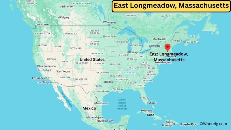
About Map: The map shows the location of East Longmeadow in Hampden County, in the U.S. state of Massachusetts.
East Longmeadow Map, Massachusetts
About East Longmeadow Map: The Google Map highlights the location of East Longmeadow in Hampden County, Massachusetts. Use the zoom, satellite, and street-view options to explore the city's neighborhoods, roads, and nearby places.
Where is East Longmeadow Located?
East Longmeadow is a town located in Hampden County, Massachusetts, the United States. It sits in the Pioneer Valley of western Massachusetts, directly south of Springfield and close to the Connecticut state line. Springfield is about 5 miles to the north, while Hartford, Connecticut, is roughly 25 miles to the south. East Longmeadow is located at approximately 42.06° North latitude and 72.50° West longitude. The 2020 Census recorded 16,430 residents. The town covers about 12.94 square miles, or 33.5 square kilometers, of land. Heritage Park is one of its best-known recreational destinations, with a pond, playground, sports fields, and picnic areas. East Longmeadow also has an unusual industrial history: more than 50 sandstone quarries once operated in the area, and local stone was used in important buildings and monuments.
Most Viewed US Maps
| USA Sttae Map | USA Region Map | USA Road Map |
| USA County Map | Where is USA in World Map? | US ZIP Code Map |
| USA Time Zones Map | US State and Capitals Map | USA Physical Map |
Find 4,400+ U.S. Cities by State - Explore Their Locations and Get Detailed Information
East Longmeadow City Facts
| Fact | Details |
|---|---|
| City | East Longmeadow |
| State | Massachusetts |
| County | Hampden County |
| Country | United States |
| Region | Pioneer Valley, Western Massachusetts |
| Incorporated | July 1, 1894 |
| Founded | 1720 |
| Total Area | 12.94 sq mi (33.52 sq km) |
| Land Area | 12.94 sq mi (33.52 sq km) |
| Water Area | Less than 0.1 sq mi |
| Elevation | About 400 feet (122 m) |
| Population (2023 estimate) | Approximately 16,500 |
| Population (2020 Census) | 16,430 |
| Population Density | 1,270.1 people per sq mi |
| Time Zone | Eastern Time Zone (EST/EDT) |
| ZIP Codes | 01028, 01116 |
| Area Code | 413 |
| Major Highways | Massachusetts Routes 83, 186 and 220; Interstate 91 nearby |
| Public Transit | Pioneer Valley Transit Authority (PVTA) |
| Major Attractions | Heritage Park, Redstone Rail Trail, East Longmeadow Rotary, historic sandstone quarry sites |
| Official Website | https://www.eastlongmeadowma.gov/ |
Distance from East Longmeadow, MA to Nearby Cities
- Springfield, MA – 5 miles (8 km)
- Longmeadow, MA – 5 miles (8 km)
- Hampden, MA – 6 miles (10 km)
- Wilbraham, MA – 7 miles (11 km)
- Enfield, CT – 8 miles (13 km)
- East Windsor, CT – 11 miles (18 km)
- Agawam, MA – 11 miles (18 km)
- West Springfield, MA – 11 miles (18 km)
- Somers, CT – 12 miles (19 km)
- Chicopee, MA – 13 miles (21 km)
- South Hadley, MA – 17 miles (27 km)
- Holyoke, MA – 18 miles (29 km)
- Westfield, MA – 20 miles (32 km)
- West Hartford, CT – 22 miles (35 km)
- Hartford, CT – 25 miles (40 km)
- Amherst, MA – 27 miles (43 km)
- Northampton, MA – 29 miles (47 km)
- Windsor, CT – 30 miles (48 km)
- Manchester, CT – 31 miles (50 km)
- Worcester, MA – 64 miles (103 km)
Top Attractions in East Longmeadow
- Heritage Park – A community park with Blackman's Pond, baseball diamonds, a soccer field, playground, and picnic areas.
- Redstone Rail Trail – A local multiuse trail that follows part of the town's former railroad corridor.
- East Longmeadow Rotary – The town's central traffic circle, where seven streets meet without traditional traffic signals.
- Historic Sandstone Quarries – Remnants of the quarry industry that once shaped East Longmeadow's economy and identity.
- Elijah Burt House – A historic property reflecting the town's early residential history.
- Seward Pease House – A historic home associated with East Longmeadow's architectural heritage.
- East Longmeadow Train Depot – A reminder of the town's former railroad connections and industrial growth.
- First Congregational Church – A historic religious landmark in the community.
- Forest Park – A large nearby park in Springfield with walking trails, gardens, recreation areas, and seasonal events.
Airports Near East Longmeadow
- Westover Metropolitan Airport (CEF) – 11 miles
- Bradley International Airport (BDL) – 22 miles
- Westfield-Barnes Regional Airport (BAF) – 20 miles
- Hartford-Bradley Airport – 22 miles
- Worcester Regional Airport (ORH) – 65 miles
Sources:
Population and area data sourced from the United States Census Bureau (2020 Census). General town information referenced from the official East Longmeadow town website and local government records.
Massachusetts Related Maps and Info
- Where is Attleboro
- Where is Barnstable Town
- Where is Beverly
- Where is Braintree Town
- Where is Brockton
- Where is Brookline
- Where is Cambridge
- Where is Chelsea
- Where is Chicopee
- Where is Everett
- Where is Fall River
- Where is Fitchburg
- Where is Franklin Town
- Where is Gloucester
- Where is Haverhill
- Where is Holyoke
- Where is Lawrence
- Where is Leominster
- Where is Lowell
- Where is Lynn
- Where is Malden
- Where is Marlborough
- Where is Medford
- Where is Melrose
- Where is Methuen Town
- Where is Milton
- Where is Needham
- Where is New Bedford
- Where is Newton
- Where is Northampton
- Where is Norwood
- Where is Peabody
- Where is Pittsfield
- Where is Quincy
- Where is Revere
- Where is Saugus
- Where is Somerville
- Where is Taunton
- Where is Waltham
- Where is Watertown Town
- Where is Wellesley
- Where is Westfield
- Where is Weymouth Town
- Where is Woburn
- Where is Worcester