
Newburyport is a coastal city in northeastern Massachusetts and part of Essex County. It sits about 35 miles north of Boston near the mouth of the Merrimack River and the Atlantic Ocean. The city is known for its historic waterfront, Federal-style architecture, and nearby Plum Island. Newburyport also has deep maritime roots and remains a popular center for boating, fishing, and coastal recreation.
Location Map of Newburyport, Essex County, Massachusetts
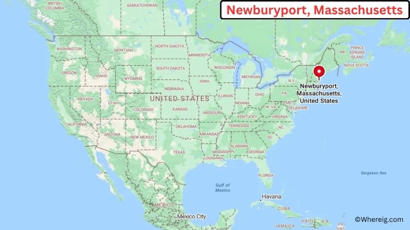
About Map: The map shows the location of Newburyport in Essex County, in the U.S. state of Massachusetts.
Newburyport Map, Massachusetts
About Newburyport Map: The Google Map highlights the location of Newburyport in Essex County, Massachusetts. Use the zoom, satellite, and street-view options to explore the city's neighborhoods, roads, and nearby places.
Where is Newburyport Located?
Newburyport is a city located in Essex County, Massachusetts, the United States. It lies on the North Shore of Massachusetts at the mouth of the Merrimack River, about 35 miles north of Boston and roughly 20 miles south of Portsmouth, New Hampshire. Amesbury is about 5 miles west, while Salisbury is around 5 miles north. Newburyport is positioned near 42.813° North latitude and 70.878° West longitude. The 2020 Census recorded 18,091 residents. The city covers about 10.40 square miles, or 26.94 square kilometers, including land and water. The Merrimack River waterfront is one of the city's most recognizable features, with parks, marinas, restaurants, and historic buildings. Plum Island, a barrier island known for beaches and wildlife habitat, lies just east of the city. Newburyport was incorporated as a city in 1851 after centuries of maritime and commercial activity. A unique fact about the city is that its historic waterfront once supported a major shipbuilding industry, with vessels built there sailing around the world. Today, the city's preserved architecture reflects its long maritime history.
Most Viewed US Maps
| USA Sttae Map | USA Region Map | USA Road Map |
| USA County Map | Where is USA in World Map? | US ZIP Code Map |
| USA Time Zones Map | US State and Capitals Map | USA Physical Map |
Find 4,400+ U.S. Cities by State - Explore Their Locations and Get Detailed Information
Newburyport City Facts
| City | Newburyport |
| State | Massachusetts |
| County | Essex County |
| Country | United States |
| Region | North Shore and Northeastern Massachusetts |
| Incorporated | 1851 |
| Founded | 1635 |
| Total Area | 10.40 sq mi (26.94 sq km) |
| Land Area | 8.10 sq mi (20.98 sq km) |
| Water Area | 2.30 sq mi (5.96 sq km) |
| Elevation | 20 ft (6 m) |
| Population (2023 estimate) | About 18,200 |
| Population (2020 Census) | 18,091 |
| Population Density | 2,233 people per sq mi |
| Time Zone | Eastern Time (EST/EDT) |
| ZIP Codes | 01950 |
| Area Code | 351 and 978 |
| Major Highways | US-1, I-95, MA-1A, MA-113, and MA-110 |
| Public Transit | Merrimack Valley Regional Transit Authority and MBTA commuter rail connections |
| Major Attractions | Newburyport Waterfront, Custom House Maritime Museum, Market Square, Waterfront Park, and Plum Island |
| Official Website | https://www.cityofnewburyport.com/ |
Distance from Newburyport, MA to Nearby Cities
- Salisbury, MA – 5 miles (8 km)
- Amesbury, MA – 5 miles (8 km)
- Newbury, MA – 5 miles (8 km)
- Rowley, MA – 10 miles (16 km)
- Georgetown, MA – 10 miles (16 km)
- Haverhill, MA – 20 miles (32 km)
- Ipswich, MA – 20 miles (32 km)
- Gloucester, MA – 30 miles (48 km)
- Portsmouth, NH – 20 miles (32 km)
- Exeter, NH – 20 miles (32 km)
- Lawrence, MA – 25 miles (40 km)
- Salem, MA – 35 miles (56 km)
- Lowell, MA – 35 miles (56 km)
- Manchester, NH – 40 miles (64 km)
- Boston, MA – 35 miles (56 km)
- Concord, NH – 55 miles (89 km)
- Worcester, MA – 75 miles (121 km)
- Providence, RI – 80 miles (129 km)
Top Attractions in Newburyport, MA
- Newburyport Waterfront – A historic waterfront along the Merrimack River with marinas, walking areas, restaurants, shops, and scenic views.
- Custom House Maritime Museum – A museum dedicated to Newburyport's maritime, shipbuilding, fishing, and customs history.
- Market Square – The historic center of downtown Newburyport, surrounded by preserved Federal-style buildings, shops, restaurants, and public spaces.
- Waterfront Park – A riverside park offering walking paths, open space, benches, and views across the Merrimack River.
- Plum Island – A nearby barrier island known for beaches, dunes, salt marshes, birdwatching, and wildlife habitat.
- Newburyport Historic District – A large historic area containing well-preserved homes, commercial buildings, churches, and streetscapes.
- Maudslay State Park – A nearby park with gardens, wooded trails, meadows, historic estate features, and views of the Merrimack Valley.
- Joppa Flats Education Center – A nearby nature center focused on birding, coastal habitats, conservation, and environmental education.
Airports Near Newburyport, MA
- Portsmouth International Airport at Pease (PSM) – 20 miles
- Boston Logan International Airport (BOS) – 45 miles
- Manchester-Boston Regional Airport (MHT) – 45 miles
- Lawrence Municipal Airport (LWM) – 25 miles
- Beverly Regional Airport (KBVY) – 30 miles
Sources:
Population and area data sourced from the United States Census Bureau (2020 Census). General city information referenced from the official Newburyport city website and local government records.
Massachusetts Related Maps and Info
- Where is Attleboro
- Where is Barnstable Town
- Where is Beverly
- Where is Braintree Town
- Where is Brockton
- Where is Brookline
- Where is Cambridge
- Where is Chelsea
- Where is Chicopee
- Where is Everett
- Where is Fall River
- Where is Fitchburg
- Where is Franklin Town
- Where is Gloucester
- Where is Haverhill
- Where is Holyoke
- Where is Lawrence
- Where is Leominster
- Where is Lowell
- Where is Lynn
- Where is Malden
- Where is Marlborough
- Where is Medford
- Where is Melrose
- Where is Methuen Town
- Where is Milton
- Where is Needham
- Where is New Bedford
- Where is Newton
- Where is Northampton
- Where is Norwood
- Where is Peabody
- Where is Pittsfield
- Where is Quincy
- Where is Revere
- Where is Saugus
- Where is Somerville
- Where is Taunton
- Where is Waltham
- Where is Watertown Town
- Where is Wellesley
- Where is Westfield
- Where is Weymouth Town
- Where is Woburn
- Where is Worcester