
North Attleborough is a town in southeastern Massachusetts, located in Bristol County near the Rhode Island border. It sits about 16 miles north of Providence and 40 miles southwest of Boston. The community is known for its historic downtown, Attleboro area jewelry industry, and access to parks and conservation land. Its location makes it part of the busy Providence metropolitan region.
Location Map of North Attleborough, Bristol County, Massachusetts
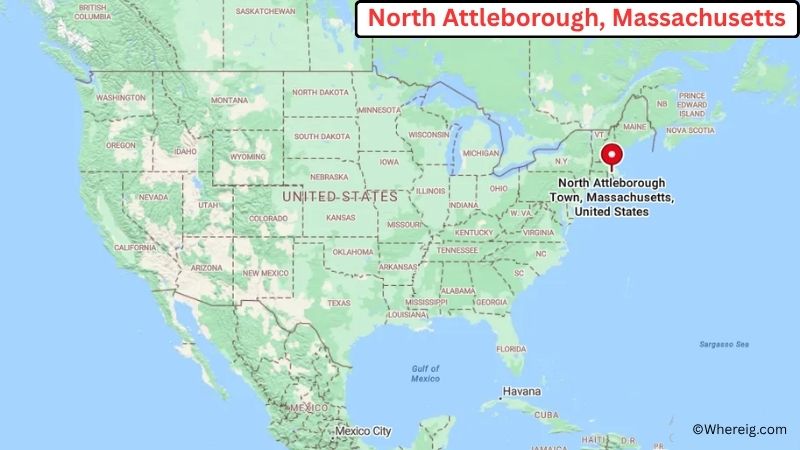
About Map: The map shows the location of North Attleborough in Bristol County, in the U.S. state of Massachusetts.
North Attleborough Map, Massachusetts
About North Attleborough Map: The Google Map highlights the location of North Attleborough in Bristol County, Massachusetts. Use the zoom, satellite, and street-view options to explore the city's neighborhoods, roads, and nearby places.
Where is North Attleborough Located?
North Attleborough is a town located in Bristol County, Massachusetts, the United States. It lies in southeastern Massachusetts along the Rhode Island border, about 16 miles north of Providence and roughly 40 miles southwest of Boston. Attleboro is about 5 miles southeast, while Plainville is around 5 miles east. North Attleborough is positioned near 41.971° North latitude and 71.335° West longitude. The 2020 Census recorded 31,572 residents. The town covers about 19.0 square miles, or 49.2 square kilometers, including land and water. Falls Pond and the Ten Mile River are among the area's notable natural features. The North Attleborough Town Common and historic downtown provide a look at the community's long development. Nearby attractions include the World War I Memorial Park and Zoo and the Attleboro Springs Wildlife Sanctuary. North Attleborough was settled in the 17th century and incorporated as a town in 1695. A unique fact about the community is its long association with jewelry and metal manufacturing, industries that helped shape the local economy during the 19th and 20th centuries.
Most Viewed US Maps
| USA Sttae Map | USA Region Map | USA Road Map |
| USA County Map | Where is USA in World Map? | US ZIP Code Map |
| USA Time Zones Map | US State and Capitals Map | USA Physical Map |
Find 4,400+ U.S. Cities by State - Explore Their Locations and Get Detailed Information
North Attleborough City Facts
| City | North Attleborough |
| State | Massachusetts |
| County | Bristol County |
| Country | United States |
| Region | Southeastern Massachusetts and Greater Providence |
| Incorporated | 1695 |
| Founded | 1660s |
| Total Area | 19.0 sq mi (49.2 sq km) |
| Land Area | 18.8 sq mi (48.7 sq km) |
| Water Area | 0.2 sq mi (0.5 sq km) |
| Elevation | 190 ft (58 m) |
| Population (2023 estimate) | About 31,500 |
| Population (2020 Census) | 31,572 |
| Population Density | 1,680 people per sq mi |
| Time Zone | Eastern Time (EST/EDT) |
| ZIP Codes | 02760 |
| Area Code | 508 and 774 |
| Major Highways | I-95, I-295, US-1, MA-120, and MA-152 |
| Public Transit | GATRA regional bus service |
| Major Attractions | World War I Memorial Park and Zoo, North Attleborough Town Common, Attleboro Springs Wildlife Sanctuary, and Falls Pond |
| Official Website | https://www.nattleboro.com/ |
Distance from North Attleborough, MA to Nearby Cities
- Attleboro, MA – 5 miles (8 km)
- Plainville, MA – 5 miles (8 km)
- Wrentham, MA – 7 miles (11 km)
- Foxborough, MA – 10 miles (16 km)
- Franklin, MA – 10 miles (16 km)
- Woonsocket, RI – 10 miles (16 km)
- Cumberland, RI – 10 miles (16 km)
- Providence, RI – 16 miles (26 km)
- Milford, MA – 20 miles (32 km)
- Taunton, MA – 20 miles (32 km)
- Stoughton, MA – 20 miles (32 km)
- Fall River, MA – 30 miles (48 km)
- New Bedford, MA – 35 miles (56 km)
- Worcester, MA – 45 miles (72 km)
- Boston, MA – 40 miles (64 km)
- Plymouth, MA – 45 miles (72 km)
- Newport, RI – 40 miles (64 km)
- New Haven, CT – 90 miles (145 km)
Top Attractions in North Attleborough, MA
- World War I Memorial Park and Zoo – A large recreation area with walking trails, picnic areas, playgrounds, a small zoo, and open green space.
- North Attleborough Town Common – A historic civic space surrounded by traditional New England buildings and local landmarks.
- Attleboro Springs Wildlife Sanctuary – A nearby natural area with wooded trails, wetlands, ponds, and wildlife habitat.
- Falls Pond – A scenic local waterbody connected to the Ten Mile River watershed and surrounded by residential and natural areas.
- Ten Mile River – A regional river that passes through North Attleborough and neighboring communities, supporting wetlands and wildlife.
- Plainridge Park Casino – A nearby entertainment complex in Plainville with gaming, dining, and live events.
- Capron Park Zoo – A nearby zoo in Attleboro featuring animals, educational programs, gardens, and family recreation.
- Slater Memorial Park – A large regional park in Pawtucket, Rhode Island, with walking areas, ponds, recreational facilities, and seasonal attractions.
Airports Near North Attleborough, MA
- T.F. Green International Airport (PVD) – 25 miles
- Norwood Memorial Airport (OWD) – 20 miles
- New Bedford Regional Airport (EWB) – 35 miles
- Boston Logan International Airport (BOS) – 45 miles
- Worcester Regional Airport (ORH) – 50 miles
Sources:
Population and area data sourced from the United States Census Bureau (2020 Census). General city information referenced from the official North Attleborough town website and local government records.
Massachusetts Related Maps and Info
- Where is Attleboro
- Where is Barnstable Town
- Where is Beverly
- Where is Braintree Town
- Where is Brockton
- Where is Brookline
- Where is Cambridge
- Where is Chelsea
- Where is Chicopee
- Where is Everett
- Where is Fall River
- Where is Fitchburg
- Where is Franklin Town
- Where is Gloucester
- Where is Haverhill
- Where is Holyoke
- Where is Lawrence
- Where is Leominster
- Where is Lowell
- Where is Lynn
- Where is Malden
- Where is Marlborough
- Where is Medford
- Where is Melrose
- Where is Methuen Town
- Where is Milton
- Where is Needham
- Where is New Bedford
- Where is Newton
- Where is Northampton
- Where is Norwood
- Where is Peabody
- Where is Pittsfield
- Where is Quincy
- Where is Revere
- Where is Saugus
- Where is Somerville
- Where is Taunton
- Where is Waltham
- Where is Watertown Town
- Where is Wellesley
- Where is Westfield
- Where is Weymouth Town
- Where is Woburn
- Where is Worcester