
Watertown is a historic town in eastern Massachusetts, just west of Boston in Middlesex County. It is about 6 miles west of downtown Boston and sits along the Charles River. The town is known for the historic Perkins School for the Blind, Mount Auburn Cemetery nearby, Arsenal Yards, and its long connection to early Massachusetts history and the Boston metropolitan area.
Location Map of Watertown, Middlesex County, Massachusetts
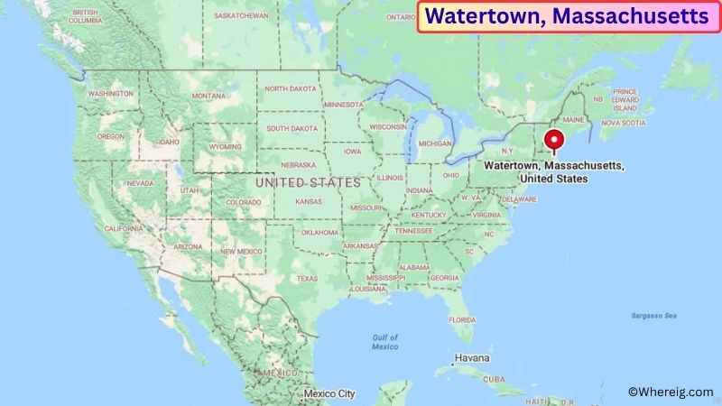
About Map: The map shows the location of Watertown in Middlesex County, in the U.S. state of Massachusetts.
Watertown Map, Massachusetts
About Watertown Map: The Google Map highlights the location of Watertown in Middlesex County, Massachusetts. Use the zoom, satellite, and street-view options to explore the city's neighborhoods, roads, and nearby places.
Where is Watertown Located?
Watertown is a town located in Middlesex County, Massachusetts, the United States. It is immediately west of Boston, about 6 miles from downtown Boston and close to Cambridge, Belmont, Newton, and Waltham. Watertown lies at approximately 42.370° North latitude and 71.182° West longitude. The town had 35,329 residents in the 2020 Census and covers about 4.2 square miles, or 10.9 square kilometers. Watertown was settled in 1630 and was one of the earliest English settlements in Massachusetts. The town grew along the Charles River and became an important center for agriculture, trade, manufacturing, and transportation. Watertown played a role in the American Revolution, including as a meeting place for the Massachusetts government during the early months of the conflict. Today, the town combines historic neighborhoods with modern commercial and residential areas. Arsenal Yards occupies the former Watertown Arsenal site and is a major local destination. The Charles River also provides opportunities for walking, cycling, and enjoying waterfront views. Route 2 and Interstate 90 provide convenient access to Boston and surrounding communities.
Most Viewed US Maps
| USA Sttae Map | USA Region Map | USA Road Map |
| USA County Map | Where is USA in World Map? | US ZIP Code Map |
| USA Time Zones Map | US State and Capitals Map | USA Physical Map |
Find 4,400+ U.S. Cities by State - Explore Their Locations and Get Detailed Information
Watertown City Facts
| Fact | Details |
|---|---|
| City | Watertown |
| State | Massachusetts |
| County | Middlesex County |
| Country | United States |
| Region | Greater Boston / Eastern Massachusetts |
| Incorporated | 1630 |
| Founded | 1630 |
| Total Area | 4.2 sq mi (10.9 sq km) |
| Land Area | 4.1 sq mi (10.6 sq km) |
| Water Area | 0.1 sq mi (0.3 sq km) |
| Elevation | Approximately 50 ft (15 m) |
| Population (2023 estimate) | Approximately 35,000 |
| Population (2020 Census) | 35,329 |
| Population Density | Approximately 8,600 people per sq mi |
| Time Zone | Eastern Time Zone (EST/EDT) |
| ZIP Codes | 02472 |
| Area Code | 617, 857 |
| Major Highways | Massachusetts Route 2, Massachusetts Route 16, Massachusetts Route 20, Interstate 90 |
| Public Transit | MBTA bus and subway connections |
| Major Attractions | Watertown Arsenal, Arsenal Yards, Perkins School for the Blind, Charles River, Watertown Square |
| Official Website | https://www.watertown-ma.gov/ |
Distance from Watertown, MA to Nearby Cities
- Newton, MA – 4 miles (6 km)
- Belmont, MA – 3 miles (5 km)
- Waltham, MA – 5 miles (8 km)
- Cambridge, MA – 4 miles (6 km)
- Boston, MA – 6 miles (10 km)
- Brookline, MA – 5 miles (8 km)
- Somerville, MA – 6 miles (10 km)
- Arlington, MA – 6 miles (10 km)
- Medford, MA – 8 miles (13 km)
- Needham, MA – 9 miles (14 km)
- Quincy, MA – 14 miles (23 km)
- Lexington, MA – 10 miles (16 km)
- Framingham, MA – 15 miles (24 km)
- Wellesley, MA – 12 miles (19 km)
- Salem, MA – 22 miles (35 km)
- Lowell, MA – 25 miles (40 km)
- Worcester, MA – 45 miles (72 km)
- Providence, RI – 50 miles (80 km)
Top Attractions in Watertown
- Watertown Arsenal – A historic former U.S. Army arsenal site along the Charles River that played an important role in local industry and military manufacturing.
- Arsenal Yards – A redeveloped riverfront district at the former arsenal site featuring shops, restaurants, entertainment, public spaces, and community events.
- Watertown Square – The historic center of the town with local businesses, restaurants, civic buildings, and connections to the Charles River.
- Perkins School for the Blind – A historic educational institution founded in the 19th century and known for its work in education and services for people who are blind or visually impaired.
- Charles River – The river forms part of Watertown's southern boundary and provides opportunities for walking, cycling, rowing, fishing, and scenic recreation.
- Mount Auburn Cemetery – A historic cemetery and landscaped garden in nearby Cambridge and Watertown known for its monuments, trees, gardens, and views from Washington Tower.
- Arsenal Park – A riverfront recreational area with walking paths, open space, and views of the Charles River.
- Watertown Public Library – A historic community library offering local history materials, educational resources, programs, and public services.
- Saltonstall Park – A central green space near Watertown Square used for recreation, community events, and outdoor activities.
- New Repertory Theatre – A nearby performing arts organization presenting theater productions and cultural programs in the Watertown area.
Airports Near Watertown, MA
- Boston Logan International Airport (BOS) – 10 miles
- Hanscom Field (BED) – 9 miles
- Norwood Memorial Airport (OWD) – 18 miles
- Lawrence G. Hanscom Field (BED) – 9 miles
- Manchester-Boston Regional Airport (MHT) – 55 miles
Sources:
Population and area data sourced from the United States Census Bureau (2020 Census). General town information referenced from the official Town of Watertown website and local government records.
Massachusetts Related Maps and Info
- Where is Attleboro
- Where is Barnstable Town
- Where is Beverly
- Where is Braintree Town
- Where is Brockton
- Where is Brookline
- Where is Cambridge
- Where is Chelsea
- Where is Chicopee
- Where is Everett
- Where is Fall River
- Where is Fitchburg
- Where is Franklin Town
- Where is Gloucester
- Where is Haverhill
- Where is Holyoke
- Where is Lawrence
- Where is Leominster
- Where is Lowell
- Where is Lynn
- Where is Malden
- Where is Marlborough
- Where is Medford
- Where is Melrose
- Where is Methuen Town
- Where is Milton
- Where is Needham
- Where is New Bedford
- Where is Newton
- Where is Northampton
- Where is Norwood
- Where is Peabody
- Where is Pittsfield
- Where is Quincy
- Where is Revere
- Where is Saugus
- Where is Somerville
- Where is Taunton
- Where is Waltham
- Where is Watertown Town
- Where is Wellesley
- Where is Westfield
- Where is Weymouth Town
- Where is Woburn
- Where is Worcester