
West Springfield is a town in western Massachusetts, located in Hampden County across the Connecticut River from Springfield. It is about 5 miles west of downtown Springfield and sits in the Pioneer Valley. The town is known for the Eastern States Exposition, historic neighborhoods, and its location near the Connecticut River, making it a convenient base for exploring the Springfield area.
Location Map of West Springfield, Hampden County, Massachusetts
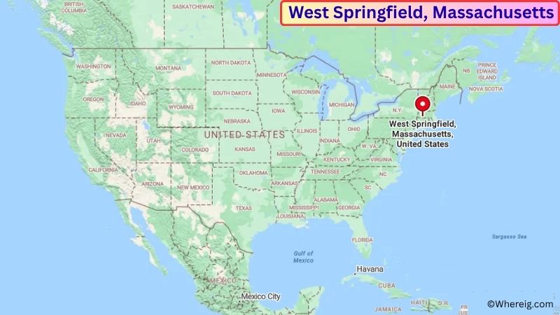
About Map: The map shows the location of West Springfield in Hampden County, in the U.S. state of Massachusetts.
West Springfield Map, Massachusetts
About West Springfield Map: The Google Map highlights the location of West Springfield in Hampden County, Massachusetts. Use the zoom, satellite, and street-view options to explore the city's neighborhoods, roads, and nearby places.
Where is West Springfield Located?
West Springfield is a town located in Hampden County, Massachusetts, the United States. It is in western Massachusetts, about 5 miles west of downtown Springfield, 25 miles north of Hartford, Connecticut, and approximately 30 miles east of Northampton. West Springfield lies at approximately 42.107° North latitude and 72.620° West longitude. The town had 28,835 residents in the 2020 Census and covers about 17.53 square miles, or 45.41 square kilometers. West Springfield was settled in the 17th century and separated from Springfield in 1774. Its location along the Connecticut River helped shape its early farming, manufacturing, and transportation economy. The town is also home to the Eastern States Exposition, commonly known as The Big E, a major annual regional fair that draws visitors from across New England. West Springfield has a mix of established neighborhoods, commercial areas, riverfront landscapes, and historic sites. Nearby attractions include the Basketball Hall of Fame, Springfield Museums, Forest Park, and the Connecticut River. Interstate 91, Interstate 5, and U.S. Route 20 provide major transportation connections to Springfield, Hartford, Northampton, and other communities in the Pioneer Valley.
Most Viewed US Maps
| USA Sttae Map | USA Region Map | USA Road Map |
| USA County Map | Where is USA in World Map? | US ZIP Code Map |
| USA Time Zones Map | US State and Capitals Map | USA Physical Map |
Find 4,400+ U.S. Cities by State - Explore Their Locations and Get Detailed Information
West Springfield City Facts
| Fact | Details |
|---|---|
| City | West Springfield |
| State | Massachusetts |
| County | Hampden County |
| Country | United States |
| Region | Western Massachusetts / Pioneer Valley |
| Incorporated | 1774 |
| Founded | 1636 |
| Total Area | 17.53 sq mi (45.41 sq km) |
| Land Area | 16.92 sq mi (43.82 sq km) |
| Water Area | 0.61 sq mi (1.58 sq km) |
| Elevation | Approximately 100 ft (30 m) |
| Population (2023 estimate) | Approximately 29,000 |
| Population (2020 Census) | 28,835 |
| Population Density | Approximately 1,704 people per sq mi |
| Time Zone | Eastern Time Zone (EST/EDT) |
| ZIP Codes | 01089, 01090, 01091 |
| Area Code | 413 |
| Major Highways | Interstate 91, Interstate 5, U.S. Route 20, Massachusetts Route 20A |
| Public Transit | Pioneer Valley Transit Authority (PVTA) |
| Major Attractions | The Big E, Connecticut River, Basketball Hall of Fame, Springfield Museums, Forest Park |
| Official Website | https://www.townofwestspringfield.org/ |
Distance from West Springfield, MA to Nearby Cities
- Springfield, MA – 5 miles (8 km)
- Agawam, MA – 5 miles (8 km)
- Holyoke, MA – 8 miles (13 km)
- Chicopee, MA – 8 miles (13 km)
- Westfield, MA – 10 miles (16 km)
- South Hadley, MA – 12 miles (19 km)
- Longmeadow, MA – 8 miles (13 km)
- East Longmeadow, MA – 10 miles (16 km)
- Wilbraham, MA – 12 miles (19 km)
- Northampton, MA – 20 miles (32 km)
- Amherst, MA – 25 miles (40 km)
- Hartford, CT – 25 miles (40 km)
- Windsor, CT – 20 miles (32 km)
- Greenfield, MA – 45 miles (72 km)
- Pittsfield, MA – 50 miles (80 km)
- Worcester, MA – 65 miles (105 km)
- Albany, NY – 85 miles (137 km)
- Boston, MA – 90 miles (145 km)
Top Attractions in West Springfield
- The Big E – The Eastern States Exposition is a major annual fair featuring exhibits, agricultural displays, food, entertainment, and events representing the six New England states.
- Connecticut River – The river forms the eastern boundary of West Springfield and provides opportunities for boating, fishing, wildlife viewing, and scenic recreation.
- Mittineague Park – A large local park with wooded trails, open areas, recreational facilities, and access to the surrounding landscape.
- Josiah Day House – A historic house museum preserving an early colonial-era home and offering a look at local life during the town's early history.
- Springfield Museums – A nearby museum complex featuring art, science, history, and natural history collections in downtown Springfield.
- Naismith Basketball Hall of Fame – A major Springfield attraction celebrating the history of basketball, its players, coaches, teams, and inventors.
- Forest Park – One of the largest urban parks in New England, featuring gardens, trails, a zoo, ponds, and recreational areas.
- Dr. Seuss National Memorial Sculpture Garden – A nearby attraction in Springfield honoring the life and work of author and illustrator Dr. Seuss.
- Mount Tom State Reservation – A nearby natural area with hiking trails, wooded slopes, scenic overlooks, and views across the Connecticut River Valley.
- Holyoke Heritage State Park – A nearby historic park centered on the city's canal system, industrial history, and Connecticut River setting.
Airports Near West Springfield, MA
- Westover Metropolitan Airport (CEF) – 12 miles
- Bradley International Airport (BDL) – 20 miles
- Westfield-Barnes Regional Airport (BAF) – 15 miles
- Worcester Regional Airport (ORH) – 65 miles
- Albany International Airport (ALB) – 85 miles
Sources:
Population and area data sourced from the United States Census Bureau (2020 Census). General city information referenced from the official Town of West Springfield website and local government records.
Massachusetts Related Maps and Info
- Where is Attleboro
- Where is Barnstable Town
- Where is Beverly
- Where is Braintree Town
- Where is Brockton
- Where is Brookline
- Where is Cambridge
- Where is Chelsea
- Where is Chicopee
- Where is Everett
- Where is Fall River
- Where is Fitchburg
- Where is Franklin Town
- Where is Gloucester
- Where is Haverhill
- Where is Holyoke
- Where is Lawrence
- Where is Leominster
- Where is Lowell
- Where is Lynn
- Where is Malden
- Where is Marlborough
- Where is Medford
- Where is Melrose
- Where is Methuen Town
- Where is Milton
- Where is Needham
- Where is New Bedford
- Where is Newton
- Where is Northampton
- Where is Norwood
- Where is Peabody
- Where is Pittsfield
- Where is Quincy
- Where is Revere
- Where is Saugus
- Where is Somerville
- Where is Taunton
- Where is Waltham
- Where is Watertown Town
- Where is Wellesley
- Where is Westfield
- Where is Weymouth Town
- Where is Woburn
- Where is Worcester