
Winthrop is a coastal town in eastern Massachusetts, located in Suffolk County just north of Boston. Set on a peninsula between Boston Harbor and Massachusetts Bay, the town is known for its beaches, waterfront neighborhoods, historic homes, and views of the Boston skyline. Winthrop offers a quieter residential setting while remaining close to downtown Boston, Logan International Airport, and other attractions in the Greater Boston area.
Location Map of Winthrop, Suffolk County, Massachusetts
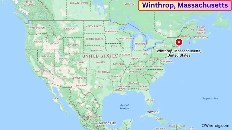
About Map: The map shows the location of Winthrop in Suffolk County, in the U.S. state of Massachusetts.
Winthrop Map, Massachusetts
About Winthrop Map: The Google Map highlights the location of Winthrop in Suffolk County, Massachusetts. Use the zoom, satellite, and street-view options to explore the city's neighborhoods, roads, and nearby places.
Where is Winthrop Located?
Winthrop is a town located in Suffolk County, Massachusetts, the United States. It is a coastal community just north of Boston, about 6 miles east of downtown Boston, 5 miles southeast of Revere, and approximately 10 miles southwest of Lynn. Winthrop lies at approximately 42.377° North latitude and 70.982° West longitude. The town had 19,316 residents in the 2020 Census and covers about 8.44 square miles, or 21.86 square kilometers, including land and water. Winthrop was settled in the 17th century and was incorporated as a town in 1852. Its location on a peninsula gives the community a strong maritime character, with neighborhoods surrounded by Boston Harbor, Massachusetts Bay, and coastal wetlands. Winthrop's beaches, waterfront parks, and harbor views are among its most recognizable features. The town is also close to Logan International Airport and provides convenient access to Boston by road, public transportation, and water routes. Nearby attractions include Belle Isle Marsh Reservation, Revere Beach, the Boston Harbor Islands, and downtown Boston. Massachusetts Route 145 is the main road through Winthrop, connecting the town with Revere and Boston.
Most Viewed US Maps
| USA Sttae Map | USA Region Map | USA Road Map |
| USA County Map | Where is USA in World Map? | US ZIP Code Map |
| USA Time Zones Map | US State and Capitals Map | USA Physical Map |
Find 4,400+ U.S. Cities by State - Explore Their Locations and Get Detailed Information
Winthrop Town Facts
| Fact | Details |
|---|---|
| Town | Winthrop |
| State | Massachusetts |
| County | Suffolk County |
| Country | United States |
| Region | Eastern Massachusetts / Greater Boston |
| Incorporated | 1852 |
| Settled | 1630 |
| Total Area | 8.44 sq mi (21.86 sq km) |
| Land Area | 1.58 sq mi (4.09 sq km) |
| Water Area | 6.86 sq mi (17.77 sq km) |
| Elevation | Approximately 20 ft (6 m) |
| Population (2023 estimate) | Approximately 19,000 |
| Population (2020 Census) | 19,316 |
| Population Density | Approximately 12,226 people per sq mi of land |
| Time Zone | Eastern Time Zone (EST/EDT) |
| ZIP Code | 02152 |
| Area Code | 617, 857 |
| Major Highways | Massachusetts Route 145 |
| Public Transit | MBTA bus and Blue Line connections |
| Major Attractions | Winthrop Beach, Yirrell Beach, Belle Isle Marsh Reservation, Boston Harbor, Boston Harbor Islands |
| Official Website | https://www.town.winthrop.ma.us/ |
Distance from Winthrop, MA to Nearby Cities
- Revere, MA – 5 miles (8 km)
- Boston, MA – 6 miles (10 km)
- Chelsea, MA – 6 miles (10 km)
- Everett, MA – 8 miles (13 km)
- Malden, MA – 9 miles (14 km)
- Somerville, MA – 10 miles (16 km)
- Lynn, MA – 10 miles (16 km)
- Medford, MA – 12 miles (19 km)
- Quincy, MA – 15 miles (24 km)
- Cambridge, MA – 11 miles (18 km)
- Newton, MA – 18 miles (29 km)
- Waltham, MA – 20 miles (32 km)
- Salem, MA – 17 miles (27 km)
- Marblehead, MA – 20 miles (32 km)
- Brookline, MA – 15 miles (24 km)
- Peabody, MA – 18 miles (29 km)
- Woburn, MA – 20 miles (32 km)
- Worcester, MA – 50 miles (80 km)
Top Attractions in Winthrop
- Winthrop Beach – A popular Atlantic waterfront beach offering swimming, walking, sunbathing, and views across Massachusetts Bay.
- Yirrell Beach – A quieter beach on the eastern side of Winthrop overlooking Massachusetts Bay and providing scenic coastal views.
- Belle Isle Marsh Reservation – A protected salt marsh near Winthrop and Boston offering walking trails, wildlife viewing, birdwatching, and views of the Boston skyline.
- Deer Island – A nearby Boston Harbor island known for its large water treatment facility, coastal scenery, and walking paths around the perimeter.
- Boston Harbor Islands National and State Park – A collection of islands and coastal sites offering hiking, boating, historic landmarks, wildlife viewing, and harbor scenery.
- Revere Beach – America's first public beach and a nearby destination with a broad sandy shoreline, ocean views, restaurants, and seasonal events.
- Boston Harbor – The harbor provides opportunities for sightseeing cruises, boating, ferry trips, fishing, and waterfront recreation.
- Freedom Trail – A historic walking route through downtown Boston connecting major landmarks associated with the American Revolution.
- Faneuil Hall Marketplace – A historic Boston marketplace featuring shops, restaurants, street performers, and nearby waterfront attractions.
- New England Aquarium – A major Boston attraction featuring marine animals, ocean exhibits, educational programs, and a large central ocean tank.
Airports Near Winthrop, MA
- Boston Logan International Airport (BOS) – 5 miles
- Beverly Regional Airport (BVY) – 20 miles
- Hanscom Field (BED) – 25 miles
- Norwood Memorial Airport (OWD) – 25 miles
- Manchester-Boston Regional Airport (MHT) – 55 miles
Sources:
Population and area data sourced from the United States Census Bureau (2020 Census). General city information referenced from the official Town of Winthrop website and local government records.
Massachusetts Related Maps and Info
- Where is Attleboro
- Where is Barnstable Town
- Where is Beverly
- Where is Braintree Town
- Where is Brockton
- Where is Brookline
- Where is Cambridge
- Where is Chelsea
- Where is Chicopee
- Where is Everett
- Where is Fall River
- Where is Fitchburg
- Where is Franklin Town
- Where is Gloucester
- Where is Haverhill
- Where is Holyoke
- Where is Lawrence
- Where is Leominster
- Where is Lowell
- Where is Lynn
- Where is Malden
- Where is Marlborough
- Where is Medford
- Where is Melrose
- Where is Methuen Town
- Where is Milton
- Where is Needham
- Where is New Bedford
- Where is Newton
- Where is Northampton
- Where is Norwood
- Where is Peabody
- Where is Pittsfield
- Where is Quincy
- Where is Revere
- Where is Saugus
- Where is Somerville
- Where is Taunton
- Where is Waltham
- Where is Watertown Town
- Where is Wellesley
- Where is Westfield
- Where is Weymouth Town
- Where is Woburn
- Where is Worcester