Where is Cos Cob Located? - Cos Cob is a city located in the Fairfield County of Connecticut, United States. Cos Cob lies between 27.9378 Degrees North latitudes and 82.2859 Degrees West longitudes.
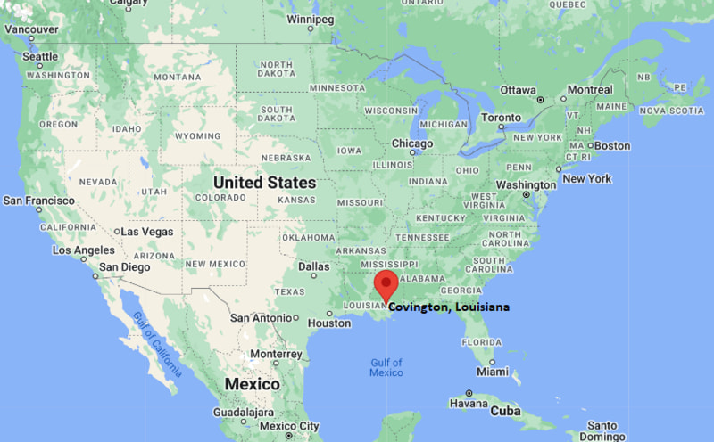
Location Map of Covington, Louisiana
Cos Cob Map, Connecticut, USA
Where is Cos Cob Located?
Cos Cob is a city located in the Fairfield County of Connecticut, United States. Cos Cob lies between 27.9378 Degrees North latitudes and 82.2859 Degrees West longitudes. According to 2020 U.S.census, the population of Cos Cob city is 6873 people and the city has a total area of 2.08 sq mi. The city has numerous parks and recreational facilities.
Most Viewed US Maps
Cos Cob, Connecticut Quick Facts
Field Value
City Cos Cob County Fairfield County State Connecticut State Capital Hartford US Region Northeastern United States Latitude 41.0330°N Longitude 73.5990°W Elevation 50 ft (15 m) Land Area 3.8 sq mi Water Area 0.6 sq mi Total Area 4.4 sq mi Population ~7,500 (2020 Census est.) Population Density ~2,000 per sq mi ZIP Codes 06807 Area Code 203 / 475 Time Zone Standard Eastern Standard Time (EST) UTC -5 Time Zone Daylight Eastern Daylight Time (EDT) UTC -4 Currency US Dollar (USD) FIPS Code 09-XXXX Congressional District 4th District
Nearby Cities to Cos Cob, Connecticut
Greenwich, Connecticut - West - 2 mi
Riverside, Connecticut - East - 2 mi
Old Greenwich, Connecticut - South - 3 mi
Stamford, Connecticut - East - 7 mi
Port Chester, New York - West - 5 mi
Rye, New York - West - 8 mi
White Plains, New York - Northwest - 15 mi
Darien, Connecticut - East - 10 mi
Norwalk, Connecticut - East - 18 mi
New York City, New York - Southwest - 32 mi
Cos Cob, Connecticut Climate and Weather Overview
Month Avg High (°F) Avg Low (°F) Avg Rainfall (in)
January 38 24 3.5 April 58 40 4.0 July 84 66 4.2 October 64 48 4.1 Annual 61 45 48.0
Climate Attribute Value
Climate Classification (Köppen) Humid Subtropical / Humid Continental (Cfa/Dfa transition) Annual Rainfall ~45–50 inches Annual Sunshine Days ~200 days Tornado Risk Very Low Snowfall 20–30 inches annually
Driving Distances from Cos Cob, Connecticut
City State Distance (mi) Approx. Drive Time
Greenwich CT 2 5 min Stamford CT 7 15 min Port Chester NY 5 10 min Rye NY 8 15 min White Plains NY 15 25 min Darien CT 10 18 min Norwalk CT 18 25 min New Haven CT 45 55 min New York City NY 32 50 min Hartford CT 85 1 hr 30 min
Transportation and Connectivity in Cos Cob, Connecticut
Mode Details
Airport Westchester County Airport (HPN), JFK International Airport, LaGuardia Airport Port Port of Stamford (regional access) Major Highways I-95, US-1, Merritt Parkway (CT-15 nearby) Rail/Amtrak Metro-North Railroad (Cos Cob Station - New Haven Line) Local Transit CT Transit + Greenwich local bus services
I-95 - major coastal interstate connecting Cos Cob with New York City and coastal Connecticut
US-1 - local corridor running through Greenwich and nearby shoreline towns
CT-15 Merritt Parkway - scenic limited-access highway linking inland Connecticut regions
Key Landmarks and Places to Visit in Cos Cob, Connecticut
Landmark Name Type
Bush-Holley House Historic House Museum Greenwich Point Park Beach / Park Bruce Museum Museum Putnam Cottage Historic Site Binney Park Public Park Greenwich Avenue Shopping District Audubon Center in Greenwich Nature Center Cos Cob Harbor Marina / Waterfront
Places to Visit in Cos Cob, Connecticut
Landmark Name Type
Bush-Holley House Historic Museum Greenwich Point Park Beach Park Bruce Museum Cultural Museum Cos Cob Railroad Station Area Historic Transit Site Binney Park Recreation Park Audubon Center Greenwich Nature Reserve Old Greenwich Village Nearby Historic Village Area Greenwich Harbor Waterfront Scenic Waterfront
Colleges and Universities in Cos Cob, Connecticut
Institution Name Type Level Notable For
University of Connecticut (Stamford Campus) Public University Business & Liberal Arts Programs Fairfield University (Nearby) Private University Jesuit Education & Research Norwalk Community College (Nearby) Public Community College Affordable transfer programs
Waterbodies in Cos Cob, Connecticut
Cos Cob Harbor, Mianus River, Long Island Sound, Greenwich Cove, Mill Pond
Golf Courses in Cos Cob, Connecticut
Greenwich Country Club, Stanwich Club, Griffith E. Harris Golf Course, Innis Arden Golf Club
Cos Cob, Connecticut - Key Historical Facts
Cos Cob developed as a small maritime and railroad community within Greenwich during the 19th century.
The Cos Cob Power Station played an important role in early electric railway development in the region.
The area became known for its artistic community, including painters associated with the Cos Cob Art Colony.
The arrival of the New Haven Railroad helped connect Cos Cob to New York City and boosted suburban growth.
Cos Cob remains a historic waterfront village with preserved colonial-era buildings and cultural landmarks.
Today it is primarily a residential community with strong ties to Greenwich’s coastal economy.
References
Connecticut Maps and Info
Location Map of Connecticut Cities
Popular US Cities
About USA
US Counties
World Countries
World Cup 2026