
Frostburg is a small mountain city in western Maryland and part of Allegany County. It is about 8 miles west of Cumberland along the historic National Road. The city is known for Frostburg State University, its Appalachian mountain setting, historic downtown, and nearby attractions such as Great Allegheny Passage and Savage River State Forest.
Location Map of Frostburg, Allegany County, Maryland
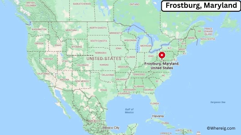
About Map: The map shows the location of Frostburg in Allegany County, in the U.S. state of Maryland.
Frostburg Map, Maryland
About Frostburg Map: The Google Map highlights the location of Frostburg in Allegany County, Maryland. Use the zoom, satellite, and street-view options to explore the city's neighborhoods, roads, and nearby places.
Where is Frostburg Located?
Frostburg is a city located in Allegany County, Maryland, the United States. It lies in the Appalachian Mountains of western Maryland, about 8 miles west of Cumberland, 75 miles west of Baltimore, and roughly 130 miles northwest of Washington, D.C. Frostburg is positioned at approximately 39.658° North latitude and 78.929° West longitude. The city covers about 3.03 square miles, or 7.85 square kilometers, of land. The 2020 Census recorded 7,027 residents, while recent estimates place the population at about 7,000. Frostburg stands at an elevation of roughly 2,050 feet above sea level, making it one of Maryland's higher-elevation communities. The city was settled in the 18th century and incorporated in 1812. Its development was closely tied to coal mining, the National Road, and the Baltimore and Ohio Railroad. Frostburg State University, founded in 1898, is a major educational institution and an important part of the local community. Historic Main Street features older commercial buildings, restaurants, shops, and cultural sites. The Great Allegheny Passage passes nearby and provides a long-distance trail for cyclists and hikers traveling between Pittsburgh and Cumberland. Other nearby attractions include Dan's Mountain State Park, Savage River State Forest, and the C&O Canal Towpath. Interstate 68 provides a direct east-west route through the region.
Most Viewed US Maps
| USA Sttae Map | USA Region Map | USA Road Map |
| USA County Map | Where is USA in World Map? | US ZIP Code Map |
| USA Time Zones Map | US State and Capitals Map | USA Physical Map |
Find 4,400+ U.S. Cities by State - Explore Their Locations and Get Detailed Information
Frostburg City Facts
| City | Frostburg |
|---|---|
| State | Maryland |
| County | Allegany County |
| Country | United States |
| Region | Western Maryland, Appalachian Mountains |
| Incorporated | 1812 |
| Founded | 1780s |
| Total Area | 3.03 sq mi (7.85 sq km) |
| Land Area | 3.03 sq mi (7.85 sq km) |
| Water Area | 0 sq mi (0 sq km) |
| Elevation | 2,050 ft (625 m) |
| Population (2023 estimate) | About 7,000 |
| Population (2020 Census) | 7,027 |
| Population Density | 2,319.5 people per sq mi |
| Time Zone | Eastern Time (EST/EDT) |
| ZIP Codes | 21532 |
| Area Code | 301, 240 |
| Major Highways | Interstate 68, U.S. Route 40, U.S. Route 40 Alternate |
| Public Transit | Allegany County Transit |
| Major Attractions | Frostburg State University, Great Allegheny Passage, Thrasher Carriage Museum, Historic Main Street, Dan's Mountain State Park |
| Official Website | https://www.frostburgcity.org/ |
Distance from Frostburg, MD to Nearby Cities
- Cumberland, MD – 8 miles (13 km)
- LaVale, MD – 10 miles (16 km)
- Westernport, MD – 15 miles (24 km)
- Keyser, WV – 20 miles (32 km)
- Somerset, PA – 40 miles (64 km)
- Bedford, PA – 35 miles (56 km)
- Meyersdale, PA – 30 miles (48 km)
- Hagerstown, MD – 65 miles (105 km)
- Winchester, VA – 70 miles (113 km)
- Martinsburg, WV – 60 miles (97 km)
- Johnstown, PA – 70 miles (113 km)
- Altoona, PA – 75 miles (121 km)
- Frederick, MD – 80 miles (129 km)
- Washington, DC – 130 miles (209 km)
- Baltimore, MD – 140 miles (225 km)
- Pittsburgh, PA – 105 miles (169 km)
- Morgantown, WV – 70 miles (113 km)
- Harrisburg, PA – 120 miles (193 km)
Top Attractions in Frostburg
- Frostburg State University – A public university founded in 1898 and a major educational and cultural institution in western Maryland.
- Great Allegheny Passage – A long-distance rail trail connecting Cumberland with Pittsburgh, popular with cyclists, hikers, and outdoor enthusiasts.
- Thrasher Carriage Museum – A museum in nearby Frostburg featuring historic horse-drawn carriages and transportation artifacts.
- Historic Main Street Frostburg – A traditional downtown district with historic buildings, restaurants, shops, galleries, and community events.
- Frostburg Museum – A local museum preserving photographs, artifacts, documents, and stories about the city's history.
- Dan's Mountain State Park – A nearby state park with hiking trails, mountain scenery, fishing, hunting, and wildlife habitat.
- Savage River State Forest – A large forested recreation area in western Maryland offering hiking, camping, fishing, boating, and scenic mountain landscapes.
- Cumberland Historic District – A nearby historic downtown area with preserved architecture, museums, shops, and access to the C&O Canal.
- Chesapeake and Ohio Canal National Historical Park – A historic canal corridor extending from Cumberland toward Washington, D.C., with towpath trails and preserved canal structures.
- Rocky Gap State Park – A nearby park surrounding Lake Habeeb and offering hiking, boating, fishing, camping, and mountain scenery.
Airports Near Frostburg
- Greater Cumberland Regional Airport (CBE) – 10 miles
- Garrett County Airport (2G4) – 35 miles
- Johnstown–Cambria County Airport (JST) – 70 miles
- Altoona-Blair County Airport (AOO) – 75 miles
- Hagerstown Regional Airport (HGR) – 75 miles
Sources:
Population and area data sourced from the United States Census Bureau (2020 Census). General city information referenced from the official City of Frostburg website and local government records.
Maryland Related Maps and Info
- Where is Annapolis
- Where is Aspen Hill
- Where is Bel Air North
- Where is Bel Air South
- Where is Baltimore
- Where is Bethesda
- Where is Bowie
- Where is Carney
- Where is Catonsville
- Where is Chillum
- Where is Clarksburg
- Where is Clinton
- Where is College Park
- Where is Columbia
- Where is Crofton
- Where is Dundalk
- Where is Eldersburg
- Where is Elkridge
- Where is Ellicott City
- Where is Essex
- Where is Frederick
- Where is Gaithersburg
- Where is Germantown
- Where is Glen Burnie
- Where is Hagerstown
- Where is Laurel
- Where is Middle River
- Where is Milford Mill
- Where is Montgomery Village
- Where is North Bethesda
- Where is North Laurel
- Where is Odenton
- Where is Olney
- Where is Owings Mills
- Where is Parkville
- Where is Pasadena
- Where is Perry Hall
- Where is Pikesville
- Where is Potomac
- Where is Randallstown
- Where is Rockville
- Where is Salisbury
- Where is Severn
- Where is Severna Park
- Where is Silver Spring
- Where is South Laurel
- Where is Towson
- Where is Waldorf
- Where is Wheaton
- Where is Woodlawn